
Tzintzuntzan, Michoacán, Mexico — The Pacific Coast (and Central Highlands)
Petroglyphs: Messages in the Rock
Photographed by J. Makali Bruton, December 2, 2022
1. Petroglyphs: Messages in the Rock Marker

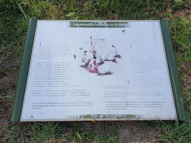
Los petroglifos o petrograbados, son figuras que se hacen retirando la capa superficial de lá roca a través de golpes, cortes y pulido hechos con otra roca de mayor dureza, la utilización de abrasivos y en este caso, también con objetos metálicos de cobre.
Aquí en Tzintzuntzan, fueron realizados y tallados en lugares estratégicos en donde pudieran ser fácilmente visibles a los demás. Los hay de vários tipos: los que parecen maquetas que representan las escaleras, los accesos principales o las plataformas de las yacatas; los geométricos: puntos, lineas rectas, en zigzag y espirales, estos últimos tal vez representan el agua o fenómenos naturales como torbellinos. Así mismo hay algunas figuras como caracoles y representaciones humanas.
Tzintzuntzan es de las pocas zonas arqueológicas que cuenta con petrograbados tanto en sus accesos como en sus edificios, durante el recorrido podrán notar que algunos diseños se repiten constantemente.
Por su semejanza con las yácatas, algunas maquetas fueron utilizadas porvlos arqueólogos para realizar investigaciones y aproximarse a la forma de los templos.
Pie de dibujo: Reconstrucción hipotética
Tsi tsakapuerh shikukatech jindesti ujatechini enjka kamajka urhatarhakuechani ka isi uni pitani tsakapuecharhu tsekanarhikuani sesi kachukukata ka pitsipiticha ukatecha, materhu jarhasti tsakapu sanderhu chuperi, ka materhu jas urhatarhakuecha, tiamuerhicha.
Ixu tsintsuntsani nirastis ukatecha pitsipiticha jimini xanachu enjka upirhinka santerhu kokani exeani: Jarhasti ma ukata enjka iammduecha exeampka namani japka ima ireta na jandepka, ambeuetenampka tsi kekuecha marhuasinti enjka inchajka kopekuarhu tsiriiakatatecha.
Tsintsuntsani jindesti ionanapu enjka jaká tsakapu umpakuni unarhikukatecha teecha kerhaticha uakas erhanaritani tsintsikatecharhu mamarhu jarhaticha utekatecha tsakapuèrhicha.
Tsi tsakapu umpakuticha mamarhuecha ukatecha enjka iaminduecha exeampka nama jajpka ima ireta na jundepka, nirhastis urhakuarhini tsïchampu jimbo enjkasï arhinajka petaskuticha (investigación) ka uekani pïerhani ka uni exeni namani ukata jaka taa tïosïo.
Petroglyphs: messages in the rock
Petroglyphs are figures that are made by removing the surface layer of the rock through blows, cuts and polishing made with another rock of greater hardness, the use of abrasives and in this case, also with copper metal objects.
Here in Tzintzuntzan, they were made and carved in strategic places where they could be easily visible to others. There are several types: those that look like models that represent the stairs, the main accesses or the platforms of the yácatas; there are also geometric petroglyphs: points, straight lines, zigzag and spirals, the latter perhaps represent water or natural phenomena such as whirlwinds. There are also some figures such as snails and human representations.
Tzintzuntzan is one of the few archaeological sites that has petroglyphs both in its accesses and in its buildings, during the tour you will notice that some designs are constantly repeated.
Because of their resemblance to the yácatas, some models were used by archaeologists to conduct research and approximate the shape of the temples.
Caption: Hypothetical reconstruction
Erected by Instituto
this page online
Topics. This historical marker is listed in these topic lists: Anthropology & Archaeology • Arts, Letters, Music • Indigenous Peoples and Communities.
Location. 19° 37.526′ N, 101° 34.326′ W. Marker is in Tzintzuntzan, Michoacán. It is on Avenida Las Yácatas east of El Llanero, on the right when traveling east. The marker is on the grounds of the Tzintzuntzan Archeological Site. Touch for map. Marker is in this post office area: Tzintzuntzan MIC 58446, Mexico. Touch for directions.

Regionally, this marker is in Western Mexico, in the Bajío, and on the Pacific Coast. Globally, it is in North America, specifically in Mesoamerica, on the Ring of Fire, in the Pacific Rim, and in the Western Hemisphere. Historically, it finds itself in what was once New Spain, a Spanish colony, and the Aztec Empire.
Other nearby markers. At least 8 other markers are within walking distance of this marker: Tzintzuntzan Archeological Zone (within shouting distance of this marker); Substructure (within shouting distance of this marker); Architecture of Farmers and Petroglyphs of Hunters
Photographed by J. Makali Bruton, December 2, 2022
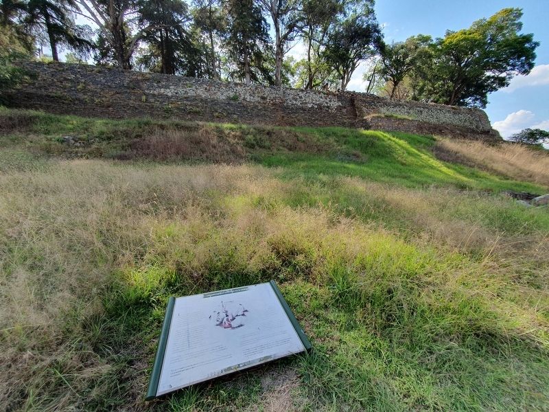
2. Petroglyphs: Messages in the Rock Marker
Photographed by J. Makali Bruton, December 2, 2022
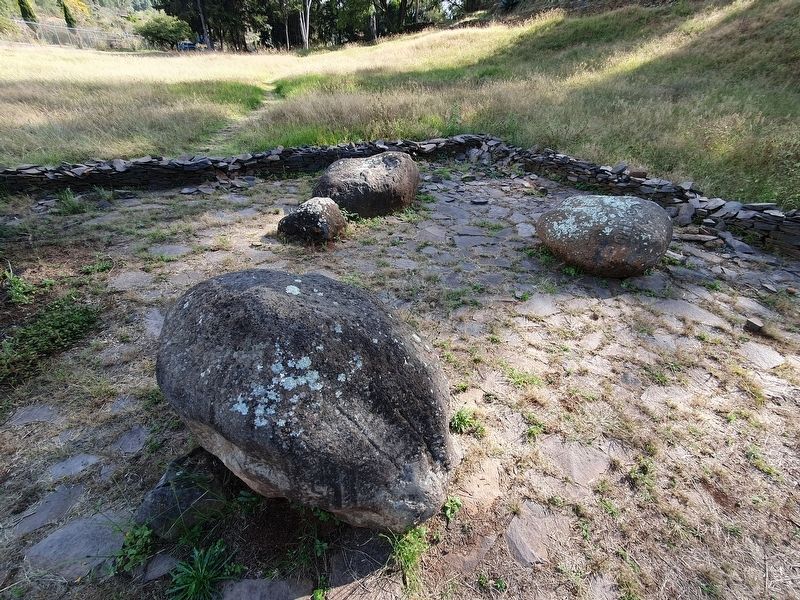
3. A example of the petroglyphs at Tzintzuntzan
Credits. This page was last revised on April 4, 2025. It was originally submitted on March 19, 2023, by J. Makali Bruton of Washington, District of Columbia. This page has been viewed 249 times since then and 36 times this year. Photos: 1, 2, 3. submitted on March 19, 2023, by J. Makali Bruton of Washington, District of Columbia.
