
Tzintzuntzan, Michoacán, Mexico — The Pacific Coast (and Central Highlands)
Las Yácatas
Photographed by J. Makali Bruton, December 2, 2022
1. Las Yácatas Marker
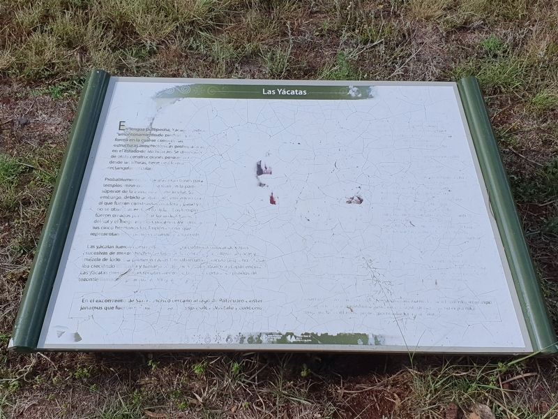
Unfortunately the marker is weathered and difficult to read. This is frustrating as the yácatas are the most compelling reason to visit the Tzintzuntzan Archeological Site.

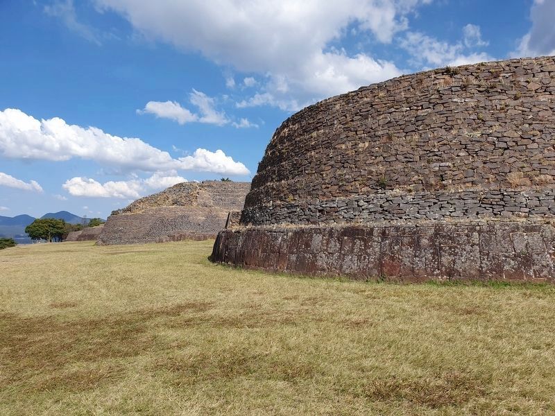
En lengua purépecha, Yácatas significa "amontonamiento de piedras” y esta forma en la cual se conocen las estructuras arquitectónicas prehispanicas en el estado de Michoacán. Se distinguen de otras construcciones porque vista desde las alturas, tiene una forma rectangular-circular.
Probablemente, las yácatas eran bases para templos, mismos que estaban en la parte superior de la estructura semicircular. Sin embargo, debido al material perecedero con el que fueron construidos (madera, paja) ya no se observan en la actualidad. Los templos fueron creados para … del sol y el fuego eterno Curicaveri, asi … cinco hermanos los Tiripemencha que representan los puntos cardinals y su centro.
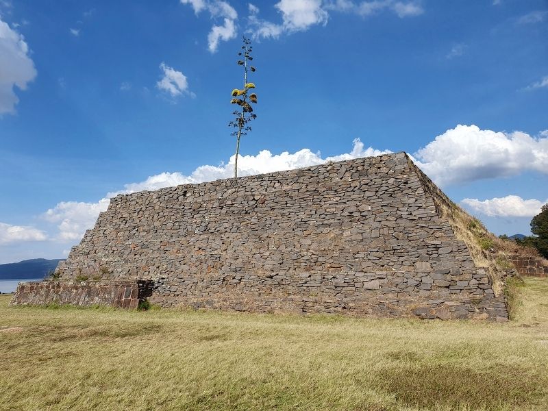
Las yácatas fueron construidos … colocando capas sucesivas de muros hechos de lajas de … rellenos de rocas y mezcla de lodo. Las primeras capas formaban un monticulo pequeño el cual iba creciendo en altura y tamaño … colocaban mas capas encimas. Las yácatas presentan un recubrimiento … cortados y pulidos de tezontle llamado “janamus” …
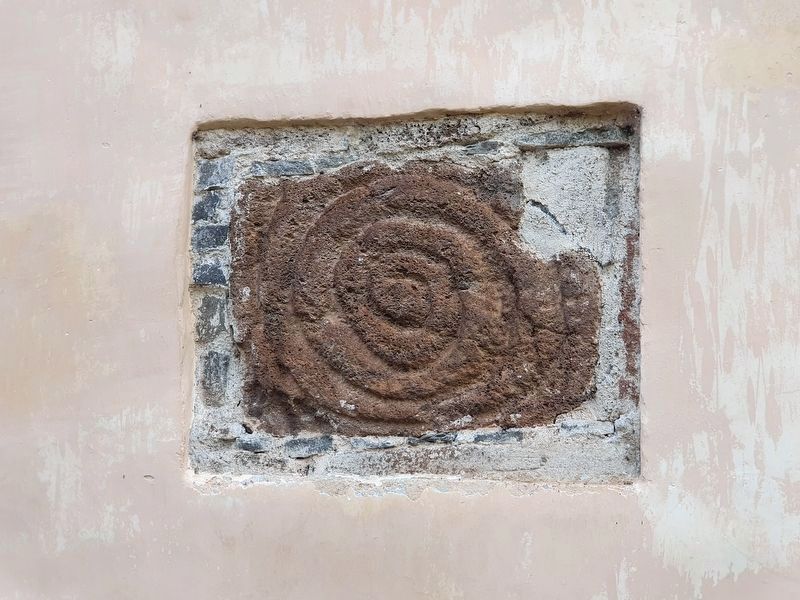
En el exconvento de San Francisco cercano al Lago de Pátzcuaro existen janamus que fueron … españoles. Vísitalo, conócelo.
Not transcribed.
Las Yácatas
In the Purépecha language, Yácatas means "a piling up of stones" and is the way in which the pre-Hispanic architectural structures are known in the state of Michoacán. They are distinguished from other constructions because, seen from above, they have a rectangular-circular shape.
The yácatas were probably the bases of temples, which were at the top of the semicircular structure. However, due to the perishable material with which they were built (wood and straw) they are no longer observed today. The temples were created to ... of the sun and the eternal fire Curicaveri, so ... five brothers the Tiripemencha representing the cardinal points and their center.
The yácatas were built ... laying successive layers of walls made of slabs of ... a filling made of a rock and mud mixture. The first layers formed a small mound which grew in height and size ... they placed more layers on top. The yácatas have a coating ... cut and polished tezontle called "janamus" ...
In the former convent of San Francisco near Lake Patzcuaro there are janamus that were ... Spanish. Visit it, get to know it.
Erected by Instituto
this page online
Topics. This historical marker is listed in these topic lists: Anthropology & Archaeology • Architecture • Indigenous Peoples and Communities • Religion & Religious Structures.
Location. 19° 37.489′ N, 101° 34.36′ W. Marker is in Tzintzuntzan, Michoacán. It can be reached from Avenida Las Yácatas, on the right when traveling east. The marker is on the grounds of the Tzintzuntzan Archeological Site. Touch for map. Marker is in this post office area: Tzintzuntzan MIC 58435, Mexico. Touch for directions.

Regionally, this marker is in Western Mexico, in the Bajío, and on the Pacific Coast. Globally, it is in North America, specifically in Mesoamerica, on the Ring of Fire, in the Pacific Rim, and in the Western Hemisphere. Historically, it finds itself in what was once New Spain, a Spanish colony, and the Aztec Empire.
Other nearby markers. At least 8 other markers are within walking distance of this marker: Tzintzuntzan Archeological Zone (within shouting distance of this marker); Substructure (within shouting distance

Photographed by J. Makali Bruton, December 2, 2022
2. Las Yácatas and Marker
The marker is at the far northern end of the row of yácatas.
Photographed by J. Makali Bruton, December 2, 2022
3. The western elevation of las yácatas
Photographed by J. Makali Bruton, December 2, 2022
4. The southernmost yácata
Photographed by J. Makali Bruton, September 23, 2022
5. A 'janamus' at the former Convent of San Francisco, as mentioned in the marker's text
Credits. This page was last revised on April 4, 2025. It was originally submitted on March 19, 2023, by J. Makali Bruton of Washington, District of Columbia. This page has been viewed 667 times since then and 65 times this year. Photos: 1, 2, 3, 4, 5. submitted on March 19, 2023, by J. Makali Bruton of Washington, District of Columbia.
