Michipicoten in Wawa in Algoma District, Ontario — Central Canada (North America)
Philip Turnor
1752-1800
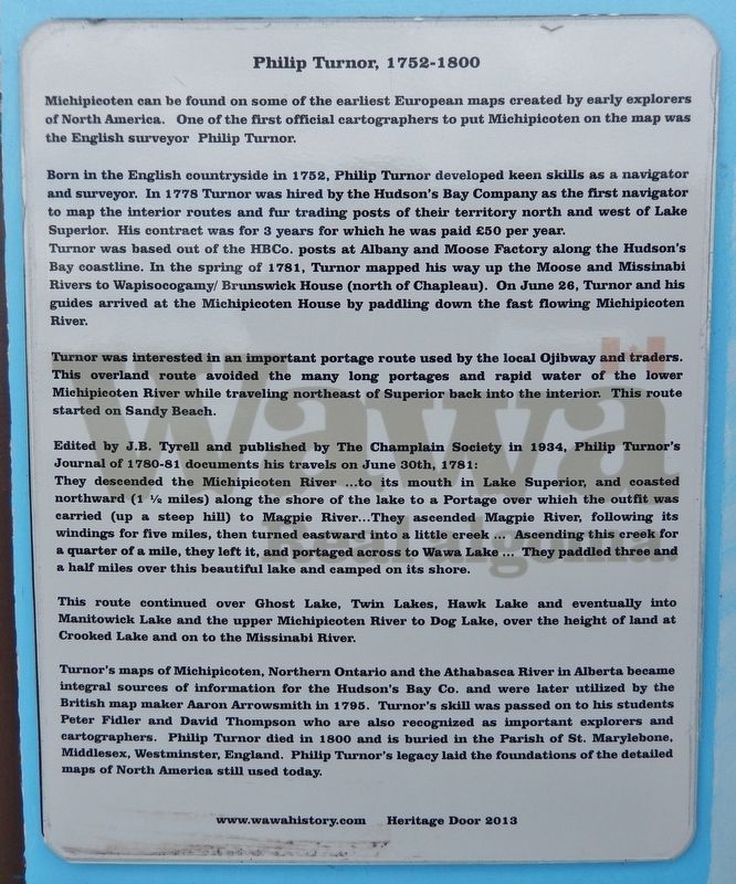
Michipicoten can be found on some of the earliest European maps created by early explorers of North America. One of the first official cartographers to put Michipicoten on the map was the English surveyor Philip Turnor.
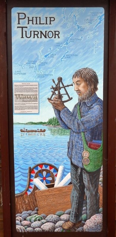
Born in the English countryside in 1752, Philip Turnor developed keen skills as a navigator and surveyor. In 1778 Turnor was hired by the Hudson's Bay Company as the first navigator to map the interior routes and fur trading posts of their territory north and west of Lake Superior. His contract was for 3 years for which he was paid £50 per year. Turnor was based out of the HBCo. posts at Albany and Moose Factory along the Hudson's Bay coastline. In the spring of 1781, Turnor mapped his way up the Moose and Missinabi Rivers to Wapisocogamy/Brunswick House (north of Chapleau). On June 26, Turnor and his guides arrived at the Michipicoten House by paddling down the fast flowing Michipicoten River.
Turnor was interested in an important portage route used by the local Ojibway and traders. This overland route avoided the many long portages and rapid water of the lower Michipicoten River while traveling northeast of Superior back into the interior. This route started on Sandy Beach.
Edited by J.B. Tyrell and published by The Champlain Society in 1934, Philip Turnor's Journal of 1780-81 documents his travels on June 30th, 1781:
They descended the Michipicoten River ...to its mouth in Lake Superior, and coasted northward (1 ½ miles) along the shore of the lake to a Portage over which the outfit was carried (up a steep hill) to Magpie River...They ascended Magpie River, following its windings for five miles, then turned eastward into a little creek ... Ascending this creek for a quarter of a mile, they left it, and portaged across to Wawa Lake ... They paddled three and a half miles over this beautiful lake and camped on its shore.
This route continued over Ghost Lake, Twin Lakes, Hawk Lake and eventually into Manitowick Lake and the upper Michipicoten River to Dog Lake, over the height of land at Crooked Lake and on to the Missinabi River.
Turnor's maps of Michipicoten, Northern Ontario and the Athabasca River in Alberta became integral sources of information for the Hudson's Bay Co. and were later utilized by the British map maker Aaron Arrowsmith in 1795. Turnor's skill was passed on to his students Peter Fidler and David Thompson who are also recognized as important explorers and cartographers. Philip Turnor died in 1800 and is buried in the Parish of St. Marylebone, Middlesex, Westminster, England. Philip Turnor's legacy laid the foundations of the detailed maps of North America still used today.
Erected 2013 by Wawa Heritage Doors.
Topics. This historical marker is listed in these topic lists: Colonial Era • Exploration • Industry & Commerce • Waterways & Vessels. A significant historical date for this entry is June 30, 1781.
Location. 47° 56.06′ N, 84° 49.756′ W. Marker is in Wawa, Ontario, in Algoma District. It is in Michipicoten. Marker can be reached from Superior Avenue, 0.6 kilometers west of Michipicoten River Village Road. Marker is mounted on the west side of the concession building at the Michipicoten Marina. Touch for map. Marker is at or near this postal address: 360 Superior Avenue, Wawa ON P0S 1K0, Canada. Touch for directions.
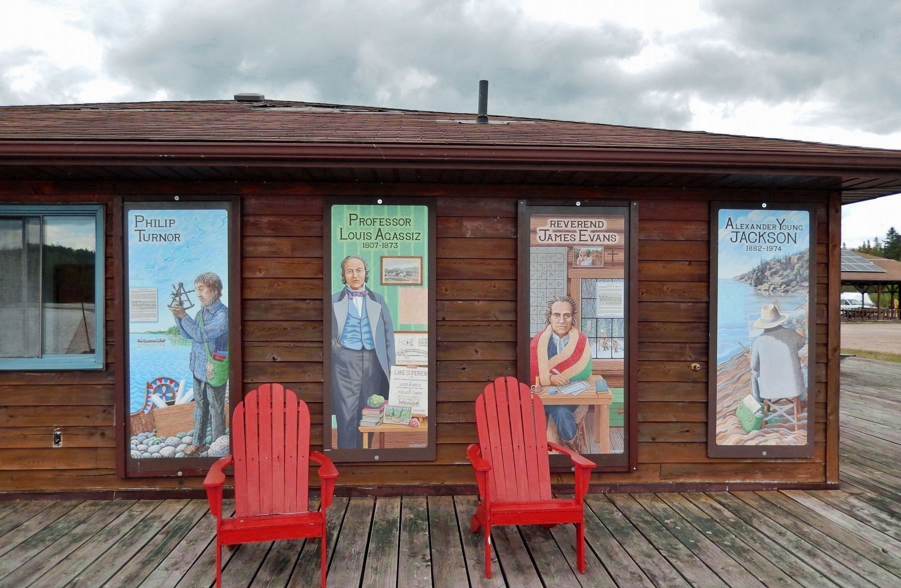
Other nearby markers. At least 8 other markers are within walking distance of this marker. Reverend James Evans (here, next to this marker); The Fur Trade at Michipicoten (approx. 0.4 kilometers away); Louisa MacKenzie Bethune (1793-1833) (approx. 0.4 kilometers away); Michipicoten River Cemetery (approx. 0.6 kilometers away); Michipicoten Scenic Lookout (approx. one kilometer away); Alexander Young Jackson (1882-1974) (approx. one kilometer away); Professor Lewis Agassiz (1807-1873) (approx. one kilometer away); Government Dock (approx. 1.5 kilometers away). Touch for a list and map of all markers in Wawa.
Related markers. Click here for a list of markers that are related to this marker. Philip Turnor
Also see . . .
1. Philip Turnor.
Philip Turnor was a surveyor and cartographer for the Hudson's Bay Company. Turnor hired on for three years as an inland surveyor with the HBCo. He is credited with exploring and mapping many of the settlements and their connecting rivers and lakes for the company in the late 18th century. A variety of willow, unique to the sand dunes of Lake Athabasca, is named "Turnor's willow" in his honour. He is credited with teaching David Thompson and Peter Fidler the skills of surveying.(Submitted on March 22, 2023, by Cosmos Mariner of Cape Canaveral, Florida.)
2. Philip Turnor.
The importance of Turnor’s work lies within the general context of the surveying effort launched by the HBC in 1778. Seeking to establish the positions of its inland posts and the river routes that linked them, the company amassed a wealth of information concerning the interior of North America that was published as a map in 1795 by Aaron Arrowsmith, the London cartographer. Entitled “A map exhibiting all the new discoveries in the interior parts of North America,” the Arrowsmith map was often reissued and became the basis of many subsequent maps of Canada. Indeed, as Arrowsmith wrote in 1794, the work of the company’s servants, Turnor among them, “had laid the permanent Foundation for the Geography of that part of the Globe.”(Submitted on March 22, 2023, by Cosmos Mariner of Cape Canaveral, Florida.)
3. Wawa Heritage Doors - portals into our past!.
"Wawa's Heritage Doors are a truly creative and effective way to combine history and art in a visually attractive cultural display for both Wawa residents and visitors to enjoy!"(Submitted on March 22, 2023, by Cosmos Mariner of Cape Canaveral, Florida.)
Credits. This page was last revised on March 23, 2023. It was originally submitted on March 22, 2023, by Cosmos Mariner of Cape Canaveral, Florida. This page has been viewed 153 times since then and 54 times this year. Photos: 1, 2, 3. submitted on March 22, 2023, by Cosmos Mariner of Cape Canaveral, Florida.


