Saint Michael in Cambria County, Pennsylvania — The American Northeast (Mid-Atlantic)
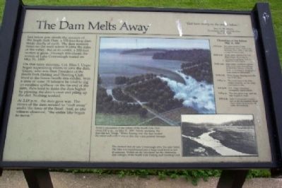
The Dam Melts Away
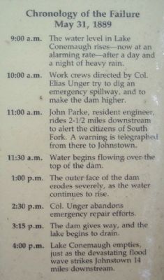
On that rainy morning, Col. Elias J. Unger began supervising efforts to save the dam. Unger, who was then President of the South Fork Fishing and Hunting Club, lived in the house beside this exhibit. With a crew of some 15 laborers he tried to dig an auxiliary spillway on the far end of the dam, then tried to make the dam higher by plowing the dam's crest and piling up the dirt. Nothing worked.
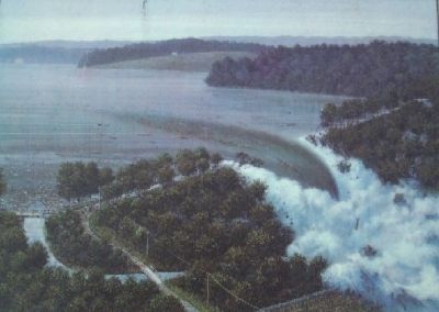
At 3:15 p.m., the dam gave way. The center of the dam seemed to “melt away” under the force of the flood. And, as one witness observed, “the entire lake began to move.”
“God have mercy on the people below.”
Rev. G. W. Brown
Eyewitness at South Fork Dam
May 31, 1889
Erected by National Park Service.
Topics. This historical marker is listed in these topic lists: Disasters • Man-Made Features • Notable Events. A significant historical month for this entry is May 1874.
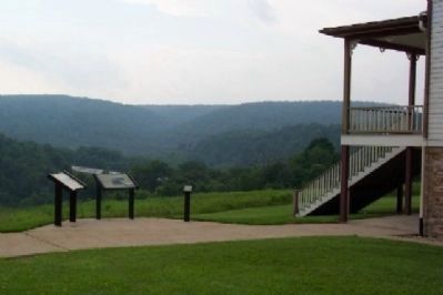
Location. 40° 20.956′ N, 78° 46.28′ W. Marker is in Saint Michael, Pennsylvania, in Cambria County. Marker is on the grounds of the Johnstown Flood National Memorial, adjacent to the Unger House, about 100 feet south of the visitor center, off Lake Road. Touch for map. Marker is in this post office area: South Fork PA 15956, United States of America. Touch for directions.
Other nearby markers. At least 8 other markers are within 4 miles of this marker, measured as the crow flies. Lake Conemaugh (here, next to this marker); The Unger House (a few steps from this marker); May 31, 1889 (within shouting distance of this marker); The South Fork Dam (approx. ¼ mile away); Johnstown Flood (approx. 0.7 miles away); American Legion Post 551 Veterans Memorial (approx. 0.8 miles away); Saint Michael World War II Honor Roll (approx. 1.2 miles away); Allegheny Portage Railroad (approx. 3.9 miles away). Touch for a list and map of all markers in Saint Michael.
Also see . . . History of the Johnstown Flood. (Submitted on August 22, 2009, by William Fischer, Jr. of Scranton, Pennsylvania.)
Photographed By William Fischer, Jr., June 26, 2009
3. The Dam Melts Away Drawing
Artist's conception of the failure of the South Fork Dam about 3:15 p.m., on May 31, 1889. Strictly speaking, the dam did not "break." Water flowing over the dam eroded the outer wall until it was so thin the water pushed through.
Photographed By William Fischer, Jr., June 26, 2009
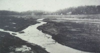
4. The Dam Melts Away Photo
The drained bed of Lake Conemaugh after the dam failed. The lake was transformed into a huge mud bowl in just 45 minutes. Visible on the lakeshore are the clubhouse and cottages of the South Fork Fishing and Hunting Club.
Credits. This page was last revised on June 16, 2016. It was originally submitted on August 22, 2009, by William Fischer, Jr. of Scranton, Pennsylvania. This page has been viewed 1,482 times since then and 8 times this year. Photos: 1, 2, 3, 4, 5, 6. submitted on August 22, 2009, by William Fischer, Jr. of Scranton, Pennsylvania. • Kevin W. was the editor who published this page.
