El Naranjal I in Pijijiapan, Chiapas, Mexico — The Southeast (North America)
Pijijiapan
Siglo XIX, XX y XXI
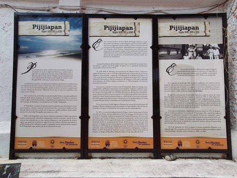
Por su importancia como corredor comercial y su fama como gran productora de cacao, la región del Soconusco, recibió desde el siglo XVI, la categoría de provincia. Esta unidad administrativa abarcaba toda la actual costa de Chiapas y fue pieza fundamental en la conformación del estado actual surgido de la fusión a fines del siglo XVIII, entre ésta y la provincia de Chiapa.
Las diferencias naturales y de explotación económica determinaron el poblamiento y la organización de redes urbanas en la provincia. Por un lado, la costa húmeda y cacaotera, con una mayor densidad demográfica, giraba en torno a las sucesivas capitales provinciales: Huehuetán, Escuintla y Tapachula. Por el otro, la costa seca y ganadera, tenía como centro a Tonalá.
Entre ambas zonas, se extendía una zona de amplias sabanas y muy poca población, dedicada desde épocas tempranas de la colonia a la ganadería. Se conoce en crónicas y mapas antiguos como El Despoblado y comprendía aproximadamente el territorio actual del municipio de Pijijiapan y sus colindancias con Tonalá y Mapastepec.
El Despoblado era asiento de grandes estancias ganaderas que determinaron el paisaje económico, cultural y social que prevalece hasta hoy. Las estancias establecieron las bases de redes de parentesco y poder, por un lado, pero también en ellas se tejió la conformación de la diversidad demográfica que todavía es visible.
Había en El Despoblado unos cuantos habitantes españoles o criollos, una minoría mestiza, una mayoría de trabajadores indígenas que tuvieron un proceso notorio de aculturación más acelerado que en otras regiones chiapaneca y una proporción de esclavos negros, que aportaron no solamente rasgos físicos sino también culturales que todavía es posible rastrear en los habitantes actuales. La ganadería bovina, herencia de las estancias de El Despoblado, sigue siendo pilar de la economía de la zona.
Entre el océano Pacífico y la Sierra Madre de Chiapas, Pijijiapan es parte del corredor de la llanura costera chiapaneca que l ha visto pasar desde la más remota antigüedad a diversos pueblos y culturas. El rico entorno de sus esteros litorales seguramente cobijó poblaciones vinculadas a los que se ha llamado cultura Chantuto. Posteriormente tuvo influencia de los olmecas de los que quedan vestigios; de los teotihuacanos, posiblemente establecidos en el vecino Tonalá y de pueblos de lengua náhua, como los mexicas que por aquí pasaron a la conquista del Soconusco, donde esta- blecieron un asentamiento.
Aunque formaba parte del área cultural mixe-zoque, el nombre del municipio deriva del náhuatl y significa "río de los pijijis". El pijiji es un ave palmípeda (dendrocygna autumnalis) común en la zona litoral.
En 1524 Pedro de Alvarado, por instrucciones de Hernán Cortés, conquistó la región del Soconusco, que en 1526 por Cédula Real pasó a formar parte de la Corona Española y posteriormente a partir de 1529 dependió de la Audiencia de México. En 1553, como parte de la provincia de Soconusco, Pijijiapan formó parte de la Capitanía General de Guatemala, en 1563 de la jurisdicción de Panamá, en 1565 volvió a depender de la Audiencia de la Nueva España y, finalmente, en 1569 reintegrado a la Capitanía General de Guatemala.
Esta zona era conocida en la época como El Despoblado. Había sin embargo estancias ganaderas y población compuesta por escasos españoles, indígenas y población negra. En 1611, en el censo del Soconusco, Pijijiapan registraba sólo 60 habitantes entre españoles y mulatos. En el siglo XVII, en 1774 forma de la provincia del Soconusco perteneciendo al curato de Tonalá. En el mes de mayo de 1779 el gobernador del Soconusco don Fernando Luis Checa, funda la primera escuela y en 1785 se funda el mancomún del pueblo. En 1786 la gobernación del Soconusco es fusionada con las Alcaldías
Mayores de Tuxtla
y Ciudad Real para formar la Intendencia de Ciudad Real de Chiapa.
Por su cercanía con Tonalá, llegaron a Pijijiapan las noticias del enfrentamiento del insurgente Mariano Matamoros contra los realistas en el lugar referido como La Chincúa. La batalla tuvo lugar el 19 de abril de 1813 en pleno proceso independentista.
En 1821, se consuma la independencia de Chiapas e inicia el proceso que lo llevaría a la unión con México, de forma definitiva en 1824. Sin embargo, el 24 de julio de 1824, en la villa de Tapachula, se declara la separación del Partido del Soconusco de la provincia de Chiapas y por lo tanto de México, y anuncia su incorporación a las Provincias Unidas de Centroamérica. El 18 de agosto del mismo año, la Asamblea Nacional Constitutiva de Guatemala declara la incorporación del Partido del Soconusco a ese nuevo país. Para entonces, la antigua provincia soconusquense ya estaba dividida en dos partidos: el de Tapachula y el de Tonalá, al que Pijijiapan pertenecía. El primero vive los vaivenes de la separación, unión a las Provincias Unidas de Centroamérica y reintegración a Chiapas y México en 1842. El partido de Tonalá por su parte, permanece dentro de los límites de Chiapas y se integra a la República Méxicana, desde el 14 de septiembre de 1824.
Por su situación de paso, Pijijiapan es testigo de todos los acontecimientos que conmueven a la costa en el siglo XIX: el paso de tropas para luchar contra los rebeldes conservadores encabezados por Chacón en 1857-1858, es un ejemplo ello.
En la segunda mitad del siglo XIX, la pequeña población vive cambios como la fundación del panteón como consecuencia de las leyes de Reforma, la construcción del primer local propio para la escuela, la inauguración del servicio telegráfico y oficialización de la feria dedicada a Santa Rita de Casia. Esto último por decreto del poder ejecutivo del estado en 1886. La feria se celebra el 17 de marzo.
El siglo XX, comienza con el memorable hecho de la caída de cenizas del volcán Santa María de Guatemala que hizo erupción en octubre de 1902. En 1906, llega a Pijijiapan el primer tren de pasajeros, inaugurando el tramo Pijijiapan-Picacho (Ixtepec, Oaxaca) del ferrocarril "Panamericano". El ferrocarril se convirtió en el principal medio de comunicación y símbolo de la prosperidad regional durante toda la primera mitad del siglo, además que permitió ampliar la diversidad de la población con la llegada de orientales y migrantes de otros estados de la república.
En la época revolucionaria, el gobierno carrancista decreta en 1915, la desaparición de la jefaturas políticas y la creación de 59 municipios libre, uno de los cuales es Pijijiapan. La población es atacada el 18 de julio de 1918 por los "mapaches", comandados por Tiburcio Fernández Ruiz, que se habían alzado en armas en contra de la ocupación carrancista de Chiapas. Ese mismo año, Pijijiapan sufre las consecuencias de la epidemia de influenza con un significativo número de víctimas, más que los provocados por las batallas de la Revolución.
El 25 de septiembre de 1933, se registra la primera inundación Pijijiapan. A lo largo del siglo XX y principios del XXI, varios fenómenos hidrometeorológicos impactan al municipio, tal como volvió a ocurrir en 1988 y en 2006.
Pijijiapan
19th, 20th and 21st Centuries
Due to its importance as a commercial corridor and its fame as a great producer of cocoa the Soconusco region has been a province since the sixteenth century. This administrative unit covered the entire current coast of Chiapas and was a fundamental piece in the formation of the current state which emerged from the merger in the late eighteenth century between it and the province of Chiapa.
Natural differences and economic exploitation determined the settlement and organization of urban networks in the province. On the one hand, the humid cocoa coast, with a greater population density, revolved around the successive provincial capitals: Huehuetán, Escuintla and Tapachula. On the other hand, the dry and livestock-oriented coastal area had as its center Tonalá.
Between both areas, there was an area of wide savannas and very little population, dedicated since early colonial times to livestock. It is known in chronicles and old maps as El Despoblado (The Unpopulated Area) and comprised approximately the current territory of the municipality of Pijijiapan and its borders with Tonalá and Mapastepec.
El Despoblado was the seat of large cattle ranches that determined the economic, cultural and social landscape that prevails until today. The estancias established the bases of networks of kinship and power, on the one hand, but also in them was woven the conformation of the demographic diversity that is still visible.
There were in El Despoblado a few Spanish or Creole inhabitants, a mestizo minority, a majority of indigenous workers who had a notorious process of acculturation that was more accelerated than in other Chiapas regions and a proportion of black slaves, who contributed not only physical but also cultural traits that can still be traced in the current inhabitants. Cattle ranching, inherited from the ranches of El Despoblado, continues to be a pillar of the economy of the area.
Between the Pacific Ocean and the Sierra Madre de Chiapas, Pijijiapan is part of the corridor of the Chiapas coastal plain that has seen diverse peoples and cultures pass through since the most remote antiquity. The rich environment of its coastal estuaries surely sheltered populations linked to what has been called the Chantuto culture. Later it was influenced by the Olmecs, of which vestiges remain; of the Teotihuacans, possibly established in the neighboring Tonalá and of Nahua-speaking peoples, such as the Mexica, who passed through here to the conquest of Soconusco, where they established a settlement.
Although it was part of the Mixe-Zoque cultural area, the name of the municipality derives from Nahuatl and means "river of the pijijis". The pijiji is a palmiped bird (Dendrocygna autumnalis) that is common in the littoral zone.
In 1524 Pedro de Alvarado, on instructions from Hernán Cortés, conquered the Soconusco region, which in 1526 by Royal Decree became part of the Spanish Crown and later from 1529 depended on the Audiencia of Mexico. In 1553, as part of the province of Soconusco, Pijijiapan was part of the Captaincy General of Guatemala, in 1563 of the jurisdiction of Panama and in 1565 it returned to depend on the Audiencia of New Spain and, finally, in 1569 reintegrated to the Captaincy General of Guatemala.
This area was known at the time as El Despoblado. There were, however, cattle ranches and a population composed of few Spaniards, Indians and the Black population. In 1611, in the census of Soconusco, Pijijiapan recorded only 60 inhabitants between Spaniards and mulattos. In the seventeenth century, in 1774w the province of Soconusco was formed as belonging to the parish of Tonalá. In May 1779 the governor of Soconusco, Don Fernando Luis Checa, founded the first school and in 1785 the common areas of the town were founded. In 1786 the governorship of Soconusco is merged with the Mayors of Tuxtla and Ciudad Real to form the Intendancy of Ciudad Real de Chiapa.
Because of its proximity to Tonalá, news reached Pijijiapan of the confrontation of the insurgent Mariano Matamoros against the royalists in the place referred to as La Chincúa. The battle took place on April 19, 1813 in the middle of the independence process.
In 1821, the independence of Chiapas was consummated and the process that would lead it to union with Mexico began definitively in 1824. However, on July 24, 1824, in the town of Tapachula, the separation of the Soconusco from the province of Chiapas and therefore from Mexico was declared, and its incorporation into the United Provinces of Central America was announced. On August 18 of the same year, the National Constituent Assembly of Guatemala declared the incorporation of the Soconusco into that new country. By then, the old province of Soconusco was already divided into two parts: Tapachula and Tonalá, to which Pijijiapan belonged. The first experienced the ups and downs of separation, union with the United Provinces of Central America and reintegration to Chiapas and Mexico in 1842. The part of Tonalá remains within the limits of Chiapas and is integrated into the Mexican Republic since September 14, 1824.
Due to its location as a route of passage, Pijijiapan is witness to all the events that moved the coast in the nineteenth century: the passage of troops to fight against the conservative rebels led by Chacón in 1857-1858, is an example of this.
In the second half of the nineteenth century, the small population experienced changes such as the foundation of the municipal cemetery as a result of the Reform laws, the construction of the first premises solely for the school, the inauguration of the telegraph service and officialization of the fair dedicated to Santa Rita de Casia. The latter by decree of the executive power of the state in 1886. The fair is held on March 17. a
The twentieth century begins with the memorable fact of the ashfall of the Santa María volcano in Guatemala that erupted in October 1902. In 1906, the first passenger train arrived in Pijijiapan, inaugurating the Pijijiapan-Picacho section (Ixtepec, Oaxaca) of the "Panamericano" railroad. The railroad became the main means of communication and a symbol of regional prosperity throughout the first half of the century, in addition to expanding the diversity of the population with the arrival of Orientals and migrants from other states of the republic.
In the revolutionary era, the Carrancista government decreed in 1915 the disappearance of the political headquarters and the creation of 59 free municipalities, one of which is Pijijiapan. The population is attacked on July 18, 1918 by the "raccoons", commanded by Tiburcio Fernández Ruiz, who had taken up arms against the Carrancista occupation of Chiapas. That same year, Pijijiapan suffers the consequences of the influenza epidemic with a significant number of victims, more than those caused by the battles of the Revolution.
On September 25, 1933, the first Pijijiapan flood was recorded. Throughout the twentieth and early twenty-first centuries, several hydrometeorological phenomena impacted the municipality, as happened again in 1988 and 2006.
Erected 2010 by Gobierno del Estado de Chiapas.
Topics. This historical marker is listed in these topic lists: Colonial Era • Native Americans • Settlements & Settlers • Wars, Non-US. A significant historical date for this entry is March 17, 1524.
Location. 15° 41.52′ N, 93° 12.595′ W. Marker is in Pijijiapan, Chiapas. It is in El Naranjal I. Marker is on Quinta Avenida Norte Poniente west of 4a Poniente Norte, on the right when traveling west. Touch for map. Marker is at or near this postal address: Quinta Avenida Nte Pte 41, Pijijiapan CHIS 30540, Mexico. Touch for directions.
Other nearby markers. At least 1 other marker is within walking distance of this marker. Miguel Hidalgo y Costilla (within shouting distance of this marker).
Credits. This page was last revised on March 24, 2023. It was originally submitted on March 24, 2023, by J. Makali Bruton of Accra, Ghana. This page has been viewed 119 times since then and 38 times this year. Photos: 1, 2, 3. submitted on March 24, 2023, by J. Makali Bruton of Accra, Ghana.


