Saint Michael in Cambria County, Pennsylvania — The American Northeast (Mid-Atlantic)
May 31, 1889
Photographed by William Fischer, Jr., June 26, 2009
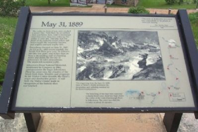
1. May 31, 1889 Marker
The valley in front of you once cradled a scenic lake. Held back by an earthen dam just below here, Lake Conemaugh stretched more than two miles up the valley to your left. The lake was the heart of an exclusive resort where sailboats caught the mountain breezes, and anglers pursued trophy fish.
Everything changed on May 31, 1889. At 3:15 p.m., after record rainfall, the South Fork Dam gave way. In minutes the lake was gone, and in less than an hour a devastating wall of churning water and debris hit the city of Johnstown 14 miles downstream. The death toll exceeded 2,200.
Johnstown Flood National Memorial, established by Congress in 1964, commemorates the tragic Johnstown Flood by preserving the remains of the South Fork Dam. Exhibits and programs in the Visitor Center describe the flood's origin and destructive power. A trail from the Visitor Center leads to viewpoints of the historic dam and lakebed.
“The scene of destruction presented was unparalleled in the annals of American history....”
Rev. David J. Beale, A survivor of the Johnstown Flood, 1890
[From flood path description at bottom center of marker.] The
this page online
Erected by National Park Service.
Topics and series. This historical marker is listed in these topic lists: Disasters • Notable Events • Waterways & Vessels. In addition, it is included in the Lost at Sea series list. A significant historical month for this entry is May 1812.
Location. 40° 20.976′ N, 78° 46.255′ W. Marker is in Saint Michael, Pennsylvania, in Cambria County. It can be reached from Lake Road. Marker is on the grounds of the Johnstown Flood National Memorial, just southeast of the Visitor Center, off Lake Road. Touch for map. Marker is in this post office area: South Fork PA 15956, United States of America. Touch for directions.

Regionally, this marker is in Pennsylvania’s Laurel Highlands. It is also in the American Northeast, in the Mid-Atlantic, in Appalachia, and specifically in Northern Appalachia. Globally, it is in North America, the Western Hemisphere, the Western World, and the Anglosphere. Historically,
Photographed by William Fischer, Jr., June 26, 2009
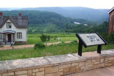
2. May 31, 1889 Marker
Unger House and marker on pathway below, with edge of Visitor Center at extreme right of photo. Mound to left of trees in distance above the Unger House marker is part of the Lake Conemaugh Dam remains. Silver strip in distance above the May 31, 1889 marker is US Route 219.
Other nearby markers. At least 8 other markers are within 2 miles of this marker, measured as the crow flies: The Unger House (within shouting distance of this marker); The Dam Melts Away (within shouting distance of this marker); Lake Conemaugh (within shouting distance of this marker); The South Fork Dam (approx. ¼ mile away); Johnstown Flood (approx. 0.7 miles away); American Legion Post 551 Veterans Memorial (approx. 0.8 miles away); Saint Michael World War II Honor Roll (approx. 1.2 miles away); Summerhill (approx. 1.9 miles away). Touch for a list and map of all markers in Saint Michael.
Also see . . . Some of the incredible stories of those who survived. Johnstown Flood Museum website entry (Submitted on August 23, 2009, by William Fischer, Jr. of Reynoldsburg, Ohio.)
Photographed by William Fischer, Jr., June 26, 2009
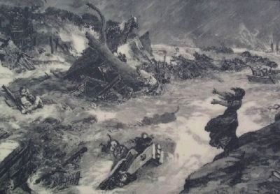
3. Harper's Weekly Engraving on Marker
"This engraving from the June 15, 1889, issue of Harper's Weekly portrays the devastation and suffering wreaked by the flood in Johnstown."
Credits. This page was last revised on May 24, 2025. It was originally submitted on August 23, 2009, by William Fischer, Jr. of Reynoldsburg, Ohio. This page has been viewed 1,204 times since then and 26 times this year. Photos: 1, 2, 3. submitted on August 23, 2009, by William Fischer, Jr. of Reynoldsburg, Ohio. • Bill Pfingsten was the editor who published this page.
