The Jewish Quarter in Jerusalem, Israel — West Asia (the Levant in the Middle East)
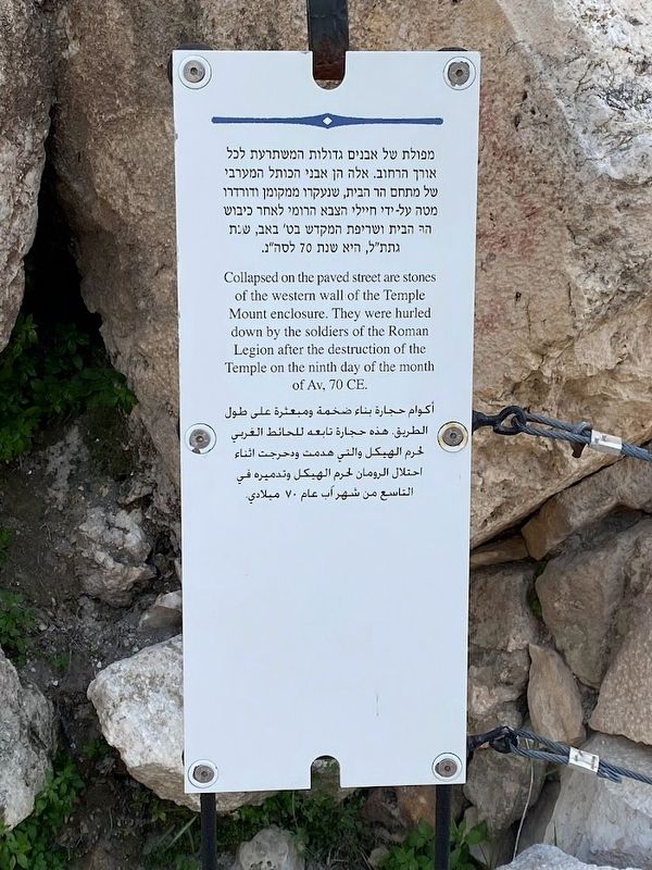
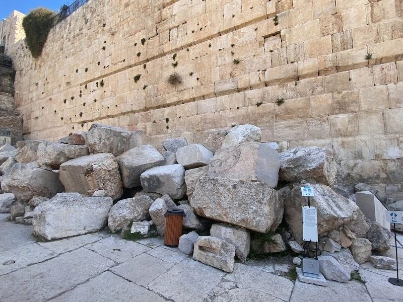
Stones from the western wall of the Temple Mount enclosure
Inscription.
Collapsed on the paved street are stones of the western wall of the Temple Mount enclosure. They were hurled down by the soldiers of the Roman Legion after the destruction of the Temple on the ninth day of the month of Av, 70 CE.
(Hebrew and Arabic texts not transcribed)
Topics. This historical marker is listed in these topic lists: Churches & Religion • Forts and Castles • Notable Events • Wars, Non-US. A significant historical date for this entry is August 30, 70 CE.
Location. 31° 46.563′ N, 35° 14.071′ E. Marker is in Jerusalem, Israel. It is in The Jewish Quarter. Touch for map. Touch for directions.
Other nearby markers. At least 8 other markers are within walking distance of this marker. "and you shall see and your heart shall rejoice and their bones like grass shall..." (within shouting distance of this marker); A Ritual Bath (within shouting distance of this marker); Western Springer of Robinson's Arch (within shouting distance of this marker); "to the place of trumpeting to..." (within shouting distance of this marker in Jerusalem District); Remains of Jerusalem's main street from the Second Temple period (within shouting distance of this marker in Jerusalem District); Welcome to the Western Wall a remnant of the Temple (within shouting distance of this marker); Western Wall (within shouting distance of this marker in Jerusalem District); A Medieval Structure (about 90 meters away, measured in a direct line). Touch for a list and map of all markers in Jerusalem.
Also see . . .
1. Siege of Jerusalem (70 CE) (Wikipedia). Overview: The siege of Jerusalem of 70 CE was the decisive event of the First Jewish–Roman War (66–73 CE), in which the Roman army led by future emperor Titus besieged Jerusalem, the center of Jewish rebel resistance in the Roman province of Judaea. Following a brutal five-month siege, the Romans destroyed the city and the Second Jewish Temple.
On Tisha B'Av, 70 CE (August 30), Roman forces finally overwhelmed the defenders and set fire to the Temple. Resistance continued for another month, but eventually the upper and lower parts of the city were taken as well, and the city was burned to the ground. Titus spared only the three towers of the Herodian citadel as a testimony to the city's former might. Josephus wrote that over a million people perished in the siege and the subsequent fighting. While contemporary studies dispute this figure, all agree that the siege had a major toll on human life, with many people being killed and enslaved, and large parts of the city destroyed… (Submitted on April 1, 2023.)
2. Tisha B'Av (Wikipedia).
Overview: Tisha B'Av (Hebrew: תִּשְׁעָה בְּאָב, lit. 'the ninth of Av') is an annual fast day in Judaism, on which a number of disasters in Jewish history occurred, primarily the destruction of both Solomon's Temple by the Neo-Babylonian Empire and the Second Temple by the Roman Empire in Jerusalem.(Submitted on April 1, 2023.)
Tisha B'Av marks the end of the three weeks between dire straits and is regarded as the saddest day in the Jewish calendar, and it is thus believed to be a day which is destined for tragedy. Tisha B'Av falls in July or August in the Gregorian calendar.
Credits. This page was last revised on April 1, 2023. It was originally submitted on March 30, 2023, by Darren Jefferson Clay of Duluth, Georgia. This page has been viewed 68 times since then and 23 times this year. Photos: 1, 2. submitted on March 30, 2023, by Darren Jefferson Clay of Duluth, Georgia. • Andrew Ruppenstein was the editor who published this page.

