This Byzantine-period dwelling stood along the broad road that ascended to the Hulda Gates. It was built atop the remains of a structure from the Second Temple period, which included ritual purification baths and cisterns. In one of the rooms of the . . . — — Map (db m219888) HM
The ancient sages gleaned from this verse that four conditions were required for a mikveh to be ritually valid. The first two involve the structure itself, rendering that the mikveh must be rock-hewn or connected to the ground. The other two are . . . — — Map (db m219884) HM
Preserving physical purity has been a hallmark of Jewish religion since ancient times. The Bible mentions various states of ritual impurity and commands a life of purity. Beginning in Second Temple times, bathing for purposes of ritual purification . . . — — Map (db m219890) HM
This tower, which was destroyed and rebuilt several times in the Middle Ages, reflects the changes in government Jerusalem underwent at this time. In 1099 CE the Crusaders conquered the city from the Muslim rulers and renovated the city wall and its . . . — — Map (db m219054) HM
A large cistern, with a rock hewn column in its center, dates to the Second Temple period (first century CE). The cistern was probably originally used in the First Temple period.
(Hebrew and Arabic text not transcribed) — — Map (db m219645) HM
A medieval structure, approached from the Temple Mount, incorporating segments of masonry from different periods. The roof offers a panoramic view of the excavated area, as well as of the Jewish Quarter, Mount Zion, and the Mount of Olives. . . . — — Map (db m219244) HM
A rock-cut Jewish ritual bath (miqveh) from the Second Temple period (1st Century BCE-1st Century CE). The parapet down the middle of the steps separated bathers on their way down to be cleansed, from those ascending who had already been purified. . . . — — Map (db m219893) HM
A stepped ritual bath (miqveh), located in the ground floor of a build, dates to the late Second Temple period (first century CE). Numerous ritual baths and water reservoirs were found in the region. They were either built or hewn inside the remains . . . — — Map (db m219809) HM
A stepped ritual bath (miqveh), located in the ground floor of a building, dates to the late Second Temple period (first century CE). Numerous ritual baths and water reservoirs were found in the region. They were either built or hewn inside the . . . — — Map (db m219648) HM
An open public space was created on the Ophel ascent for the throngs of pilgrims before they entered the Temple Mount, featuring, among other things, many ritual purification baths. Because this area was on a slope, monumental staircases were built . . . — — Map (db m219313) HM
Buildings along the fortification line from the First Temple period (tenth-sixth centuries BCE): gate house (1), royal structure (2), section of the Small Tower (3), straight wall (4), below the road: the Large Tower (5).
Right Two vaulted rooms . . . — — Map (db m219819) HM
The gate was originally a small wicket gate built by Suleiman the Magnificent. It is named after the gate mentioned in the Book of Nehemiah. Arabic: Bab al-Maghariba.
(Hebrew and Arabic text not transcribed) — — Map (db m219898) HM
Rising above us, Jerusalem's impressive city wall was built by the Ottomans in the 16th century CE. In many places t was built above the remains of earlier city walls. Evidence of the wall's construction and destruction is visible in this section, . . . — — Map (db m219048) HM
In addition to laws governing bodily purity, Jewish law also mandates how to purify food utensils that were purchased from a gentile or had been rendered impure.
Many vessels from the Second Temple period were uncovered in excavations in the . . . — — Map (db m219887) HM
Jerusalem Walls National Park was officially declared in 1974 with the goal of protecting the landscape of open spaces and the heritage values surrounding the Old City. Most of the current line of the wall and its gates were built during the Ottoman . . . — — Map (db m219057) HM
The archaeological remains discovered in 1909 on this site have been transferred to the Notre-Dame de France guest house where father Germer-Durand created a museum. During the 1948 war, bombs hurt the southern wing of the building and destroyed . . . — — Map (db m222071) HM
The massive piers are the remains of one of the imposing public buildings erected around the Temple Mount area by the Umayyad rulers (7th-8th centuries CE).
(Hebrew and Arabic text not transcribed) — — Map (db m219818) HM
Ottoman Period - White
Ayyubid Period - Green
Early Islamic Period - Fatimid Wall - Yellow
Byzantine Period - Dark Blue
Roman Period - Herodian Wall - Gray
Hellenistic Period - Hasmonean Wall - Light Blue
Israelite Period - First . . . — — Map (db m219049) HM
Buildings, preserved to a considerable height along the fortification line of the First Temple period (tenth-sixth centuries BCE): a straight wall, a royal structure, destroyed by the Babylonians in 586 BCE, on the floors of which large store jars . . . — — Map (db m219340) HM
An entire tractate of the Mishnah is named "Miqva'ot" (ritual purification baths), and is devoted to laws related to these installations, such as the conditions needed to render them ritually valid and technical details concerning their . . . — — Map (db m219886) HM
Rock-cut channels covered in stone slabs served for drainage in the Second Temple period (1st century BCE - 1st century CE). One of the channels reaches nears the eastern Huldah gate.
(Hebrew and Arabic not transcribed) — — Map (db m219894) HM
The presence of tens of thousands of pilgrims in Jerusalem required suitable infrastructure, the most basic of which was the water supply. The water was used, among other purposes, for religious rituals and purification rites.
The water supply . . . — — Map (db m219876) HM
A hall built in the Middle Ages at the place where, according to tradition, Jesus partook of the Passover meal with his disciples, just before the crucifixion. — — Map (db m220113) HM
Miqva'ot are installations unique to the Jewish people. Their religious purpose is to cleanse the individual from ritual impurity, and they were built in keeping with the principles of Jewish religious regulations (Halakha). This rock-cut . . . — — Map (db m219824) HM
Gate house (1) and royal structure (2) from the First Temple period. The excavator, Eilat Mazar, suggests the buildings are part of the city wall that King Solomon constructed in Jerusalem: "...until he had made an end of building his own house, and . . . — — Map (db m219816) HM
The wall we see today was built at the initiative of the Turkish sultan Suleiman the Magnificent in 1535-1538 CE to enhance Jerusalem's importance as a holy city and to protect it from Christianity's patron, the king of Spain.
The Ottoman wall . . . — — Map (db m219046) HM
The Ottoman city wall is sealed, but the steps adjacent to it reveal a secret: they allude to the existence of a gate or postern in the city wall from the time of the Second Temple. Presumably this gate led to Herod's palace, which was located . . . — — Map (db m219053) HM
In the Second Temple Period, [illegible] the eastern ridge, which included the Temple Mount and the City of David, and the western ridge where the Upper City was built. The segment of wall in front of us encloses the northwestern part of the Upper . . . — — Map (db m219050) HM
The eastern Huldah Gate, built in the Second Temple period, was a triple gate. Of the original masonry, only the threshold and the lowest stone of the left doorpost have survived. A person cured of an illness carved a Hebrew inscription of . . . — — Map (db m219321) HM
The gate house comprises four rooms of identical size, flanking a central passage paved with tamped chalk. Its plan is characteristic of the First Temple period (tenth-sixth centuries BCE) and is similar to that of the gate houses exposed at . . . — — Map (db m219806) HM
"The two Hulda Gates on the south (of the Temple Mount), that served for coming in and going out" - (Mishnah, Middoth 1, 3)
The Hulda Gates, the eastern double gate and the western triple gate, in the southern wall of the Temple Mount . . . — — Map (db m219311) HM
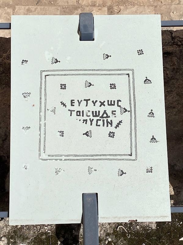
"Nevertheless a fountain of a cistern wherein is a gathering of water shall be clean" - Leviticus 11:36
The Mikveh Trail passes through excavated remnants of various structures. Signs along the trail explain archaeological features, . . . — — Map (db m219829) HM
"Neverless a fountain or a cistern wherein is a gathering of water shall be clean" - Leviticus 11:36
The Mikveh Trail passes through excavated remnants of various structures. Signs along the trail explain archaeological features, . . . — — Map (db m219248) HM
The Mishnaic Tractate Mikva'ot details all the rules, formulated in Second Temple times, regarding ritual purification baths. These rules are based on the following conditions that made the mikveh ritually valid: It had to be connected to the . . . — — Map (db m219312) HM
The western Huldah Gate was built in the Second Temple period as a double gate. Most of the gate is blocked today with only part of one of the arches still visible. The façade of the gate was decorated with floral and geometric motifs when it was . . . — — Map (db m219896) HM
The two burial caves in front of us date to the latter part of the First Temple period. These caves were found devoid of remains and were part of Jerusalem's western cemetery which was hewn outside the city walls.
It was customary at the time . . . — — Map (db m219040) HM
In tribute to Poles buried in this cemetery, civilians and soldiers of General Vladyslaw Anders Polish II Corps
Former Prisoners of War and Inmates of Soviet Lagers who died on their way to homeland in the years World War II and after
Poland . . . — — Map (db m219058) WM
The ground floor of a royal structure, destroyed in a fierce conflagration during the Babylonian conquest of the city in 586 BCE. Twelve large, clay store jars (pithoi), which probably contained wine or oil, were discovered on the floor of the . . . — — Map (db m219650) HM
Two superposed, vaulted rooms, dating to the Second Temple period (first century CE), were preserved to a height of two stories. The rooms are part of a public building, whose continuation lies beneath the street. An opening in the western wall of . . . — — Map (db m219811) HM
On this site was a temporary prison in which members of the Jewish underground forces were detained for questioning. Amongst those detained were Betar and I.Z.L members who blew the shofar at the Western Wall at the close of Yom Kippur. — — Map (db m220144) HM
An Ottoman military camp, presently used by the Israel Police. Site of Herod's luxurious palace at the end of the Second Temple period. — — Map (db m220145) HM
The remains of the east wall of the Umayyad Palace, as well as its wide gate which has been filled with stones, served as foundations for the medieval and Ottoman city walls. During the archaeological excavations the blocking of the gate was . . . — — Map (db m219246) HM
A residential building from the Byzantine period (6th - 7th centuries CE), preserved beneath the Umayyad Palace. Surviving parts are courtyards, rock-cut cavities and (partly reconstructed) residential rooms with plastered walls and mosaic floors.
. . . — — Map (db m219245) HM
This site owes its fame to Jesus' healing of the paralytic, a story told in John's Gospel:
"One man was there who had been ill for thirty-eight years. When Jesus saw him lying there... he said to him: 'Do you want to be made well?' The sick man . . . — — Map (db m222074) HM
Sont au service de l’Eglise dans 21 pays d’Afrique. Ici depuis 1878, ils se veulent au service de l’unite.
Serve the church in 21 African countries.
In 1878, they came to Jerusalem, where their aim is to work for . . . — — Map (db m220239) HM
One of the stones in the wall, bears a Hebrew inscription "and you shall see and your heart shall rejoice and their bones like grass shall..." - a biblical verse somewhat altered.. The circumstances of the inscription are unknown.
(Hebrew . . . — — Map (db m219240) HM
In the course of the reconstruction of the Jewish Quarter the 1970s, archaeological finds dated to different periods include numerous architectural elements. These were found throughout the Jewish Quarter in secondary use in later structures, and . . . — — Map (db m220137) HM
From the 7th century CE, Jerusalem's architectural tradition continued to develop, while utilizing earlier traditions and reusing architectural elements. Over the years new architectural and artistic styles appeared. one of the innovations was the . . . — — Map (db m220135) HM
During 1930-1948 the grocery store of brothers Avraham and Ben-Zion Maimaran operated in this building. Both were born in the Jewish Quarter to one of its oldest families.
The store served as a social and commercial center. In 1948 it became a . . . — — Map (db m219070) HM
Commander of the Jewish Quarter in Israel's War of Independence in 1948 and named "Worthy of Jerusalem." The City of Jerusalem and his comrades in arms have chosen this site to commemorate their commander Moshe Rusnak.
Who with wisdom and faith, . . . — — Map (db m220138) WM
Collapsed on the paved street are stones of the western wall of the Temple Mount enclosure. They were hurled down by the soldiers of the Roman Legion after the destruction of the Temple on the ninth day of the month of Av, 70 CE.
(Hebrew and . . . — — Map (db m219242) HM
This is a Second Temple period home that was situated in the opulent Herodian Quarter. Excavations revealed burnt wooden beams and soot. Apparently it burned down in the great fire the Romans started in Jerusalem after the Temple's destruction (70 . . . — — Map (db m219153) HM
The University of North Carolina at Charlotte has been conducting archaeological excavations at this location for more than a decade, with the discovery of the remains of a major multi-roomed structure from the Second Temple period (late 1st century . . . — — Map (db m220181) HM
The Foundation Stone sits at the peak of Mount Moriah above the Western Wall. According to tradition, the world was created from this stone, the Binding of Isaac took place on it, and King Solomon built the First Temple around it as "a house for the . . . — — Map (db m221891) HM
A pier of large stones which originally supported the western springer of Robinson's Arch. The pier enclosed four cubicles that served as shops, opening onto the paved street.
(Hebrew and Arabic not transcribed) — — Map (db m219239) HM