Castolon in Big Bend National Park in Brewster County, Texas — The American South (West South Central)
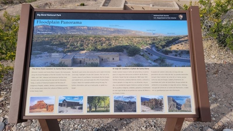
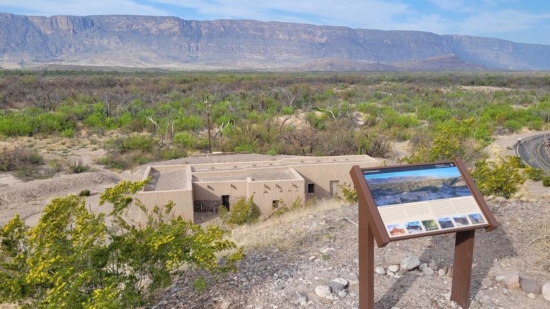
Floodplain Panorama
Big Bend National Park
The Drive from Castolon to Santa Elena Canyon
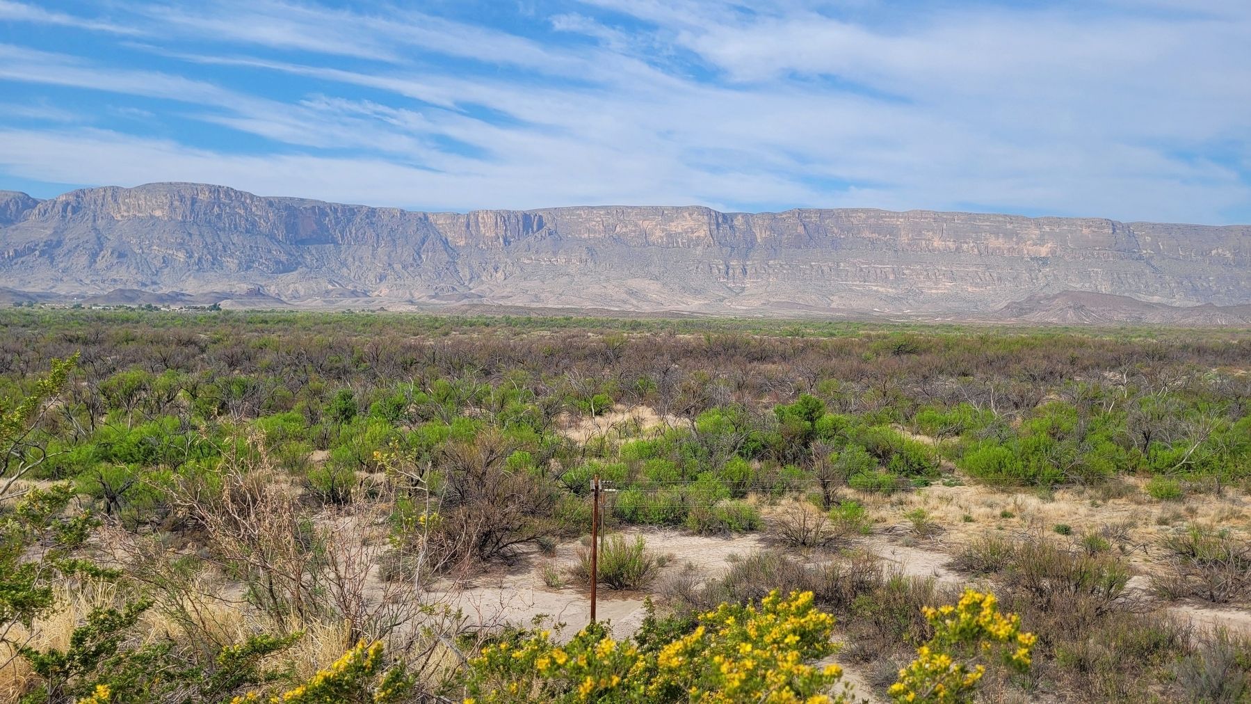
Between Castolon and Santa Elena Canyon, the road passes along the broad floodplain of the Rio Grande. From the late 1880s until 1961, Mexican and American families lived, farmed, and ranched along the river and its tributaries. Today, a variety of historical locations tell the story of Indigenous Peoples, soldiers, farmers, and entrepreneurs in this remote place where the cultures of Mexico and the United States meet.
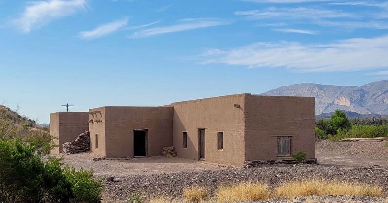
Big Bend's past comes alive along the scenic eight-mile drive (one-way). Highlights include Old Castolon, the ruins of La Coyota, views of rural Mexico, homesteads like the Dorgan and Sublett farms, and eventually the cliffs of Santa Elena Canyon. Watch for roadside exhibits along the way. For further information, pick up a road guide, or speak to a ranger.
Captions
Historic Castolon
Old Castolon
Cottonwood Campground
La Coyota Ruins
Sublett House
Santa Elena Canyon
Spanish:
Desde Castolon hasta el Cañón de Santa Elena, el camino pasa a lo largo de la llanura de inundación del Río Bravo del Norte. Desde final de la década de 1880 hasta 1961, familias mexicanas y estadounidenses vivieron, cultivaron y criaron ganado a lo largo del río y sus afluentes. Hoy en día, una variedad de lugares históricos cuentan la historia de los pueblos indígenas, soldados, granjeros y empresarios en este lugar donde se encuentran las culturas de México y los Estados Unidos.
El pasado de Castolon cobra vida a lo largo del viaje panorámico de ocho millas (de ida). Las paradas destacadas incluyen Viejo Castolon, las ruinas de La Coyota, granjas como las casas de Dorgan, Sublett y finalmente, los acantilados del Cañón de Santa Elena. Busque señales de exhibición en las paradas a lo largo del camino. Obtenga una guía de turismo en un centro de información, o hable con un guardaparque para más información.
Erected by National Park Service - U.S. Department of the Interior.
Topics. This historical marker is listed in these topic lists: Hispanic Americans • Native Americans • Parks & Recreational Areas • Settlements & Settlers. A significant historical year for this entry is 1961.
Location. 29° 8.058′ N, 103° 30.908′ W. Marker is in Big Bend National Park, Texas, in Brewster County. It is in Castolon. Marker can be reached from the intersection of River Road West and Santa Elena Canyon Road. The marker is located on the grounds of the Castolon Ranger Station and Visitors Center. Touch for map. Marker is in this post office area: Big Bend National Park TX 79834, United States of America. Touch for directions.
Other nearby markers. At least 8 other markers are within 7 miles of this marker, measured as the crow flies. Cavalry Post to Trading Post (a few steps from this marker); Garlick House (within shouting distance of this marker); Magdalena's House (within shouting distance of this marker); Cotton Boom in Castolon (within shouting distance of this marker); La Harmonia Store (approx. 0.6 miles away); Grand Canyon Farms (approx. 4.2 miles away); Luna's Jacal (approx. 5.7 miles away); Into the Canyon! (approx. 6.2 miles away). Touch for a list and map of all markers in Big Bend National Park.
More about this marker. The marker is located on the grounds of the Big Bend National Park which requires an entrance fee to access.
Also see . . . Castolon Historic District. National Park Service
The buildings at Castolon are a remnant of Big Bend's pioneer and military history. Castolon experienced a rich cross-cultural mingling, as the Hispanic culture was a melding of Spanish and indigenous peoples of the region. Anglo-American settlers later entered the area, learning survival methods from the previous settlers and forming a bicultural community with the Mexican settlers. These rural families in Big Bend survived in a harsh landscape, compounded by the Mexican Revolution that began in 1910. During this time, bandits from Mexico took advantage of the chaos to raid small border communities, causing some families on both sides of the Rio Grande to abandon their homes.(Submitted on March 31, 2023, by James Hulse of Medina, Texas.)
Credits. This page was last revised on March 31, 2023. It was originally submitted on March 30, 2023, by James Hulse of Medina, Texas. This page has been viewed 82 times since then and 19 times this year. Photos: 1, 2, 3, 4. submitted on March 31, 2023, by James Hulse of Medina, Texas.


