Thompson Falls in Sanders County, Montana — The American West (Mountains)
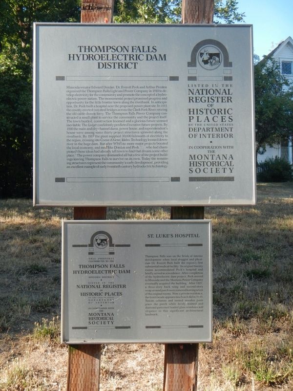
Thompson Falls Hydroelectric Dam District
St. Luke's Hospital
Inscription.
Missoula senator Edward Donlan, Dr. Everett Peek, and Arthur Preston organized the Thompson Falls Light and Power Company in 1910 to develop electricity for the community and promote the concept of a hydroelectric power station. The monumental project promised progress and opportunity for the little frontier town along the riverbank. In anticipation, Dr. Peek built a hospital near the proposed power plant site. In 1911, the county erected two steel bridges across the Clark Fork River retiring the old cable-drawn ferry. The Thompson Falls Power Company constructed a small plant to service the community and the project itself. The town bustled, construction boomed, and a glorious future seemed inevitable. The Ledger confidently predicted lucrative future projects. By 1916, the main and dry channel dams, power house, and superintendent’s house were among some thirty project structures sprawled along the riverbank. By 1917, the plant supplied 30,000 kilowatts of electricity to the region, crossing into Coeur D’Alene, Idaho. Technology loomed downriver in the huge dam. But after World War I no more major projects boosted the local economy, and men like Donlan and Peek “…who had championed those ideas had already left town to find that dream some other place.” The power company dismantled all but a few of the project buildings, leaving Thompson
Falls to survive on its own. Today the remaining structures represent the community’s early development,
St. Luke's Hospital
Thompson Falls Hydroelectric Dam Historic District
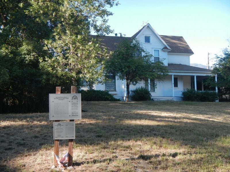
Thompson Falls was on the brink of intense development when local druggist and physician Dr. Everett Peek built the region’s first substantial medical facility. Its original twenty rooms accommodated Peek’s hospital and briefly served as a residence. After completion of the hydroelectric dam project, Peek moved to Missoula and the Montana Power Company eventually acquired the building. After 1927, a three-story back wing and second-story wraparound porch were removed, leaving seven of the original rooms. Now a private residence, the front façade appears much as it did in 1910. Tuscan columns and turned wooden posts grace the porch while lovely stained and diamond-patterned leaded glass windows add elegance to this significant architectural landmark.129, 0122
Erected by Montana Heritage Commission, Montana History Foundation.
Topics and series. This historical marker is listed in these topic lists: Architecture • Man-Made Features • Notable Buildings • Science & Medicine. In addition, it is included in the Montana National Register Sign Program series list. A significant historical year for this entry is 1910.
Location.
47° 35.771′ N, 115° 21.5′ W. Marker is in Thompson Falls, Montana, in Sanders County. Marker is on Maiden Lane near Pond Street, on the right when traveling west. Touch for map. Marker is at or near this postal address: 1014 Maiden Lane, Thompson Falls MT 59873, United States of America. Touch for directions.
Other nearby markers. At least 8 other markers are within walking distance of this marker. 102 Park Street (approx. ¼ mile away); Sanders County Jail (approx. 0.3 miles away); Randolph Hoyt House (approx. 0.3 miles away); Ainsworth House (approx. 0.4 miles away); Ward Hotel (approx. half a mile away); Bedard House (approx. 0.6 miles away); Weber's Store (approx. 0.7 miles away); Fort Thompson Playground (approx. 0.7 miles away). Touch for a list and map of all markers in Thompson Falls.
Credits. This page was last revised on April 3, 2023. It was originally submitted on April 3, 2023, by Barry Swackhamer of Brentwood, California. This page has been viewed 65 times since then and 16 times this year. Photos: 1, 2. submitted on April 3, 2023, by Barry Swackhamer of Brentwood, California.

