Prescott in Yavapai County, Arizona — The American Mountains (Southwest)
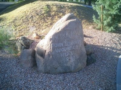
John Towhey
Stone Marker:
John Towhey
Wounded
Here
1861
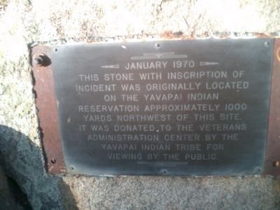
Plaque Attached to Stone:
It was donated to the Veterans Administration Center by the Yavapai Indian Tribe for viewing by the public.
Erected 1970.
Topics. This historical marker is listed in these topic lists: Military • Native Americans • Wars, US Indian. A significant historical month for this entry is January 1970.
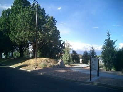
Location. 34° 33.104′ N, 112° 27.11′ W. Marker is in Prescott, Arizona, in Yavapai County. Marker is on Entrance to Bob Stump VA Medical Center, on the right. This stone is located on the right of the drive entering the VA hospital. It is where the first road splits to the right. Touch for map. Marker is at or near this postal address: Arizona Route 89, Prescott AZ 86301, United States of America. Touch for directions.
Other nearby markers. At least 8 other markers are within one mile of this marker, measured as the crow flies. Fort Whipple (approx. 0.2 miles away); Citizens Cemetery (approx. 0.6 miles away); VFW Bucky O'Neill Post No. 541 (approx. 0.7 miles away); Grace M. Sparkes (approx. ¾ mile away); Prescott National Guard Armory (approx. ¾ mile away); Site of the O'Neill/Munds House (approx. 0.8 miles away); City Park and Ballfield (approx. 0.8 miles away); Washington School (approx. one mile away). Touch for a list and map of all markers in Prescott.
Credits. This page was last revised on June 16, 2016. It was originally submitted on August 27, 2009, by Joseph Cavinato of Fountain Hills, Arizona. This page has been viewed 1,307 times since then and 20 times this year. Photos: 1, 2, 3. submitted on August 27, 2009, by Joseph Cavinato of Fountain Hills, Arizona. • Syd Whittle was the editor who published this page.


