Okeechobee in Okeechobee County, Florida — The American South (South Atlantic)
The Battle of Okeechobee Historic State Park
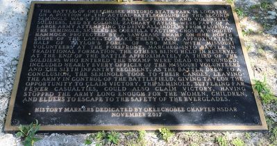
The Battle of Okeechobee Historic State Park is located on a portion of the actual battleground of the Second Seminole War's fiercest battle. Federal and volunteer soldiers, led by colonel Zachary Taylor, were part of a large army attempting to drive all Indians from Florida. The Seminole, skilled in guerrilla tactics, chose a wooded hammock protected by a sawgrass swamp on the north shore of the lake. To make their stand, approximately half of Taylor’s force of 850 men, with Missouri volunteers at the forefront, marched into battle in traditional formation, the others being held in reserve. At the end of the battle approximately a third of the soldiers who entered the swamp were dead or wounded, including nearly every officer of the Missouri Volunteers and the Sixth Infantry Regiment. As the battle drew to a conclusion, the Seminole took to their canoes, leaving the army in control of the battlefield, giving Taylor the opportunity to claim victory. The Seminole, suffering far fewer casualties, could also claim victory, having stopped the army long enough for the women, children, and elders to escape to the safety of the everglades.
Erected 2017 by Okeechobee Chapter NSDAR.
Topics and series. This memorial is listed in these topic lists: Native Americans • Wars, US Indian. In addition, it is included in the Daughters of the American Revolution series list. A significant historical year for this entry is 1837.
Location. 27° 12.711′ N, 80° 47.358′ W. Marker is in Okeechobee, Florida, in Okeechobee County. Memorial is on Southeast 38th Avenue, 0.2 miles north of Route 98/441, on the right when traveling north. Touch for map. Marker is at or near this postal address: 3501 SE 38th Ave, Okeechobee FL 34974, United States of America. Touch for directions.
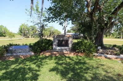
Other nearby markers. At least 8 other markers are within 4 miles of this marker, measured as the crow flies. Battle of Okeechobee (here, next to this marker); The Okeechobee Battlefield Historic State Park (here, next to this marker); Liberty Tree (a few steps from this marker); a different marker also named The Battle of Okeechobee (within shouting distance of this marker); Peter and Louisiana Chandler Raulerson Log Cabin Historic Site (approx. 3 miles away); Vietnam Pilots and Crewmembers Memorial (approx. 3.3 miles away); For All Who Have Served (approx. 3.3 miles away); First United Methodist Church of Okeechobee, Florida (approx. 3˝ miles away). Touch for a list and map of all markers in Okeechobee.
Credits. This page was last revised on April 13, 2023. It was originally submitted on April 13, 2023, by Dave W of Co, Colorado. This page has been viewed 82 times since then and 8 times this year. Photos: 1, 2. submitted on April 13, 2023, by Dave W of Co, Colorado. • Devry Becker Jones was the editor who published this page.

