Lebanon in Wilson County, Tennessee — The American South (East South Central)
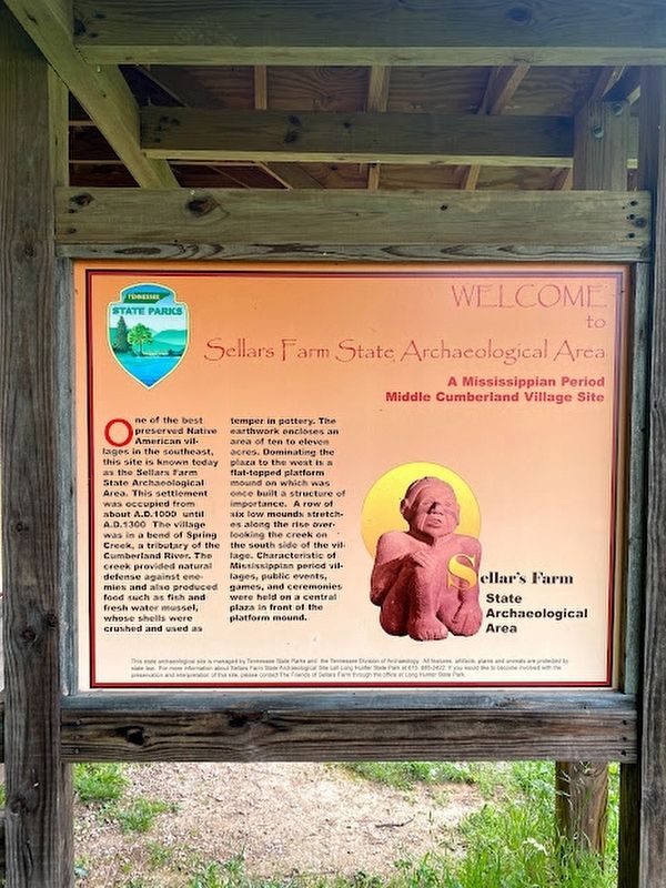
Welcome to Sellars Farm State Archaeological Area
A Mississippian Period Middle Cumberland Village Site
One of the best preserved Native American villages in the southeast, this site is known today as the Sellars Farm State Archaeological Area. This settlement was occupied from about A.D. 1000 until A.D. 1300. The village was in a bend of Spring Creek, a tributary of the Cumberland River. The creek provided natural defense against enemies and also produced food such as fish and fresh water mussel, whose shells were crushed and used as temper in pottery. The earthworks enclose an area of ten to eleven acres. Dominating the plaza to the west is a flat-topped platform mound on which was once built a structure of importance. A row of six low mounds stretches along the rise overlooking the creek on the south side of the village. Characteristic of Mississippian period villages, public events, games, and ceremonies were held on a central plaza in front of the platform mound.
Erected by Tennessee State Park.
Topics. This historical marker is listed in these topic lists: Anthropology & Archaeology • Native Americans • Settlements & Settlers.
Location. 36° 9.948′ N, 86° 14.573′ W. Marker is in Lebanon, Tennessee, in Wilson County. Marker can be reached from Poplar Hill Road, 0.4 miles east of Sparta Pike (U.S. 70), on the left when traveling east. Touch for map. Marker is at or near this postal address: 433 Poplar Hill Rd, Lebanon TN 37090, United States of America. Touch for directions.
Other nearby markers. At least 8 other markers are within 3 miles of this marker, measured as the crow flies. Sellars Farm Site (here, next to this marker); Sellars Farm (within shouting distance of this marker); a different marker also named Sellars Farm (within shouting distance of this marker); Thompson-Partlow Cabin and Smokehouse (approx. 2.7 miles away); Cartmell Cabin (approx. 2.7 miles away); Livesay Mill (approx. 2.7 miles away); Forbes Cabin (approx. 2.7 miles away); Melrose Church (approx. 2.7 miles away). Touch for a list and map of all markers in Lebanon.
Credits. This page was last revised on April 19, 2023. It was originally submitted on April 18, 2023, by Darren Jefferson Clay of Duluth, Georgia. This page has been viewed 97 times since then and 21 times this year. Photos: 1, 2. submitted on April 18, 2023, by Darren Jefferson Clay of Duluth, Georgia. • Devry Becker Jones was the editor who published this page.

