Sidney in Delaware County, New York — The American Northeast (Mid-Atlantic)
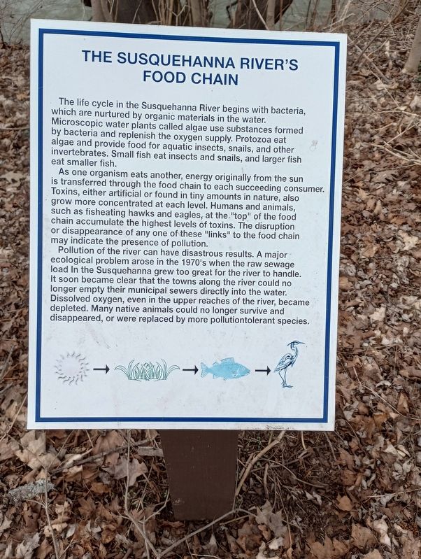
The Susquehanna River's Food Chain
The life cycle in the Susquehanna River begins with bacteria, which are nurtured by organic materials in the water. Microscopic water plants called algae use substances formed by bacteria and replenish the oxygen supply. Protozoa eat algae and provide food for aquatic insects, snails, and other invertebrates. Small fish eat insects and snails, and larger fish eat smaller fish.
As one organism eats another, energy originally from the sun is transferred through the food chain to each succeeding consumer. Toxins, either artificial or found in tiny amounts in nature, also grow more concentrated at each level. Humans and animals, such as fisheating hawks and eagles, at the "top" of the food chain accumulate the highest levels of toxins. The disruption or disappearance of any one of these "links" to the food chain may indicate the presence of pollution.
Pollution of the river can have disastrous results. A major ecological problem arose in the 1970's when the raw sewage load In the Susquehanna grew too great for the river to handle. It soon became clear that the towns along the river could no longer empty their municipal sewers directly into the water. Dissolved oxygen, even in the upper reaches of the river, became depleted. Many native animals could no longer survive and disappeared, or were replaced by more pollutiontolerant species.
Topics. This historical marker is listed in these topic lists: Environment • Waterways & Vessels.
Location. 42° 18.864′ N, 75° 24.062′ W. Marker is in Sidney, New York, in Delaware County. Marker can be reached from River Street near Dunham Street, on the right when traveling west. Touch for map. Marker is in this post office area: Sidney NY 13838, United States of America. Touch for directions.
Other nearby markers. At least 8 other markers are within walking distance of this marker. Larry "L.T." Thrower (within shouting distance of this marker); Sidney Firemen's Memorial Park (within shouting distance of this marker); The Susquehanna River (within shouting distance of this marker); Juglans Cinerea (within shouting distance of this marker); Mayor Elwood "Dixie" Davis (about 400 feet away, measured in a direct line); Acer Saccharum (about 400 feet away); January 1996 Flash Flood In The Susquehanna River Basin (about 500 feet away); The Covered Bridge at Sidney (about 700 feet away). Touch for a list and map of all markers in Sidney.
Credits. This page was last revised on April 22, 2023. It was originally submitted on April 18, 2023, by Craig Doda of Napoleon, Ohio. This page has been viewed 157 times since then and 58 times this year. Photos: 1, 2. submitted on April 18, 2023, by Craig Doda of Napoleon, Ohio. • Michael Herrick was the editor who published this page.

