Vermillion in Clay County, South Dakota — The American Midwest (Upper Plains)
Welcome to Cotton Park
— Missouri National Recreational River Water Trail —
Lat 42° 46' 23.0" N
Long 96° 55' 51.0" W
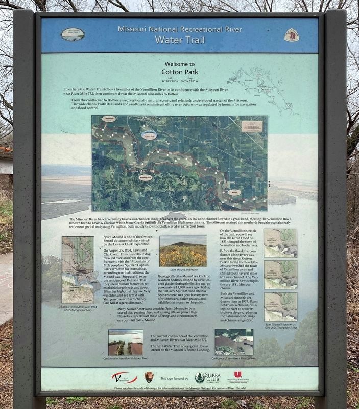
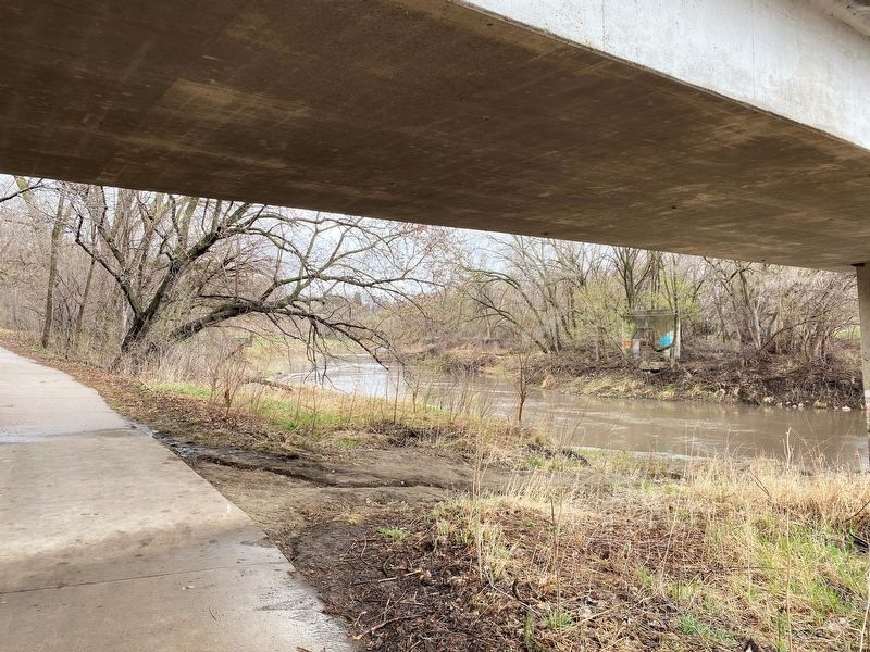
From here the Water Trail follows five miles of the Vermillion River to its confluence with the Missouri River near River Mile 772, then continues down the Missouri nine miles to Bolton.
From the confluence to Bolton is an exceptionally natural, scenic, and relatively undeveloped stretch of the Missouri. The wide channel with its islands and sandbars is reminiscent of the river before it was regulated by humans for navigation and flood control.
The Missouri River has carved many braids and channels in this area over the years. In 1804, the channel flowed in a great bend, meeting the Vermillion River (known then to Lewis & Clark as White Stone Creek) beneath the Vermillion Bluffs near this site. The Missouri retained this northerly bend through the early settlement period and young Vermillion, built mostly below the bluff, served as a riverboat town.
Spirit Mound is one of the few confirmed documented sites visited by the Lewis & Clark Expedition.
On August 25, 1804, Lewis and Clark, with 11 men and their dog, traveled overland from the confluence to visit the "Mountain of little people or Spirits." Captain Clark wrote in his journal that, according to tribal tradition, the Mound was "Suppose[d] to be the residence of Deavels. That they are in human form with remarkable large heads and about 18 inches high, that they are Very watchful, and are arm'd with Sharp arrows with which they Can Kill at a great distance."
Geologically, the Mound is a knob of resistant bedrock shaped by a Pleistocene glacier during the last ice age, approximately 13,000 years ago. Today, the 320-acre Spirit Mound site has been restored to a prairie ecosystem of wildflowers, native grasses, and wildlife that is open to the public.
Many Native Americans consider Spirit Mound to be a sacred site, praying there and leaving gifts or prayer flags. Please be respectful of these offerings and circumstances on your visit to the Mound.
On the Vermillion stretch of the trail, you will see how the Great Flood of 1881 changed the town of Vermillion and both rivers.
Before the flood, the confluence of the rivers was near this site at Cotton Park. During the flood, the Missouri washed the town of Vermillion away and shifted south several miles to a new channel. The Vermillion River now occupies the pre-1881 Missouri channel.
Both the Vermillion and Missouri channels are deeper than in 1957. Dams hold back sediment, causing the river to scour its bed ever deeper, reducing the natural meanderings and channel migration.
The current confluence of the Vermillion and Missouri Rivers is at River Mile 772.
The next Water Trail access point downstream on the Missouri is Bolton Landing.
Reverse
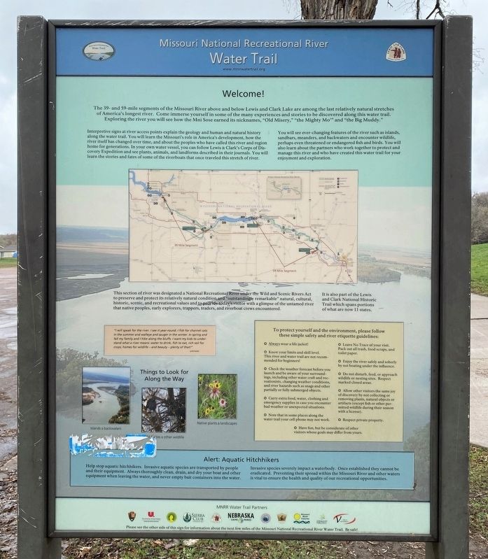
The 39- and 59-mile segments of the Missouri River above and below Lewis and Clark Lake are among the last relatively natural stretches of America's longest river. Come immerse yourself in some of the many experiences and stories to be discovered along this water trail. Exploring the river you will see how the Mni Sose earned its nicknames, "Old Misery," "the Mighty Mo'" and "the Big Muddy."
Interpretive signs at river access points explain the geology and human and natural history along the water trail. You will learn the Missouri's role in America's development, how the river itself has changed over time, and about the peoples who have called this river and region home for generations. In your own water vessel, you can follow Lewis & Clark's Corps of Discovery Expedition and see plants, animals, and landforms described in their journals. You will learn the stories and fates of some of the riverboats that once traveled this stretch of river.
You will see ever-changing features of the river such as islands, sandbars, meanders, and backwaters and encounter wildlife, perhaps even threatened or endangered fish and birds. You will also learn about the partners who work together to protect and manage this river and who have created this water trail for your enjoyment and exploration.
This section of river was designated a National Recreational River under the Wild and Scenic Rivers Act to preserve and protect its relatively natural condition and "outstandingly remarkable" natural, cultural, historic, scenic, and recreational values and to provide today's visitor with a glimpse of the untamed river that native peoples, early explorers, trappers, traders, and riverboat crews encountered.
It is also part of the Lewis and Clark National Historic Trail which spans portions of what are now 11 states.
Erected by City of Vermillion, National Parks Service, Sierra Club, and The University of South Dakota Missouri River Institute.
Topics. This historical marker is listed in these topic lists: Environment • Exploration • Waterways & Vessels. A significant historical date for this entry is August 25, 1804.
Location. 42° 46.401′ N, 96° 55.865′ W. Marker is in Vermillion, South Dakota, in Clay County. Marker is on South Dakota Street, 0.1 miles south of East Broadway Street, on the right when traveling south. Touch for map. Marker is at or near this postal address: 501 S Dakota St, Vermillion SD 57069, United States of America. Touch for directions.
Other nearby markers. At least 8 other markers are within walking distance of this marker. Vermillion (within shouting distance of this marker); Lewis and Clark / Vermillion (within shouting distance of this marker); Confluence of the Vermillion and Missouri Rivers (about 300 feet away, measured in a direct line); Grand Lodge Constitution Site (approx. 0.2 miles away); Site of the First Permanent School House in Dakota Territory (approx. 0.2 miles away); Old Vermillion (approx. 0.2 miles away); The First Baptist Church, Vermillion, South Dakota (approx. 0.4 miles away); Downtown Vermillion (approx. 0.4 miles away). Touch for a list and map of all markers in Vermillion.
Credits. This page was last revised on April 27, 2023. It was originally submitted on April 27, 2023. This page has been viewed 60 times since then and 13 times this year. Photos: 1, 2, 3, 4, 5. submitted on April 27, 2023.
