Shelbina in Monroe County, Missouri — The American Midwest (Upper Plains)
Trail of Death
April 22, 2023
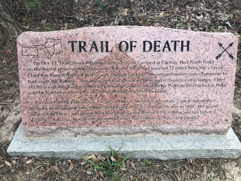
1. Trail of Death Marker
On October 13, 1838 about 800 Potawatomi Indians camped at Clinton, Mo (North Fork) on the forced removal from Indiana to Oklahoma. They had traveled 17 miles from See's Creek. Chief Ash-Kum asked that Gen. A. Morgan not leave the emigration because of promises he had made the Indians, also requested that they travel less and remain in camp longer. Chief I-O-Weh said Ash-Kum was not a Chief and that he wanted Judge Polke to be conductor. Polke said he had been conductor all along. Morgan departed for home.
Erected 1999 by Clifford and Josephine (Tarboe) Gander. Josephine’s great grandfather Barnaby Worland and wife Catherine Deering, from Ky., lived at Clinton in 1839. Her grandmother Lou Ellen and grandfather Joseph M. Tarboe from Ky. lived there and her father J.A. Craig Tarboe was born there. Josephine was born 3 miles southwest of Clinton.
Erected 1999.
Topics and series. This historical marker is listed in these topic lists: Disasters • Indigenous Peoples and Communities • Wars, US Indian. In addition, it is included in the Potawatomi Trail of Death series list. A significant historical date for this entry is October 13, 1838.
Location. 39° 36.629′ N,
this page online

Regionally, this marker is in North Missouri and in Mark Twain Country. It is also in the American Midwest, in the Lewis & Clark Corridor, and in the Corn Belt. Globally, it is in North America, the Western Hemisphere, the Western World, and the Anglosphere. Historically, it finds itself in what was once the territory of the Mississippian Culture, the Louisiana Purchase, and the Antebellum South.
Other nearby markers. At least 8 other markers are within 15 miles of this marker, measured as the crow flies: Monroe County Veterans Memorial (approx. 9.8 miles away); In Memory of Ezra Fox (approx. 9.8 miles away); a different marker also named Trail of Death (approx. 9.8 miles away); Hannibal & St. Joseph Railroad (approx. 10.3 miles away); James Monroe (approx. 10.3 miles away); The Town of Florida (approx. 10.8 miles away); Mark Twain (approx. 11.1 miles away); Shelby County World War I Memorial (approx. 15 miles away).
Credits. This page was last revised on November 23, 2024. It was originally submitted on April 28, 2023. This page has been viewed 475 times since then and 58 times this year. Photo 1. submitted on April 28, 2023. • J. Makali Bruton was the editor who published this page.
Editor’s want-list for this marker. A clearly readable close-up photo of the marker. • A wide view photo of the marker and the surrounding area together in context. • Accurate coordinates for the marker. • Can you help?
