Busby in Big Horn County, Montana — The American West (Mountains)
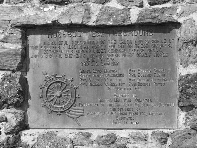
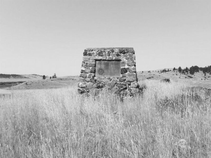
Rosebud Battlefield
Sergt. David Marshall Pvt. Brooks Conner
Sergt. Anton Neukirchen Pvt. Eugene Flynn
Pvt. William W. Allen Pvt. Allen Mitchell
Pvt. Richard W. Bennett Pvt. George Potts
Pvt. Gilbert Roe
Erected by Shining Mountain Chapter Daughters of the American Revolution, Billings and citizens of Rosebud and Big Horn Counties, Montana. Dedicated June 17, 1934."
Erected 1934 by Shining Mountain Chapter Daughters of the American Revolution, Billings and citizens of Rosebud and Big Horn Counties, Montana.
Topics and series. This memorial is listed in these topic lists: Native Americans • Wars, US Indian. In addition, it is included in the Daughters of the American Revolution series list. A significant historical date for this entry is June 17, 1876.
Location. 45° 13.183′ N, 106° 56.964′ W. Marker is in Busby, Montana, in Big Horn County. Memorial is on State Highway 314. Located along Rosebud Creek in Big Horn County off MT 314. Touch for map. Marker is in this post office area: Busby MT 59016, United States of America. Touch for directions.
Other nearby markers. At least 5 other markers are within 2 miles of this marker, measured as the crow flies. The Land Speaks (approx. 1.2 miles away); What Is This Land Worth? (approx. 1.2 miles away); The Way They Saw It (approx. 1.2 miles away); General Crook's Troops (approx. 1.2 miles away); The Time When The People Fought The Soldiers. (approx. 1.2 miles away).
More about this marker. Commemorates one of the largest battles of the Indian wars with 1,050 US troops and a similar number of Indians.
Credits. This page was last revised on April 30, 2023. It was originally submitted on April 13, 2020. This page has been viewed 354 times since then and 27 times this year. Last updated on April 29, 2023. Photos: 1. submitted on April 13, 2020, by Cheryl Genovese of Bozeman, Montana. 2. submitted on April 13, 2020. • J. Makali Bruton was the editor who published this page.

