Kittrell in Vance County, North Carolina — The American South (South Atlantic)
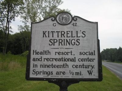
Kittrell’s Springs
Photographed by Bill Coughlin, July 31, 2010
1. Kittrell’s Springs Marker
Erected 1948 by Archives, Conservation, and Highway Departments. (Marker Number G-42.)
Topics and series. This historical marker is listed in these topic lists: Entertainment • Parks & Recreational Areas • Waterways & Vessels. In addition, it is included in the North Carolina Division of Archives and History series list.
Location. 36° 13.373′ N, 78° 26.624′ W. Marker is in Kittrell, North Carolina, in Vance County. It is at the intersection of U.S. 1 and Main Street, on the right when traveling south on U.S. 1. Touch for map. Marker is at or near this postal address: 3920 US-1, Kittrell NC 27544, United States of America. Touch for directions.

Regionally, this marker is in North Carolina’s Piedmont. It is also in the American South and specifically in the Upper South. Globally, it is in North America, the Western Hemisphere, the Western World, and the Anglosphere. Historically, it finds itself in what was once the territory of the Mississippian Culture,
this page online
Other nearby markers. At least 8 other markers are within 8 miles of this marker, measured as the crow flies: The Glass House (within shouting distance of this marker); Confederate Cemetery (within shouting distance of this marker); Kittrell College (about 800 feet away, measured in a direct line); Kittrell Confederate Cemetery (approx. ¼ mile away); "Tiny" Broadwick (approx. 5.9 miles away); Ben E. King (approx. 7.4 miles away); Henderson City Center (approx. 7.6 miles away); Vance County World War II Memorial (approx. 7.6 miles away). Touch for a list and map of all markers in Kittrell.
Photographed by Bill Coughlin, July 31, 2010
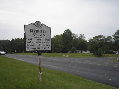
2. Kittrell’s Springs Marker
Photographed by Bill Coughlin, July 31, 2010
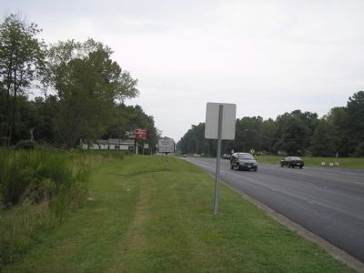
3. Kittrell’s Springs Marker
Credits. This page was last revised on May 5, 2023. It was originally submitted on August 21, 2010, by Bill Coughlin of Woodland Park, New Jersey. This page has been viewed 1,694 times since then and 112 times this year. Last updated on May 4, 2023, by Michael Buckner of Durham, North Carolina. Photos: 1, 2, 3. submitted on August 21, 2010, by Bill Coughlin of Woodland Park, New Jersey. • Bernard Fisher was the editor who published this page.
