Jacksons' Gap in Tallapoosa County, Alabama — The American South (East South Central)
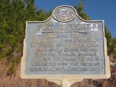
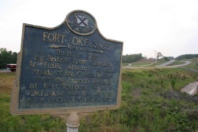
Fort Okfuskee
←— 6 mi. west —«
Erected 1953 by Alabama Historical Association.
Topics and series. This historical marker is listed in these topic lists: Colonial Era • Forts and Castles • Native Americans. In addition, it is included in the Alabama Historical Association series list. A significant historical year for this entry is 1735.
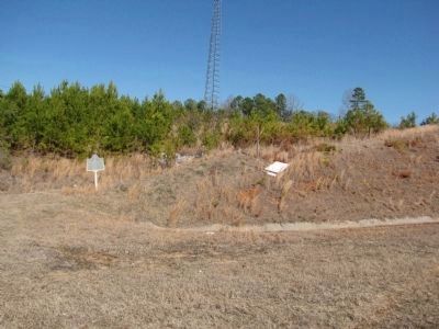
Location. 32° 52.98′ N, 85° 51.258′ W. Marker is in Jacksons' Gap, Alabama, in Tallapoosa County. Marker is on U.S. Highway 280, on the right when traveling north. Touch for map. Marker is in this post office area: Jacksons Gap AL 36861, United States of America. Touch for directions.
Other nearby markers. At least 8 other markers are within 7 miles of this marker, measured as the crow flies. Woods Presbyterian Church (approx. 5 miles away); Horseshoe Bend Battle Ground (approx. 5 miles away); Dadeville Coca-Cola Company (approx. 6.3 miles away); Grafenberg Medical Institute (approx. 6.3 miles away); Dennis Hotel (approx. 6.3 miles away); Tallapoosa County Korean & Vietnam War Memorial (approx. 6.4 miles away); Tallapoosa County World War II Memorial (approx. 6.4 miles away); Battle Of Horseshoe Bend (approx. 6.4 miles away).
Regarding Fort Okfuskee.
Georgia Provincial Companies - 1734-1747.
"Raised in May 1734, Captain Patrick Mackay's Independent Company of Rangers built and manned Fort Okfuskee on the Tallapoosa River among the Upper Creeks in present Alabama. The company was divided into two separate parties during 1736, but the remnants were on duty among the Creeks and on the coast until 1740. Mounted on horseback, Mackay's Rangers wore broad-brimmed hats, civilian coats, buckskin breeches, leather Indian leggins and shoes. Cartridge boxes, powder flasks, and iron-handled cutlasses hung from belts with brass buckles. Muskets were long-barreled infantry types, but probably not the "Brown Bess" (largely unavailable in Georgia before 1740)."
Syd Whittle of El Dorado Hills California
Credits. This page was last revised on September 4, 2020. It was originally submitted on September 6, 2009, by Timothy Carr of Birmingham, Alabama. This page has been viewed 3,207 times since then and 71 times this year. Photos: 1. submitted on February 28, 2011, by Lee Hattabaugh of Capshaw, Alabama. 2. submitted on September 6, 2009, by Timothy Carr of Birmingham, Alabama. 3. submitted on February 28, 2011, by Lee Hattabaugh of Capshaw, Alabama. • Syd Whittle was the editor who published this page.


