Near Hanover in Caroline County, Virginia — The American South (Mid-Atlantic)
Caroline County
⎯⎯⎯
Hanover County
Photographed by Bernard Fisher, September 1, 2009
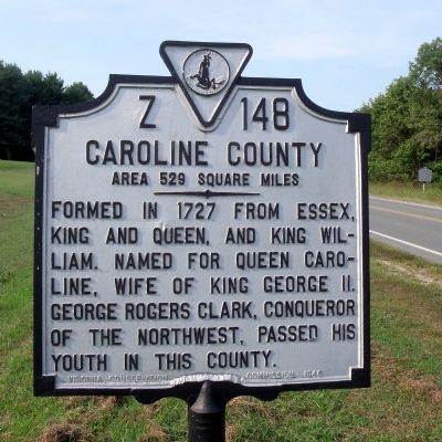
1. Caroline County Marker
Caroline County. Area 529 Square Miles. Formed in 1727 from Essex, King and Queen, and King William. Named for Queen Caroline, wife of King George II. George Rogers Clark, conqueror of the Northwest, passed his youth in this county.
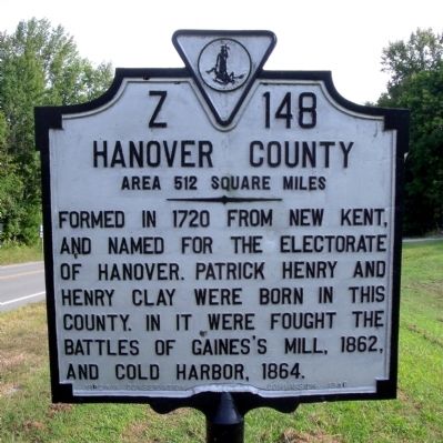
Hanover County. Area 512 Square Miles. Formed in 1720 from New Kent, and named for the Electorate of Hanover. Patrick Henry and Henry Clay were born in this county. In it were fought the battles of Gaines's Mill, 1862, and Cold Harbor, 1864.
Erected 1946 by Virginia Conservation Commission. (Marker Number Z-148.)
Topics and series. This historical marker is listed in these topic lists: Political Subdivisions • War, US Civil • War, US Revolutionary • Women. In addition, it is included in the Virginia Department of Historic Resources (DHR) series list. A significant historical year for this entry is 1727.
Location. 37° 47.416′ N, 77° 22.2′ W. Marker is near Hanover, Virginia, in Caroline County. It is at the intersection of Richmond Turnpike (U.S. 301) and Mt Gideon Road, on the left when traveling north on Richmond Turnpike. Touch for map. Marker is in this post office
this page online

Regionally, this marker is in the Piedmont and in Central Virginia. It is also in the American South, specifically in the Upper South, and on the Eastern Seaboard. Globally, it is in the North Atlantic Region, North America, the Western Hemisphere, the Western World, and the Anglosphere. Historically, it finds itself in what was once the territory of the Mississippian Culture, one of the original Thirteen Colonies, one of the Confederate States of America, and the Antebellum South.
Other nearby markers. At least 8 other markers are within 2 miles of this marker, measured as the crow flies: Gabriel’s Rebellion (within shouting distance of this marker); Hanover Courthouse (approx. 1.9 miles away); a different marker also named Hanover Courthouse (approx. 1.9 miles away); Hanover Confederate Soldiers Monument (approx. 1.9 miles away); The Fields Family (approx. 1.9 miles away); Patrick Henry (approx. 1.9 miles away); Hanover Tavern (approx. 1.9 miles away); a different marker also named Hanover Tavern (approx. 1.9 miles away). Touch for a list and map
Photographed by Bernard Fisher, September 1, 2009
2. Hanover County Marker
Other markers no longer nearby. Washington-Rochambeau Route (was approx. 1.9 miles away but has been permanently removed); Hanover Court House (was approx. 1.9 miles away but has been permanently removed).
Also see . . .
1. Caroline County, Virginia. (Submitted on September 7, 2009, by Bernard Fisher of Richmond, Virginia.)
2. Hanover County Historical Society. (Submitted on September 7, 2009, by Bernard Fisher of Richmond, Virginia.)
Photographed by Bernard Fisher, September 1, 2009
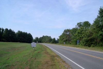
3. Caroline County Marker
Photographed by Bernard Fisher, September 1, 2009
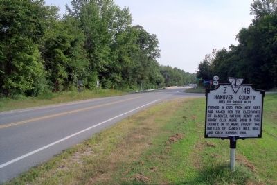
4. Hanover County Marker
Credits. This page was last revised on July 3, 2021. It was originally submitted on September 7, 2009, by Bernard Fisher of Richmond, Virginia. This page has been viewed 1,142 times since then and 49 times this year. Photos: 1, 2, 3, 4. submitted on September 7, 2009, by Bernard Fisher of Richmond, Virginia.
