Hillsborough in Orange County, North Carolina — The American South (South Atlantic)
Occaneechi
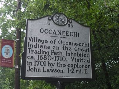
Photographed by Bill Coughlin, July 31, 2010
1. Occaneechi Marker
Erected 1991 by NC Division of Archives and History. (Marker Number G-33.)
Topics and series. This historical marker is listed in these topic lists: Indigenous Peoples and Communities • Industry & Commerce • Roads & Vehicles • Settlements & Settlers. In addition, it is included in the North Carolina Division of Archives and History series list. A significant historical year for this entry is 1680.
Location. 36° 4.324′ N, 79° 5.953′ W. Marker is in Hillsborough, North Carolina, in Orange County. It is on South Churton Street, on the right when traveling north. The marker is on the south side of the bridge leading to the Hillsborough Historic District. Touch for map. Marker is at or near this postal address: 229 S Churton St, Hillsborough NC 27278, United States of America. Touch for directions.

Regionally, this marker is in the Piedmont and in the Research Triangle. It is also in the American South and specifically in the Upper South. Globally, it is in North America,
this page online
Other nearby markers. At least 8 other markers are within walking distance of this marker: William Churton (within shouting distance of this marker); James Hogg (about 600 feet away); Billy Strayhorn (approx. 0.2 miles away); North Carolina Society of the Cincinnati (approx. 0.2 miles away); a different marker also named William Churton (approx. 0.2 miles away); Edmund Fanning (approx. 0.2 miles away); Lynching In America / The Lynching of Washington, Thomas Jefferson, and Daniel Morrow (approx. 0.2 miles away); Regulators Hanged (approx. 0.2 miles away). Touch for a list and map of all markers in Hillsborough.
Other markers no longer nearby. Paper Mill (was about 500 feet away, measured in a direct line but has been permanently removed); a different marker also named Edmund Fanning (was approx. 0.2 miles away but has been replaced with another marker now near
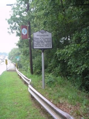
Photographed by Bill Coughlin, July 31, 2010
2. Marker on S Churton Street
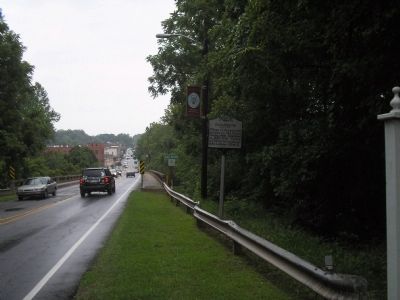
Photographed by Bill Coughlin, July 31, 2010
3. Marker in the Hillsborough Historic District

Photographed by Richard Hawkins, August 2, 2025
4. Occaneechi Marker
Credits. This page was last revised on August 5, 2025. It was originally submitted on August 1, 2010, by Bill Coughlin of Woodland Park, New Jersey. This page has been viewed 1,248 times since then and 39 times this year. Last updated on May 11, 2023, by Michael Buckner of Durham, North Carolina. Photos: 1, 2, 3. submitted on August 1, 2010, by Bill Coughlin of Woodland Park, New Jersey. 4. submitted on August 2, 2025, by Richard Hawkins of Phelan, California. • J. Makali Bruton was the editor who published this page.
