Franklin in Williamson County, Tennessee — The American South (East South Central)
First Burying Ground in Franklin
Photographed by Larry Gertner, June 22, 2019
1. First Burying Ground in Franklin Marker
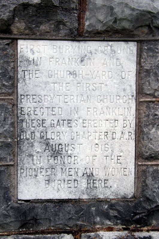
First burying ground in Franklin and the church-yard of the first Presbyterian Church erected in Franklin. These gates erected by Old Glory Chapter D.A.R.
August 1916 in honor of the pioneer men and women buried here.
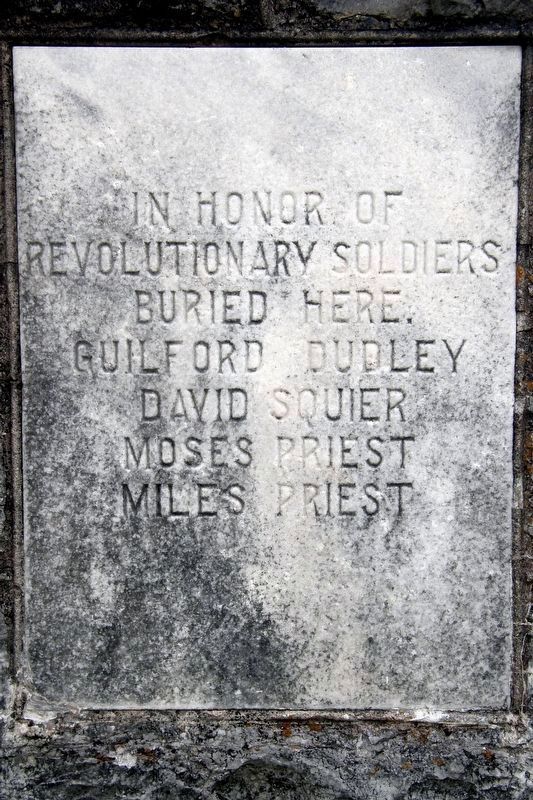
In honor of Revolutionary soldiers buried here.
Guilford Dudley · David Squier · Moses Priest · Miles Priest
Erected by Old Glory Chapter Daughters of the American Revolution (DAR).
Topics and series. This historical marker is listed in these topic lists: Cemeteries & Burial Sites • Religion & Religious Structures • War, US Revolutionary. In addition, it is included in the Daughters of the American Revolution (DAR) series list. A significant historical month for this entry is August 1916.
Location. 35° 55.677′ N, 86° 52.357′ W. Marker is in Franklin, Tennessee, in Williamson County. It is on 4th Avenue North north of North Margin Street, on the right when traveling north. Touch for map. Marker is at or near this postal address: 320 4th Ave N, Franklin TN 37064, United States of America. Touch for directions.

Regionally, this marker is in Middle Tennessee and in Greater Nashville. It is also in the American South and specifically in the Upper South. Globally, it is in North America, the Western Hemisphere, the Western World, and the Anglosphere. Historically, it finds itself in what was once the territory of the Mississippian Culture, one of the Confederate States of America, and the Antebellum South.
Other nearby markers. At least 8 other markers are within walking distance of this marker: City Cemetery (here, next to this marker); Rest Haven Cemetery (within shouting distance of this marker); Unknown Civil War Soldier (about 300 feet away, measured in a direct line); Liberty and Justice for All, Denied (about 400 feet away); a different marker also named Liberty and Justice for All, Denied
this page online
Photographed by Larry Gertner, June 22, 2019
2. First Burying Ground in Franklin Marker
Photographed by Larry Gertner, June 22, 2019
3. First Burying Ground in Franklin Marker
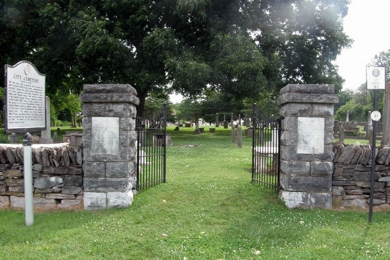
The marker is on the two columns at the entrance to the City Cemetery.
Credits. This page was last revised on May 16, 2023. It was originally submitted on May 15, 2023, by Larry Gertner of New York, New York. This page has been viewed 408 times since then and 33 times this year. Photos: 1, 2, 3. submitted on October 25, 2019, by Larry Gertner of New York, New York. • J. Makali Bruton was the editor who published this page.
