Near Pinson in Madison County, Tennessee — The American South (East South Central)
The Middle Woodland Tradition
Photographed by David Austin
1. The Middle Woodland Tradition Marker
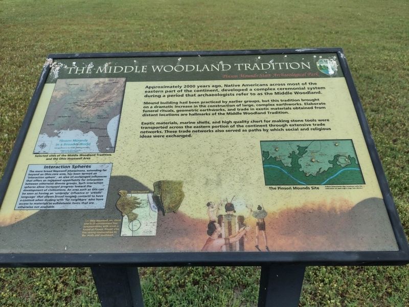
Mound building had been practiced by earlier groups, but this tradition brought on a dramatic increase in the construction of large, complex earthworks. Elaborate funeral rituals, geometric earthworks, and trade in exotic materials obtained from distant locations are hallmarks of the Middle Woodland Tradition.
Exotic materials, marine shells, and high quality chert for making stone tools were transported across the eastern portion of the continent through extensive trade networks. These trade networks also served as paths by which social and religious ideas were exchanged.
Captions
Selected sites of the Moodland Tradition and the Ohio Hopewell Area
Interaction Spheres
The more broad Hopewell phenomena, extending far beyond an Ohio core area, has been termed an that offers an 'interaction sphere' - an area of exchanged influences that offers an increased opportunity for interaction between otherwise diverse groups. Such interaction spheres allow increased progress toward the development of civilizations. An area such as this can be seen as having an 'umbrella' influence or 'artistic language' that allows broad ranging contacts to have a context when dealing with 'far neighbors' who have access to materials or subsistence items that are otherwise not available.
The Ohio Hopewell art, ritual, and built environment has commonalities with what is found at Pinson, Pinson also has strong relationships to the south and southeast.
The Pinson Mounds Site
Erected by Pinson
this page online
Topics. This historical marker is listed in these topic lists: Anthropology & Archaeology • Indigenous Peoples and Communities. A significant historical year for this entry is 2000.
Location. 35° 29.846′ N, 88° 40.937′ W. Marker is near Pinson, Tennessee, in Madison County. It can be reached from Pinson Mound Road 0.8 miles south of Ozier Road (Tennessee Route 197). The marker is located on the grounds of the Pinson Mounds State Archaeological Park. Touch for map. Marker is in this post office area: Pinson TN 38366, United States of America. Touch for directions.

Regionally, this marker is in West Tennessee. It is also in the American South, specifically in the Deep South, and specifically in the Upper South. Globally, it is in North America, the Western Hemisphere, the Western World, and the Anglosphere. Historically, it finds itself in what was once the territory of the Mississippian Culture, one of the Confederate States of America, and the Antebellum South.
Other nearby markers. At least 8 other markers are within walking distance of this marker: Pinson Mounds in the Mississippi Delta

Photographed by David Austin
2. The Middle Woodland Tradition Marker
1st on Left just behind the museum

Photographed by James Hulse, October 1, 2023
3. The view of the four markers with the museum and visitor’s center in the background
Credits. This page was last revised on October 18, 2023. It was originally submitted on May 16, 2023, by David Austin of Scotts Hill, Tennessee. This page has been viewed 174 times since then and 18 times this year. Photos: 1, 2. submitted on May 16, 2023, by David Austin of Scotts Hill, Tennessee. 3. submitted on October 17, 2023, by James Hulse of Medina, Texas. • James Hulse was the editor who published this page.
