Orangeburg in Orangeburg County, South Carolina — The American South (South Atlantic)
Mattie E. Pegues New Homemakers Camp
Photographed by Dave W, May 17, 2023
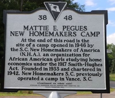
1. Mattie E. Pegues New Homemakers Camp Marker, Side One
At the end of this road is the site of a camp opened in 1946 by the S.C. New Homemakers of America (N.H.A.), an organization for African American girls studying home economics under the 1917 Smith-Hughes Act. Founded in 1933 and chartered in 1942, New Homemakers S.C. previously operated a camp in Vance, S.C.
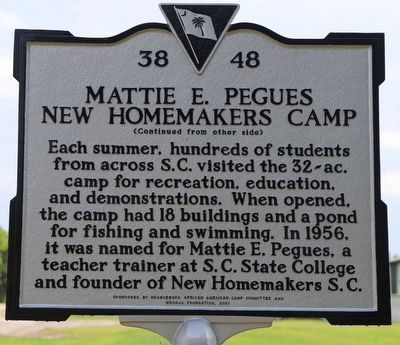
Each summer, hundreds of students from across S.C. visited the 32-ac. camp for recreation, education, and demonstrations. When opened, the camp had 18 buildings and a pond for fishing and swimming. In 1956, it was named for Mattie E. Pegues, a teacher trainer at S.C. State College and founder of New Homemakers S.C.
Erected 2021 by Orangeburg African American Camp Committee and WeGOJA Foundation. (Marker Number 38-48.)
Topics and series. This historical marker is listed in these topic lists: African Americans • Education • Entertainment • Parks & Recreational Areas • Women. In addition, it is included in the Historically Black Colleges and Universities series list. A significant historical year for this entry is 1946.
Location. 33° 33.342′ N, 80° 51.774′ W. Marker is in Orangeburg, South Carolina,
this page online

Regionally, this marker is in the Lowcountry and in Santee Cooper Country. It is also in the American South and specifically in the Deep South. Globally, it is in North America, the Western Hemisphere, the Western World, and the Anglosphere. Historically, it finds itself in what was once the territory of the Mississippian Culture, one of the original Thirteen Colonies, one of the Confederate States of America, and the Antebellum South.
Other nearby markers. At least 8 other markers are within 4 miles of this marker, measured as the crow flies: Pewilburwhitcade New Farmers Camp (approx. 1.4 miles away); Miller Cemetery (approx. 3½ miles away); Alexander S. Salley (approx. 3.7 miles away); Wilkinson High School (approx. 3.9 miles away); Episcopal Church of the Redeemer and Graveyard (approx. 4 miles away); Civil Rights Meetings / Sit-in March
Photographed by Dave W, May 17, 2023
2. Mattie E. Pegues New Homemakers Camp Marker, Side Two
Photographed by Dave W, May 17, 2023
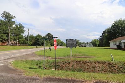
3. Mattie E. Pegues New Homemakers Camp Marker
Credits. This page was last revised on May 25, 2023. It was originally submitted on May 18, 2023, by Dave W of Co, Colorado. This page has been viewed 513 times since then and 48 times this year. Photos: 1, 2, 3. submitted on May 18, 2023, by Dave W of Co, Colorado. • Devry Becker Jones was the editor who published this page.
