Granjeno in Hidalgo County, Texas — The American South (West South Central)
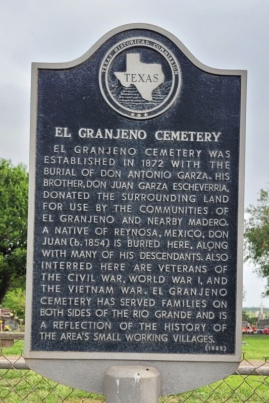
El Granjeno Cemetery
Erected 1985 by Texas Historical Commission. (Marker Number 1420.)
Topics. This historical marker is listed in these topic lists: Cemeteries & Burial Sites • Hispanic Americans. A significant historical year for this entry is 1872.
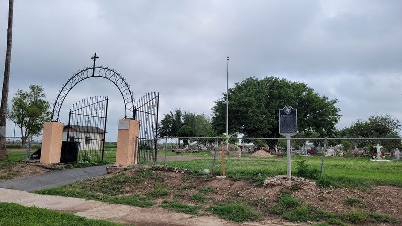
Location. 26° 8.176′ N, 98° 18.306′ W. Marker is in Granjeno, Texas, in Hidalgo County. Marker is at the intersection of Farm to Market Road 494 and Anzaldua Drive, on the right when traveling west on Highway 494. The marker is located in front of the cemetery by the street. Touch for map. Marker is at or near this postal address: 6556 South FM 494, Mission TX 78572, United States of America. Touch for directions.
Other nearby markers. At least 8 other markers are within 3 miles of this marker, measured as the crow flies. Ranch Headquarters (approx. 2.2 miles away); Juan Davis Bradburn (approx. 2.2 miles away); Virgin Mary (approx. 2.2 miles away); Guest House (approx. 2.2 miles away); La Lomita Chapel (approx. 2.2 miles away); a different marker also named La Lomita Chapel (approx. 2.2 miles away); Capilla de la Lomita (approx. 2.2 miles away); Chimney Park (approx. 2.7 miles away).
Credits. This page was last revised on May 24, 2023. It was originally submitted on May 24, 2023, by James Hulse of Medina, Texas. This page has been viewed 94 times since then and 44 times this year. Photos: 1, 2. submitted on May 24, 2023, by James Hulse of Medina, Texas.

