Vasa Township near Welch in Goodhue County, Minnesota — The American Midwest (Upper Plains)
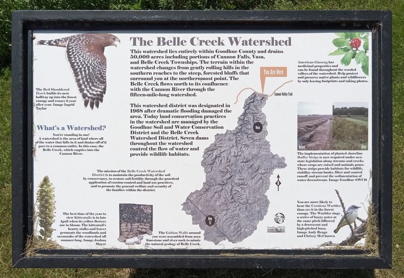
The Belle Creek Watershed
This watershed district was designated in 1968 after dramatic flooding damaged the area. Today land conservation practices in the watershed are managed by the Goodhue Soil and Water Conservation District and the Belle Creek Watershed District. Seven dams throughout the watershed control the flow of water and provide wildlife habitats.
The Red Shouldered Hawk builds its nest halfway up into the forest canopy and reuses it year after year. Image Ingrid Taylar
You're standing in one! A watershed is the area of land where all of the water that falls in it and drains off of it goes to a common outlet. In this case, the Belle Creek, which empties into the Cannon River.
The mission of the Belle Creek Watershed District is to maintain the productivity of the soil by conservancy, to restore soil fertility through the practical application of erosion control and land use practices, and to promote the general welfare and security of the families within the district.
The best time of the year to view Kittentails is in late April when its yellow flowers are in bloom. The kittentail's hearty stalks and leaves permeate the woodlands and savannahs of the watershed all summer long. Image Joshua Mayer
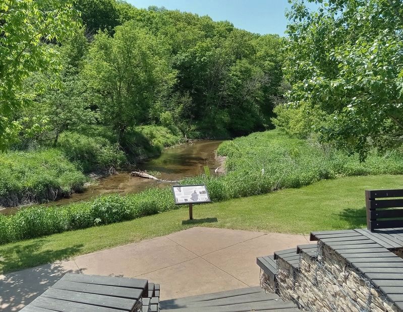
The Gabion Walls around you were assembled from area limestone and river rock to mimic the natural geology of Belle Creek.
American Ginseng has medicinal properties and can be found throughout the wooded valleys of the watershed. Help protect and preserve native plants and wildflowers by only leaving footprints and taking photos.
The implementation of planted shoreline Buffer Strips is now required under new state legislation along streams and creeks were crops are raised and animals graze. These strips provide habitats for wildlife, stabilize stream banks, filter and control runoff, and prevent the sedimentation of water downstream. Image Goodhue SWCD
You are more likely to hear the Cerulean Warbler than see it in the forest canopy. The Warbler sings a series of buzzy notes at the same pitch followed by a drawn-out and high-pitched buzz. Image Andy Reago and Chrissy McClarren
Topics. This historical marker is
listed in these topic lists: Agriculture • Disasters • Environment • Waterways & Vessels. A significant historical year for this entry is 1968.
Location. 44° 33.187′ N, 92° 42.709′ W. Marker is near Welch, Minnesota, in Goodhue County. It is in Vasa Township. Marker can be reached from the Cannon Valley Trail east of County 7 Boulevard, on the right when traveling east. The marker is at a rest plaza along the Cannon Valley Trail bikeway. Touch for map. Marker is in this post office area: Welch MN 55089, United States of America. Touch for directions.
Other nearby markers. At least 8 other markers are within 4 miles of this marker, measured as the crow flies. Cannon Valley Trail Archaeology (approx. 1˝ miles away); Vasa: Mattson's Settlement (approx. 3˝ miles away); Oak Trees in the Tallgrass Prairie (approx. 3.7 miles away); Military Roads (approx. 3.7 miles away); Early Inhabitants (approx. 3.7 miles away); Restoring the Land (approx. 3.8 miles away); Our Native Forests (approx. 3.8 miles away); Anderson Center and Outdoor Sculpture Garden (approx. 3.8 miles away).
Credits. This page was last revised on May 29, 2023. It was originally submitted on May 29, 2023, by McGhiever of Minneapolis, Minnesota. This page has been viewed 81 times since then and 21 times this year. Photos: 1, 2. submitted on May 29, 2023, by McGhiever of Minneapolis, Minnesota. • J. Makali Bruton was the editor who published this page.

