Lowell in Benton County, Arkansas — The American South (West South Central)
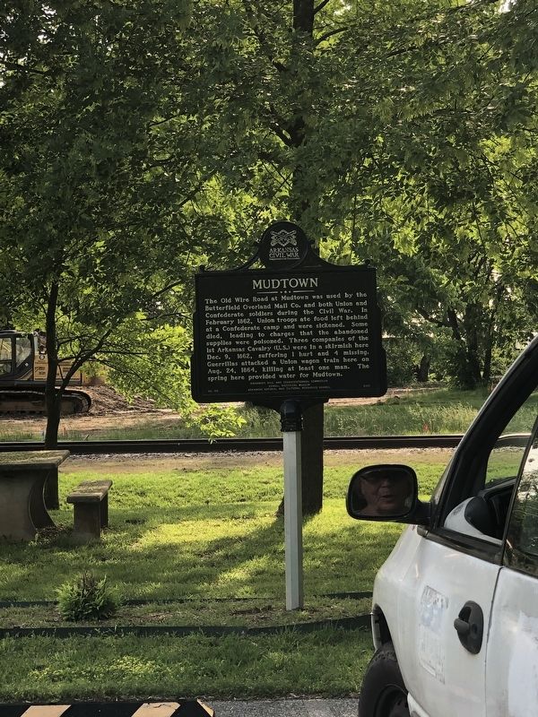
Mudtown
Erected 2015 by Arkansas Civil War Sesquicentennial Commission • Lowell Historical Museum • Arkansas Natural and Cultural Resources Council. (Marker Number 107.)
Topics and series. This historical marker is listed in these topic lists: Roads & Vehicles • War, US Civil. In addition, it is included in the Arkansas Civil War Sesquicentennial Commission series list. A significant historical month for this entry is February 1862.
Location. 36° 15.484′ N, 94° 7.91′ W. Marker is in Lowell, Arkansas, in Benton County. Marker is on Jackson Place north of McClure Avenue (County Road 923), on the left when traveling north. Touch for map. Marker is at or near this postal address: 304 Jackson Pl, Lowell AR 72745, United States of America. Touch for directions.
Other nearby markers. At least 8 other markers are within walking distance of this marker. The Lowell Historical Museum (a few steps from this marker); Original Site of Bloomington (Mudtown) Arkansas (within shouting distance of this marker); The Butterfield Stagecoach Road (within shouting distance of this marker); Service Station and Garage (within shouting distance of this marker); City of Lowell (within shouting distance of this marker); Evaporator Near School (within shouting distance of this marker); Old School on South Lincoln Street (within shouting distance of this marker); School House on McClure Street (within shouting distance of this marker). Touch for a list and map of all markers in Lowell.
Also see . . . Skirmishes at Mud Town and Gerald Mountain. Keeping the main road from Springfield, Missouri, to Fayetteville (Washington County) open was a major task for the Union troops. (Carolyn Yancey Kent, Encyclopedia of Arkansas) (Submitted on May 31, 2023, by Duane and Tracy Marsteller of Murfreesboro, Tennessee.)
Credits. This page was last revised on May 31, 2023. It was originally submitted on May 31, 2023, by Duane and Tracy Marsteller of Murfreesboro, Tennessee. This page has been viewed 85 times since then and 21 times this year. Photos: 1, 2. submitted on May 31, 2023, by Duane and Tracy Marsteller of Murfreesboro, Tennessee.

