Edenton in Chowan County, North Carolina — The American South (South Atlantic)
A look back at our history
Slip/Scoop scraper
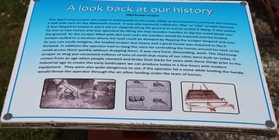
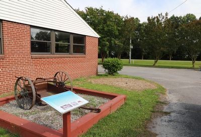
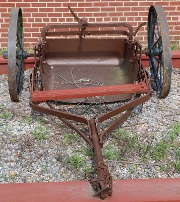
This slip/scoop scraper was used to build ponds in the early 1900s at the hatcheries previous site located a half mile east on the Albemarle sound. It was also variously called the "flip" or "slip" scraper because It was flipped to empty it and it slid (or slipped) along the ground as horses pulled it along. It was pulled by one or two horses and was operated by lifting the two wooden handles to dig the metal blade into the ground. As the scraper filled with dirt and rocks the handles would be lowered and the loaded scraper pulled to a location where the load could be dumped by flipping the scraper forward and over. As you can easily imagine, the loaded scraper was heavy and a great heave was required to flip it forward. In addition the operator had to hang the reins for controlling the horses around his neck so he could access them quickly without dropping them. It was very hard, demanding, work. This slip/scoop scraper or drag pan excavated millions of tons of earth that many of our cities were built on today. It comes from an age when people sweated and broke their backs for years with these things prior to the industrial age to create the early landscapes we can produce today in a few hours with modern equipment. They were also quite dangerous to use, if the operator hit a stone while loading the handle would throw the operator through the air often landing under the team of horses.
Topics. This historical marker is listed in these topic lists: Agriculture • Animals • Environment • Waterways & Vessels.
Location. 36° 3.441′ N, 76° 38.376′ W. Marker is in Edenton, North Carolina, in Chowan County. Marker is at the intersection of West Queen Street and Oak Hill Drive, on the right when traveling west on West Queen Street. Located at the Edenton National Fish Hatchery Aquarium. Touch for map. Marker is at or near this postal address: 1104 W Queen St, Edenton NC 27932, United States of America. Touch for directions.
Other nearby markers. At least 8 other markers are within 2 miles of this marker, measured as the crow flies. Weapemeoc (approx. 1.3 miles away); Thomas Child (approx. 1.6 miles away); Roanoke River Lighthouse (approx. 1.6 miles away); 1886 Roanoke River Lighthouse (approx. 1.6 miles away); Escape Via Maritime Underground Railroad (approx. 1.7 miles away); Edenton (approx. 1.7 miles away); Mackeys Ferry (approx. 1.7 miles away); Silent Service Memorial (approx. 1.7 miles away). Touch for a list and map of all markers in Edenton.
Credits. This page was last revised on June 5, 2023. It was originally submitted on June 5, 2023, by Dave W of Co, Colorado. This page has been viewed 90 times since then and 10 times this year. Photos: 1, 2, 3. submitted on June 5, 2023, by Dave W of Co, Colorado. • Bernard Fisher was the editor who published this page.


