Near Windsor in Bertie County, North Carolina — The American South (South Atlantic)
Indian Woods
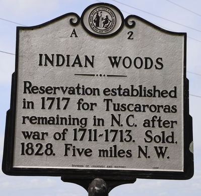
Reservation established in 1717 for Tuscaroras remaining in N.C. after war of 1711-1713. Sold, 1828. Five miles N.W.
Erected 1988 by Division of Archives and History. (Marker Number A-2.)
Topics and series. This historical marker is listed in these topic lists: Colonial Era • Native Americans • Wars, US Indian. In addition, it is included in the North Carolina Division of Archives and History series list. A significant historical year for this entry is 1717.
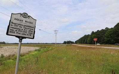
Location. 35° 55.511′ N, 77° 0.354′ W. Marker is near Windsor, North Carolina, in Bertie County. Marker is at the intersection of U.S. 17 and St Francis Road, on the right when traveling west on U.S. 17. Touch for map. Marker is at or near this postal address: 108 Spellers Ferry Rd, Windsor NC 27983, United States of America. Touch for directions.
Other nearby markers. At least 8 other markers are within 6 miles of this marker, measured as the crow flies. Roanoke River (approx. 4.8 miles away); Camp Williamston (approx. 5 miles away); Freedom Rallies (approx. 5.2 miles away); Martin County Veterans Memorial (approx. 5.4 miles away); Martin County Courthouse (approx. 5.4 miles away); Asa Biggs House (approx. 5˝ miles away); Memorial Baptist Church (approx. 5˝ miles away); Asa Biggs (approx. 5.6 miles away).
Also see . . .
1. Tuscarora Nation of North Carolina History.
From as early as the 1520’s, the Tuscarora had contact with the Spanish, who were eventually given permission to establish an outpost in Tuscarora territory. The 1630 Johannes Cloppenburg map above places “Medano Hispanis” (“Hispanic Dunes”) due east of the Tuscarora ("Mongoack").(Submitted on June 5, 2023, by Dave W of Co, Colorado.)
2. NCPedia article about the Tuscarora Indians.
Tuscarora Indians occupied much of the North Carolina inner Coastal Plain at the time of the Roanoke Island colonies in the 1580s. They were considered the most powerful and highly developed tribe in what is now eastern North Carolina and were thought to possess mines of precious metal.(Submitted on June 5, 2023, by Dave W of Co, Colorado.)
Credits. This page was last revised on June 5, 2023. It was originally submitted on June 5, 2023, by Dave W of Co, Colorado. This page has been viewed 451 times since then and 205 times this year. Photos: 1, 2. submitted on June 5, 2023, by Dave W of Co, Colorado. • Bernard Fisher was the editor who published this page.

