
Downtown in San Antonio in Bexar County, Texas — The American South (West South Central)
The Living Worlds of San Pedro Creek
Photographed by James Hulse, March 24, 2023
1. The Living Worlds of San Pedro Creek Marker
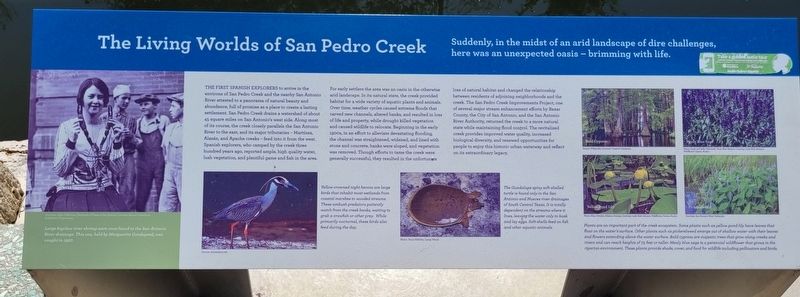
The First Spanish Explorers to arrive in the environs of San Pedro Creek and the nearby San Antonio River attested to a panorama of natural beauty and abundance, full of promise as a place to create a lasting settlement. San Pedro Creek drains a watershed of about 45 square miles on San Antonio's west side. Along most of its course, the creek closely parallels the San Antonio River to the east, and its major tributaries - Martínez, Alazán, and Apache creeks-feed into it from the west. Spanish explorers, who camped by the creek three hundred years ago, reported ample, high quality water, lush vegetation, and plentiful game and fish in the area. For early settlers the area was an oasis in the otherwise arid landscape. In its natural state, the creek provided habitat for a wide variety of aquatic plants and animals. Over time, weather cycles caused extreme floods that carved new channels, altered banks, and resulted in loss of life and property, while drought killed vegetation and caused wildlife to relocate.
this page online
Captions
Left: Large bigclaw river shrimp were once found in the San Antonio River drainage. This one, held by Marguerite Goodspeed, was caught in 1927.
Courtesy, Light Collection, University of Texas at San Antonio Libraries Special Collections and Hearst Corporation.
Middle Left: Yellow-crowned
Photographed by James Hulse, March 24, 2023
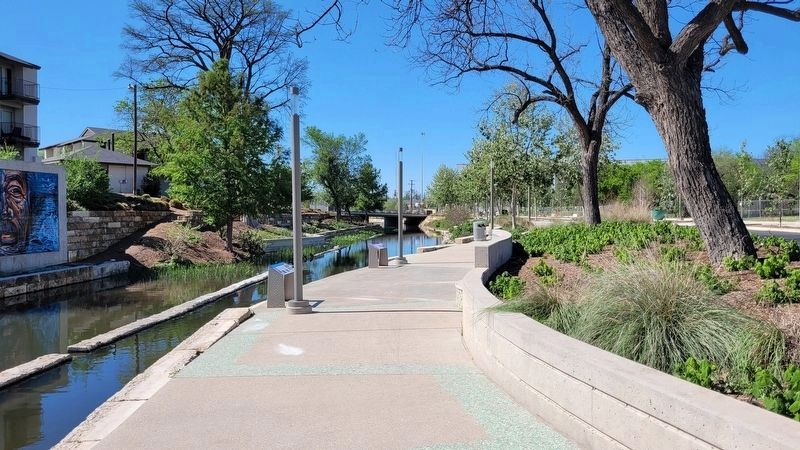
2. The view of the Living Worlds of San Pedro Creek and Marker along the creek
Source: Animalspot.net
Middle Right: The Guadalupe spiny soft shelled turtle is found only in the San Antonio and Nueces river drainages of South Central Texas. It is totally dependent on the streams where it lives, leaving the water only to bask and lay eggs. Soft-shells feed on fish and other aquatic animals.
Photo: Terry Hibbitts, Camp Wood.
Right: Plants are an important part of the creek ecosystem. Some plants such as yellow pond lily have leaves that float on the water's surface. Other plants such as pickerelweed emerge out of shallow water with their leaves and flowers extending above the water surface. Bald cypress are majestic trees that grow along creeks and rivers and can reach heights of 75 feet or taller. Mealy blue sage is a perennial wildflower that grows in the riparian environment. These plants provide shade, cover, and food for wildlife including pollinators
Photographed by James Hulse, March 24, 2023
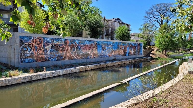
3. The artwork behind the marker
Bald Cypress
Source: Wikipedia; Courtesy: Creative Commons.
Yellow Pond Lily
Pboto: Alan Cressler, Atlanta, Georgia; Courtesy: Lady Bird Johnson Wildflower Center, Austin
Mealy Blue Saga
Photo: Andy and Sally Wasowski, Taos, New Mexico; Courtesy: Lady Bird Johnson Wildflower Center, Austin
Pickerelweed
Courtesy: San Antonio River Authority
Erected 2018 by San Pedro Creek Cultural Park. (Marker Number 7.)
Topics. This historical marker is listed in these topic lists: Animals • Exploration • Parks & Recreational Areas • Waterways & Vessels. A significant historical year for this entry is 1927.
Location. 29° 25.81′ N, 98° 29.8′ W. Marker is in San Antonio, Texas, in Bexar County. It is in Downtown. It is on Camaron Street 0.1 miles north of West Martin Street, on the left when traveling north. The marker is located on the northeast section of the San Pedro Creek Culture Park. Touch for map. Marker is in this post office area: San Antonio TX 78205, United States of America. Touch for directions.

Regionally, this marker is in South Texas. It is also in the American South. Globally, it is in North America, a Gulf of Mexico state, the Western Hemisphere, the Western World, and the Anglosphere. Historically, it finds itself in what was once New Spain, the Republic of Texas, and one of the Confederate States of America.
Other nearby markers. At least 8 other markers are within walking distance of this marker: The Taming of San Pedro Creek (a few steps from this marker); Menger Soap Works (about 400 feet away, measured in a direct line); Early Industry Along San Pedro Creek (about 400 feet away); San Pedro Creek (about 500 feet away); Historical Features along San Pedro Creek (about 500 feet away); Birth of a Community (about 600 feet away); San Pedro Creek: A Crossroads of Cultures (about 600 feet away); San Pedro Creek and the Saga of a City (about 700 feet away). Touch for a list and map of all markers in San Antonio.
Also see . . . Where beauty meets purpose. San Pedro Creek Culture Park (Submitted on June 7, 2023, by James Hulse of Medina, Texas.)
Credits. This page was last revised on June 7, 2023. It was originally submitted on June 7, 2023, by James Hulse of Medina, Texas. This page has been viewed 160 times since then and 21 times this year. Photos: 1, 2, 3. submitted on June 7, 2023, by James Hulse of Medina, Texas.
