Boquerón in Cabo Rojo in Municipio de Cabo Rojo, Puerto Rico — The Caribbean (The West Indies)
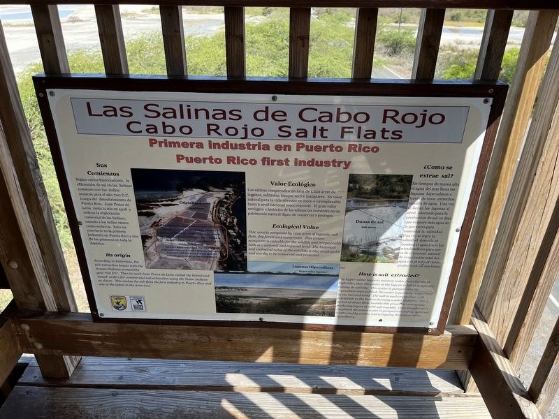
Las Salinas de Cabo Rojo / Cabo Rojo Salt Flats
Primera industria en Puerto Rico / Puerto Rico first industry
Inscription.
Sus Comienzos
Según varios historiadores, la extracción de sal en las Salinas comenzó con los indios aruacos para el año 700 D.C. Luego del descubrimiento de Puerto Rico, Juan Ponce de León visita la isla en 1508 y ordena la explotación comercial de las Salinas, usando a los indios taínos como esclavos. Esto las convierte en la primera industria en Puerto Rico y una de las primearas en toda la América.
Valor Ecológico
Las salinas comprénden un área de 1,249 acres de lagunas, salitrales, bosque seco y maglares. Su valor natural para la vida silvestre es único e irremplazable tanto a nivel nacional como regional. El gran valor ecológico e histórico de las salinas las convierte en un patrimonio natural digno de conservar y preteger.
¿Como se extrae sal?
En tiempos de marea alta el agua del mar llena las lagunas hipersalinas a través de unos estrachos canales de agua. Una vez se llenan las lagunas al nivel adecuado para la producción de sal, se deja que evapore más agua de la que entra para aumentar la salinidad. Una vez se logra la salinidad deseada se bombea el agua hasia los cristalizadores para que se de el proceso nautral de evaporación total del agua con el sol y el viento produciendo de esa forma sal.
According to historians, the salt extraction began with the Aruaco Indians around the year 700 D.C. Then in 1508 Juan Ponce de León visited the Island and issued orders for the commercial salt extraction using the Taíno Indians as slaves. This makes the salt flats the first industry in Puerto Rico and one of the oldest in the Americas.
Ecological Value
This area is composed by 1249 acres of lagoons, salt flats, dry forest and mangroves. This unique ecosystem is valuable for the wildlife and irreplaceable both at a national and regional level. The historical and ecological value of the salt flats is also incalculable and worthy to be conserved and protected.
How is salt extracted?
The hyper saline lagoons receives water from the sea in high tides, then the water in the lagoon is left to evaporate, raising its salinity. This water is pumped into the crystallizer once is filled, the water is partially evaporated by the sun and wind. The salt in each crystallizer will precipitate to the bottom forming a solid platform. For a period of about three months this process is continually producing layers of solid salt crystals. Once the process is completed the
excess water is pumped out and the solid salt is extracted by cutting and scrapping the bottom of the crystallizer.
Erected by Fish and Wildlife Service, U.S. Department of the Interior.
Topics. This historical marker is listed in these topic lists: Colonial Era • Industry & Commerce • Native Americans • Natural Features. A significant historical year for this entry is 1508.
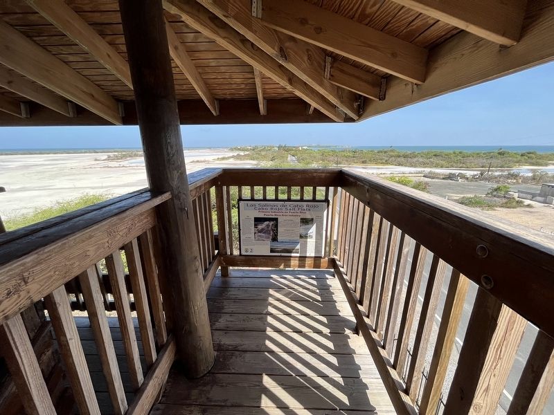
Location. 17° 57.405′ N, 67° 11.948′ W. Marker is in Cabo Rojo in Municipio de Cabo Rojo, Puerto Rico. It is in Boquerón. Marker can be reached from Puerto Rico Route 301, 1.8 kilometers south of Calle Julio Camacho when traveling south. The marker is inside the observation tower. Touch for map. Marker is in this post office area: Boqueron PR 00622, United States of America. Touch for directions.
Other nearby markers. At least 8 other markers are within 14 kilometers of this marker, measured as the crow flies. Torre de Observación Mariano Rodríguez Flores (here, next to this marker); Avenida Hon. Emilio del Toro Cuebas (approx. 14.3 kilometers away); Monumento al Soldado Caborrojeño (approx. 14.6 kilometers away); En Memoria de Todos los Veteranos de la I Guerra Mundial (approx. 14.6 kilometers away); En Memorial de Todos los Veteranos de Todas las Guerras (approx. 14.6 kilometers away); Soldado Caborrojeño (approx. 14.6 kilometers away); En Memoria de Todos los Veteranos de la II Guerra Mundial (approx. 14.6 kilometers away); En Memoria de Todos los Veteranos de la Guerra del Golfo Persico (approx. 14.6 kilometers away). Touch for a list and map of all markers in Cabo Rojo.
Credits. This page was last revised on October 16, 2023. It was originally submitted on June 12, 2023, by Devry Becker Jones of Washington, District of Columbia. This page has been viewed 80 times since then and 20 times this year. Photos: 1, 2. submitted on June 12, 2023, by Devry Becker Jones of Washington, District of Columbia.

