Silver Springs in Marion County, Florida — The American South (South Atlantic)
Silver Springs Transportation Evolution
Silver Springs State Park
Photographed by Brandon D Cross, May 7, 2023
1. Silver Springs Transportation Evolution Marker
(captions)
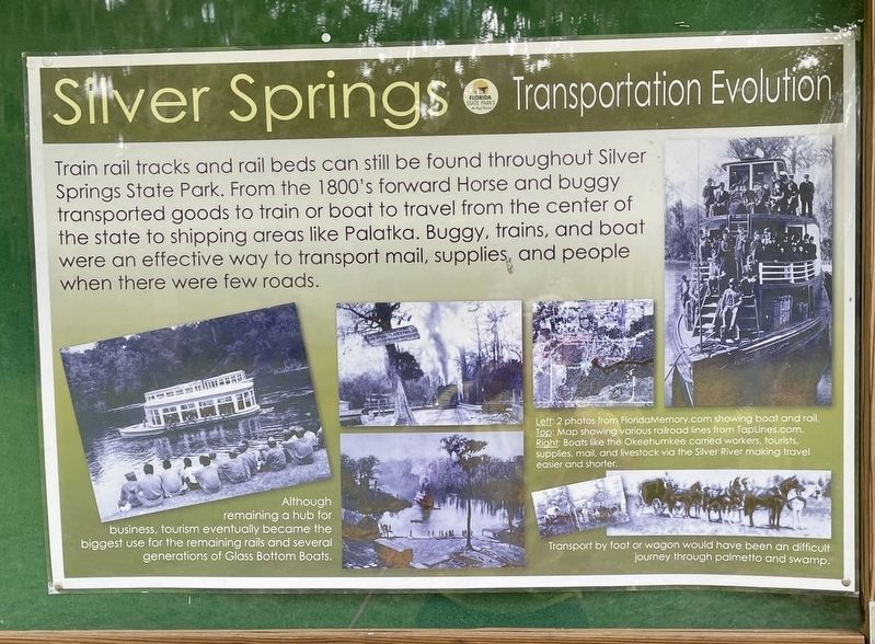
Although remaining a hub for business, tourism eventually became the biggest use for the remaining rails and several generations of Glass Bottom Boats.
Left: 2 photos from FloridaMemory.com showing boat and rail.
Top: Map showing various railroad lines from Taplines.com.
Right: Boats like the Okeehumkee carried workers, tourists, supplies, mail, and livestock via the Silver River making travel easier and shorter.
Transport by foot or wagon would have been a difficult journey through palmetto and swamp.
Erected by Silver Springs State Park.
Topics. This historical marker is listed in these topic lists: Industry & Commerce • Parks & Recreational Areas • Railroads & Streetcars • Waterways & Vessels.
Location. 29° 13.002′ N,
this page online

Regionally, this marker is in the American South. Globally, it is in the North Atlantic Region, North America, a Gulf of Mexico state, the Western Hemisphere, the Western World, and the Anglosphere. Historically, it finds itself in what was once New Spain, the territory of the Mississippian Culture, one of the Confederate States of America, and the Antebellum South.
Other nearby markers. At least 8 other markers are within walking distance of this marker: Steamboats at the Spring (about 600 feet away, measured in a direct line); Silver Springs Paradise Park (approx. 0.2 miles away); Osceola (approx. 0.2 miles away); Florida’s Springs: Our Precious Resource (approx. 0.2 miles away);
Photographed by Brandon D Cross, May 7, 2023
2. Silver Springs Transportation Evolution Marker
Also see . . . Silver Springs State Park: Famous spring plus cabins, hiking, history. (Submitted on June 13, 2023, by Brandon D Cross of Flagler Beach, Florida.)
Credits. This page was last revised on June 15, 2023. It was originally submitted on June 13, 2023, by Brandon D Cross of Flagler Beach, Florida. This page has been viewed 290 times since then and 39 times this year. Photos: 1, 2. submitted on June 13, 2023, by Brandon D Cross of Flagler Beach, Florida. • Bernard Fisher was the editor who published this page.
