Near Maysville in Onslow County, North Carolina — The American South (South Atlantic)
First Post Road
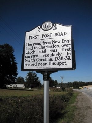
Photographed by Kevin W., October 21, 2009
1. First Post Road Marker
Erected 2008 by Department of Archives and History. (Marker Number C-28.)
Topics and series. This historical marker is listed in these topic lists: Colonial Era • Communications • Roads & Vehicles. In addition, it is included in the North Carolina Division of Archives and History series list. A significant historical year for this entry is 1738.
Location. Marker is missing. It was located near 34° 52.954′ N, 77° 14.191′ W. Marker was near Maysville, North Carolina, in Onslow County. It was at the intersection of New Bern Highway (U.S. 17) and Boyd Farm Road, on the right when traveling south on New Bern Highway. Touch for map. Marker was at or near this postal address: 7460 New Bern Hwy, Maysville NC 28555, United States of America. Touch for directions.

Regionally, this marker was in North Carolina’s Coastal Plain. It was also in the American South, specifically in the Upper South, in the Tidewater, and on the Eastern Seaboard. Globally, it was in the North Atlantic
this page online
Other nearby markers. At least 8 other markers are within 14 miles of this location, measured as the crow flies: Hofmann Forest (approx. 4.9 miles away); James Melville Jones (approx. 4.9 miles away); Julius Valentine Hofmann (approx. 5 miles away); The Foscue Plantation House (approx. 11 miles away); Edward B. Dudley (approx. 12½ miles away); Beirut Memorial (approx. 13.8 miles away); Montford Point (approx. 13.8 miles away); Onslow County 9/11 Memorial (approx. 13.8 miles away).
Another marker is no longer nearby. Camp Lejeune (was approx. 12.3 miles away but has been confirmed missing).
More about this marker. Adding picture showing pole with no marker.
Regarding First Post Road. Through the Carolinas, present-day Route 17 roughly follows the First Post Road.
Related markers. Click here for a list of markers that are
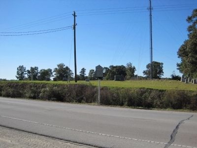
Photographed by Kevin W., October 21, 2009
2. First Post Road Marker
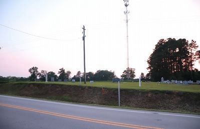
Photographed by Dave W, June 10, 2023
3. First Post Road Marker
Pole with marker missing.
Credits. This page was last revised on June 14, 2023. It was originally submitted on October 27, 2009, by Kevin W. of Stafford, Virginia. This page has been viewed 1,089 times since then and 22 times this year. Last updated on June 13, 2023, by Dave W of Co, Colorado. Photos: 1, 2. submitted on October 27, 2009, by Kevin W. of Stafford, Virginia. 3. submitted on June 13, 2023, by Dave W of Co, Colorado. • Bernard Fisher was the editor who published this page.
