Cedar Island in Carteret County, North Carolina — The American South (South Atlantic)
Ocracoke Inlet
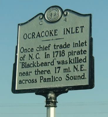
Photographed by Richard E. Miller, April 16, 2010
1. Ocracoke Inlet Marker
Erected 1989 by Division of Archives and History. (Marker Number C-4.)
Topics and series. This historical marker is listed in these topic lists: Colonial Era • Industry & Commerce • Waterways & Vessels. In addition, it is included in the North Carolina Division of Archives and History series list. A significant historical year for this entry is 1718.
Location. 35° 1.029′ N, 76° 18.935′ W. Marker is on Cedar Island, North Carolina, in Carteret County. It is on Cedar Island Road (North Carolina Route 12) north of Sound View Drive, on the left when traveling south. Marker is on the grass in the traffic circle, near the entrance to the Cedar Island / Ocracoke Ferry terminal. Touch for map. Marker is in this post office area: Cedar Island NC 28520, United States of America. Touch for directions.

Regionally, this marker is in the Coastal Plain and on the Crystal Coast. It is also in the American South, specifically in the Upper South, in the Tidewater, and on the Eastern Seaboard. Globally,
this page online
Other nearby markers. At least one other marker is within 13 miles of this marker, measured as the crow flies: Welcome to Stacy… (approx. 12.9 miles away).
Related marker. Click here for another marker that is related to this marker. To better understand the relationship, study each marker in the order shown.
Additional keywords. Edward Thatch; criminal; Outer Banks.
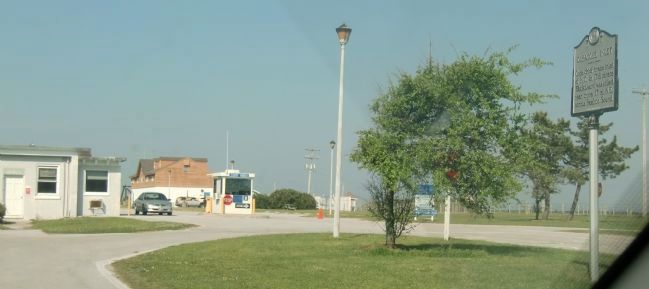
Photographed by Richard E. Miller, April 16, 2010
2. Ocracoke Inlet Marker - right, near the entrance to the Cedar Island Ferry Terminal
Credits. This page was last revised on June 16, 2023. It was originally submitted on April 20, 2010, by Richard E. Miller of Oxon Hill, Maryland. This page has been viewed 1,192 times since then and 41 times this year. Last updated on June 15, 2023, by Michael Buckner of Durham, North Carolina. Photos: 1, 2. submitted on April 20, 2010, by Richard E. Miller of Oxon Hill, Maryland. • Bernard Fisher was the editor who published this page.
