
Kinston in Lenoir County, North Carolina — The American South (South Atlantic)
Ram Neuse
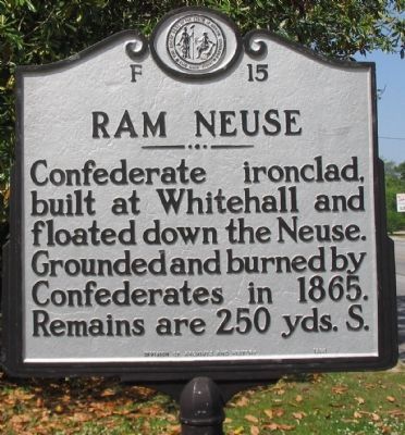
Photographed by Craig Swain, May 2, 2010
1. Ram Neuse Marker
Erected 1965 by Division of Archives and History. (Marker Number F-15.)
Topics and series. This historical marker is listed in these topic lists: War, US Civil • Waterways & Vessels. In addition, it is included in the North Carolina Division of Archives and History series list. A significant historical year for this entry is 1865.
Location. Marker is missing. It was located near 35° 16.095′ N, 77° 37.216′ W. Marker was in Kinston, North Carolina, in Lenoir County. It was on West Vernon Avenue (U.S. 70/258), on the right when traveling east. Located in front of the CSS Neuse and Caswell State Historic Site. Touch for map. Marker was in this post office area: Kinston NC 28504, United States of America. Touch for directions.

Regionally, this marker was in North Carolina’s Coastal Plain. It was also in the American South and specifically in the Upper South. Globally, it was in North America, the Western Hemisphere, the Western World, and the Anglosphere. Historically,
this page online
Other nearby markers. At least 8 other markers are within 3 miles of this location, measured as the crow flies: Grave of Richard Caswell (a few steps from this marker); Richard Caswell (a few steps from this marker); Moving the CSS Neuse (about 500 feet away, measured in a direct line); Walk of Honor Memorial (approx. 2.2 miles away); Cat Hole (approx. 2.2 miles away); John Taylor Wood, CSN (approx. 2.2 miles away); CSS Neuse Confederate Ironclad Gunboat (approx. 2.2 miles away); Birth of Funk (approx. 2.3 miles away). Touch for a list and map of all markers in Kinston.
Other markers no longer nearby. CSS Neuse (was about 600 feet away but has been permanently removed); a different marker also named Cat Hole (was approx. 2.2 miles away but has been replaced with another marker now near it).
Related markers. Click here for a list of markers that are related to this marker. Markers related to the CSS Neuse.
Also see . . . CSS Neuse Site Photos.
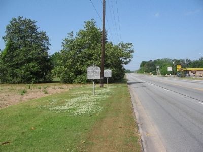
Photographed by Craig Swain, May 2, 2010
2. Markers in Front of the State Historic Site
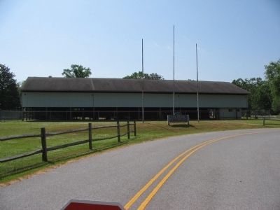
Photographed by Craig Swain, May 2, 2010
3. CSS Neuse's Display Shelter
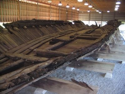
Photographed by Craig Swain, May 7, 2010
4. Remains of the Neuse
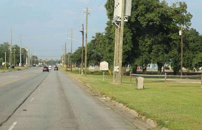
Photographed by Dave W, June 17, 2023
5. Ram Neuse Marker Missing
Credits. This page was last revised on June 19, 2023. It was originally submitted on May 7, 2010, by Craig Swain of Leesburg, Virginia. This page has been viewed 1,156 times since then and 32 times this year. Last updated on June 18, 2023, by Dave W of Co, Colorado. Photos: 1, 2, 3, 4. submitted on May 7, 2010, by Craig Swain of Leesburg, Virginia. 5. submitted on June 18, 2023, by Dave W of Co, Colorado. • Bernard Fisher was the editor who published this page.
