Mackeys in Washington County, North Carolina — The American South (South Atlantic)
Mackeys Ferry
1735-1938
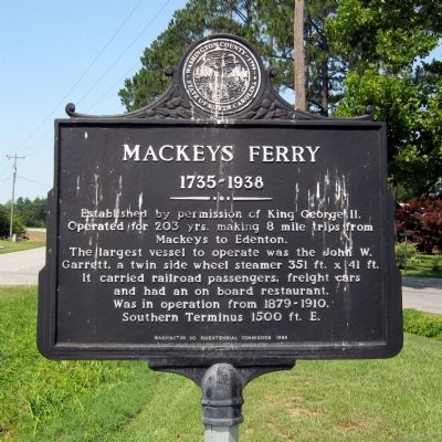
Photographed by Bernard Fisher, June 28, 2012
1. Mackeys Ferry Marker
Erected 1999 by Washington Co. Bicentennial Commission.
Topics and series. This historical marker is listed in these topic lists: Colonial Era • Waterways & Vessels. In addition, it is included in the North Carolina. Washington Co. Bicentennial Commission series list. A significant historical year for this entry is 1500.
Location. Marker is missing. It was located near 35° 55.858′ N, 76° 36.906′ W. Marker was in Mackeys, North Carolina, in Washington County. It was at the intersection of Mackeys Road (State Highway 308) and Mackeys Ferry Road, on the right when traveling east on Mackeys Road. Touch for map. Marker was in this post office area: Roper NC 27970, United States of America. Touch for directions.

Regionally, this marker was in North Carolina’s Coastal
this page online
Other nearby markers. At least 8 other markers are within 8 miles of this location, measured as the crow flies: A different marker also named Mackeys Ferry (approx. 1½ miles away); St. Luke's Episcopal Church (approx. 2.4 miles away); Edward Buncombe (approx. 3.8 miles away); Sleepy Hollow (approx. 3.8 miles away); Rehoboth Church (approx. 5.2 miles away); Pearidge (approx. 7.3 miles away); Battle of Plymouth (approx. 7.7 miles away); The Return of a Native (approx. 7.7 miles away).
Another marker is no longer nearby. Buncombe Hall (was approx. 3.8 miles away but has been replaced with another marker now near it).
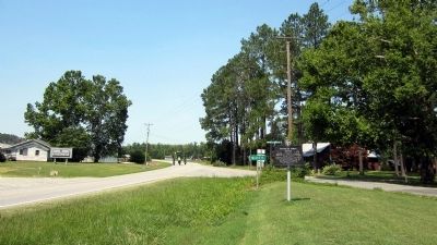
Photographed by Bernard Fisher, June 28, 2012
2. Mackeys Ferry Marker
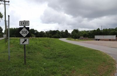
Photographed by Dave W, June 21, 2023
3. Mackeys Ferry Marker
Marker missing. Road sign on left can be seen in the original wide shot, except from the opposite angle.
Credits. This page was last revised on June 22, 2023. It was originally submitted on July 2, 2012, by Bernard Fisher of Richmond, Virginia. This page has been viewed 1,174 times since then and 52 times this year. Last updated on June 22, 2023, by Dave W of Co, Colorado. Photos: 1, 2. submitted on July 2, 2012, by Bernard Fisher of Richmond, Virginia. 3. submitted on June 22, 2023, by Dave W of Co, Colorado.
