Near Munising in Alger County, Michigan — The American Midwest (Great Lakes)
Grand Island View

Photographed by Connor Olson, June 21, 2023
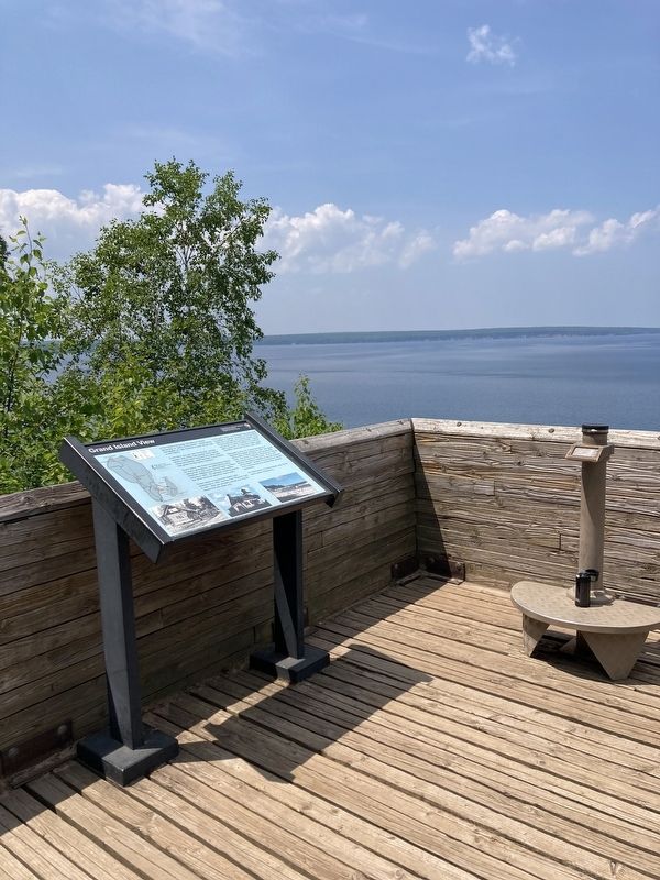
1. Grand Island View Marker
In the Ojibwa language, Munising is "Kitchi-Minissing" or "place of the island." Grand Island, the largest on Lake Superior's south shore, has a rich history.
From here, you can see "the thumb" and the eastern side of the main portion of the island which is eight miles long and four miles wide. Once two islands, sand has filled in and forest has grown on the sandy "tombolo.”
Grand Island was home to Anishnabeg Indians for many generations. An early fishing camp dating from 4,500 years ago has been recorded. Abraham Williams was the first white settler, arriving in 1840. He operated a trading post at the south tip of the island for many years.
Grand Island is home to the North Light, established in 1854, and the East Channel Light in 1867. Both are privately owned and may be viewed from the water only.
In the early 1900's, Grand Island was purchased , by William G. Mather, president of the Cleveland Cliffs Iron Company, as a private retreat. A few of the buildings from that era remain. Mather introduced a variety of wildlife to his fenced game preserve. An extensive maple sugar operation continued into the early
this page online
Managed by the U.S. Forest Service as a National Recreation Area since 1991, the island offers miles of hiking, biking, and snowmobile. trails. Bus tours in summer introduce the natural and human history of the island. Hike-in and boat-in camping is available at several locations on the island. Access is by private boat, kayak, or the commercial ferry service that operates seasonally.
For information on Grand Island, stop by the visitor center in Munising.
Captions:
Post card image of Mather Lodge, ca. 1900
The North Light
Day hikers on trout beach
Erected by Pictured Rocks National Lakeshore, National Park Service, Department of the Interior.
Topics. This historical marker is listed in these topic lists: Industry & Commerce • Parks & Recreational Areas • Waterways & Vessels. A significant historical year for this entry is 1840.
Location. 46° 29.629′ N, 86° 33.095′ W. Marker is near Munising, Michigan, in Alger County. It can be reached from Miners Castle Road near Miners Beach Road (County Route H11). The marker is located at the Miners Castle Overlook. Touch for map. Marker is in this post office
Photographed by Connor Olson, June 21, 2023
2. Grand Island View Marker

Regionally, this marker is on the Upper Peninsula. It is also in the American Midwest and on Lake Superior’s South Shore Region. Globally, it is in North America, in the Great North Woods, on the Great Lakes, in the Western Hemisphere, in the Western World, and in the Anglosphere. Historically, it finds itself in what was once the Northwest Territory.
Other nearby markers. At least 8 other markers are within 8 miles of this marker, measured as the crow flies: Different Perspectives (within shouting distance of this marker); Lake Superior Basin Geology (about 300 feet away, measured in a direct line); Crumbling Into Time (about 600 feet away); U.S. Coast Guard (approx. 3.9 miles away); Munising Falls (approx. 5.9 miles away); Chapel Rock (approx. 6.6 miles away); Alger County All Veterans Memorial (approx. 7.4 miles away); Munising Public Dock (approx. 7.4 miles away). Touch for a list and map of all markers in Munising.
Credits. This page was last revised on June 29, 2023. It was originally submitted on June 24, 2023, by Connor Olson of Menomonee Falls, Wisconsin. This page has been viewed 502 times since then and 47 times this year. Photos: 1, 2. submitted on June 24, 2023, by Connor Olson of Menomonee Falls, Wisconsin. • J. Makali Bruton was the editor who published this page.
