Westport in Fairfield County, Connecticut — The American Northeast (New England)
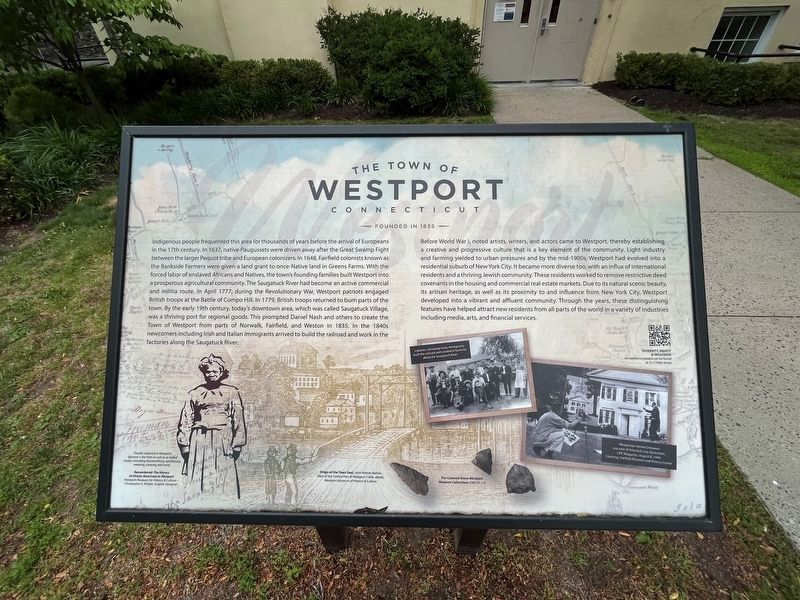
The Town of Westport, Connecticut
Founded in 1835
Indigenous people frequented this area for thousands of years before the arrival of Europeans in the 17th century. In 1637, native Paugussets were driven away after the Great Swamp Fight between the larger Pequot tribe and European colonizers. In 1648, Fairfield colonists known as the Bankside Farmers were given a land grant to once-Native land in Green Farms. With the forced labor of enslaved Africans and Natives, the town's founding families built Westport into a prosperous agricultural community. The Saugatuck River had become an active commercial and militia route. In April 1777, during the Revolutionary War, Westport patriots engaged British troops at the Battle of Compo Hill. In 1779, British troops returned to burn parts of the town. By the early 19th century, today's downtown area, which was called Saugatuck Village, was a thriving port for regional goods. This prompted Daniel Nash and others to create the Town of Westport from parts of Norwalk, Fairfield, and Weston in 1835. In the 1840s newcomers including Irish and Italian immigrants arrived to build the railroad and work in the factories along the Saugatuck River.
Before World War I, noted artists, writers, and actors came to Westport, thereby establishing a creative and progressive culture that is a key element of the community. Light industry and farming yielded to urban pressures and by the mid-1900s, Westport had evolved into a residential suburb of New York City. It became more diverse too, with an influx of international residents and a thriving Jewish community. These residents worked to remove restrictive deed covenants in the housing and commercial real estate markets. Due to its natural scenic beauty, its artisan heritage, as well as its proximity to and influence from New York City, Westport developed into a vibrant and affluent community. Through the years, these distinguishing features have helped attract new residents from all parts of the world in a variety of industries including media, arts, and financial services.
[Captions:]
People enslaved in Westport labored in the field as well as at skilled trades, including blacksmithing apothecary, weaving, cooking and more.
Origin of the Town Seal, John Warner Barber, View of the Central Park of Westport (1836, detail).
Laborers, including many immigrants, built the railroad and worked in factories along the Saugatuck River.
Westporter Steven Dohanas was one of America's top illustrators, LIFE Magazine, August 8, 1949.
Erected by Town of Westport, Connecticut.
Topics. This historical marker is listed in these topic lists: African Americans
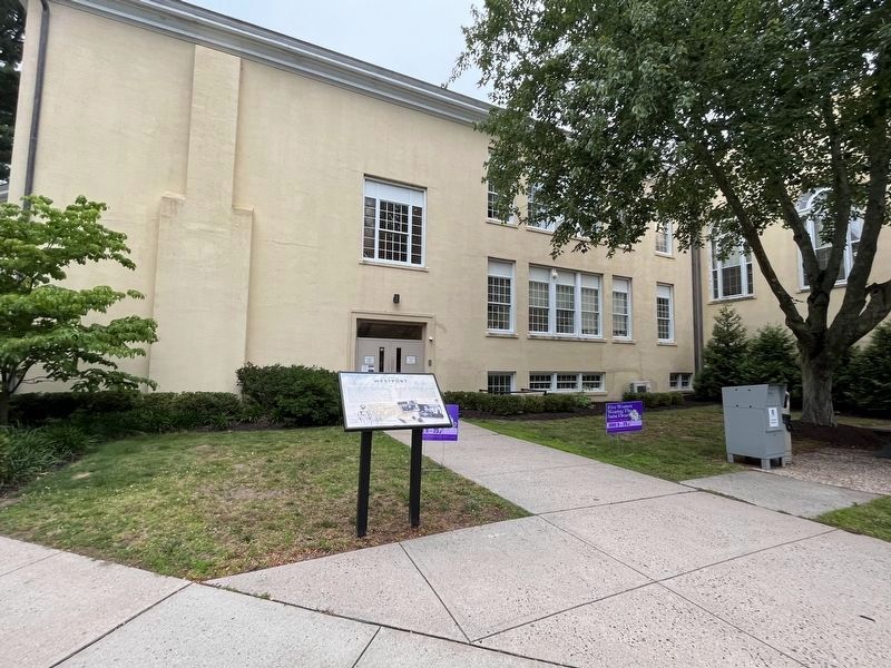
Location. 41° 8.693′ N, 73° 21.58′ W. Marker is in Westport, Connecticut, in Fairfield County. Marker can be reached from Myrtle Avenue, 0.1 miles north of Avery Place, on the right when traveling north. The marker stands on the back of Westport Town Hall adjacent to the parking lot. Touch for map. Marker is at or near this postal address: 110 Myrtle Avenue, Westport CT 06880, United States of America. Touch for directions.
Other nearby markers. At least 8 other markers are within walking distance of this marker. Wheeler House (about 400 feet away, measured in a direct line); Westport World War I Monument (about 400 feet away); Westport Vietnam War Monument (about 400 feet away); Westport World War II Memorial (about 400 feet away); Westport Korean War Monument (about 400 feet away); Westport World War II Honor Roll (about 500 feet away); Disbrow Tavern (approx. 0.2 miles away); 22˝ Main Street (approx. 0.2 miles away). Touch for a list and map of all markers in Westport.
Credits. This page was last revised on February 2, 2024. It was originally submitted on June 25, 2023, by Devry Becker Jones of Washington, District of Columbia. This page has been viewed 134 times since then and 49 times this year. Photos: 1, 2. submitted on June 25, 2023, by Devry Becker Jones of Washington, District of Columbia.

