Near Flovilla in Butts County, Georgia — The American South (South Atlantic)
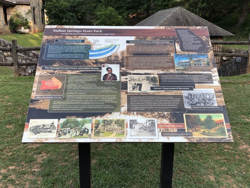
Indian Springs State Park
A Cultural and Geological Journey through Time
Artesian aquifers are fed by groundwater seeping downward into the basin through cracks, often entering from miles away. The groundwater, entering from a higher elevation, exerts pressure on the aquifer and pushes the trapped water up through a fissure where it rises and flows out at the surface giving it the name of a “flowing” artesian well.
Many people over the years have believed that the water has therapeutic and curative effects. As a result, people have been drawn here for generations seeking the mineral spring water.
The Muscogee (Creek) Nation and Indian Springs
The Muscogee (Creek) Nation is now located in Oklahoma, but has historical ties to Alabama and Georgia. The Muscogee (Creek) people used the springs for generations prior to contact with Europeans.
Europeans trading manufactured goods for furs and other supplies named the Muscogee people “Creeks” due to their many towns situated along rivers. These towns were a major focus of activity and were divided among “upper” towns, mostly in present-day Alabama, and “lower” towns in what is now Georgia. The Muscogee people practiced agriculture (corns, beans and squash), fished and hunted game for subsistence.
Georgia's westward expansion encroached on Creek territory, and a series of treaties led to a significant loss of territory. After the Treaty of Indian Springs (1821), the Creek National Council resisted further concessions. Against their wishes, William McIntosh, a leader of the Lower Creeks and signer of the 1821 treaty, agreed to further concessions and signed another treaty in 1825. McIntosh and other signers were sentenced to death by the Creek National Council and executed.
Unfortunately for the Creeks, resistance to Georgia's expansion ended with the Treaty of Washington (1826), and all remaining Creek lands in Georgia were ceded. As many as 20,000 Creeks were then forcibly removed westward. [Captions] Left: Creek land cessions 1733-1832; Right: William McIntosh (Tustunnuggee Hutkee)
Resort Development of Indian Springs
The community of Indian Springs sprang up after ten acres surrounding the spring were reserved for public use by state statue. Known as Lot Number 1 in the 1827 land lottery, the tract has remained in state custody and holds claim to be the oldest state-owned recreation area in the country.
The next 100 years saw the growth of numerous hotels. The Indian Springs Hotel, established by William McIntosh, was the first of many resorts constructed to accommodate the tourists who flocked to the area by the thousands. As one newspaper noted of the hotel, it is a “place
of fashionable resort, either for health or amusement.” Several of the larger resorts held up to 700 guests. Some of the notable lodging establishments that once stood in Indian Springs were the Elder, Calumet, Wigwam and Foy hotels, as well as the McIntosh House.
The grand-hotel era at Indian Springs began to declines during the late nineteenth century. The downturn in tourism was affected by several factors: fires destroyed some of the hotels; the automobile and better roads gave travelers access to more destinations; and, the development of science and medicine changed public opinion regarding the medicinal value of the springs. [Caption] Right: The Indian Springs Hotel (present day)
Resort, Depression & Recovery
The stock market crash of 1929 threw the nation into an economic depression. To get the country back on track, newly elected President Franklin D. Roosevelt created the New Deal, a series of works projects to stimulate the economy. One of these programs was the Civilian Conservation Corps (CCC)> Known as Roosevelt's “Tree Army,” millions of young men were put to work reclaiming land, planting trees, building parks and many other projects.
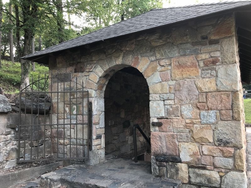
CCC Company 459 built most of the stone park structures still evident at Indian Springs today. [Captions] Top: Company 459 Civilian Conservation
Corps; Bottom: The stone spring house built by the CCC
Topics. This historical marker is listed in these topic lists: Charity & Public Work • Native Americans • Parks & Recreational Areas • Waterways & Vessels. A significant historical year for this entry is 1821.
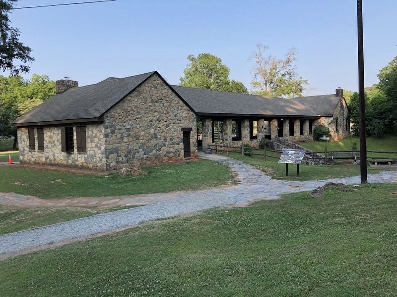
Location. 33° 14.816′ N, 83° 55.305′ W. Marker is near Flovilla, Georgia, in Butts County. Marker can be reached from Spring Road, 0.1 miles west of Georgia Highway 42, on the right when traveling west. Marker is by the stone pavilion in Indian Springs State Park. Touch for map. Marker is at or near this postal address: 678 Lake Clark Rd, Flovilla GA 30216, United States of America. Touch for directions.
Other nearby markers. At least 8 other markers are within 5 miles of this marker, measured as the crow flies. Indian Spring (within shouting distance of this marker); Sherman’s Right At Indian Springs (about 400 feet away, measured in a direct line); “Idlewilde” (about 500 feet away); Indian Springs (approx. 0.2 miles away); William McIntosh (approx. 0.2 miles away); Iron Springs (approx. 3 miles away); Kilpatrick at Cork (approx. 3.8 miles away); Butts County Confederate Monument (approx. 4.2 miles away). Touch for a list and map of all markers in Flovilla.
Credits. This page was last revised on June 30, 2023. It was originally submitted on June 30, 2023, by Duane and Tracy Marsteller of Murfreesboro, Tennessee. This page has been viewed 87 times since then and 19 times this year. Photos: 1, 2, 3. submitted on June 30, 2023, by Duane and Tracy Marsteller of Murfreesboro, Tennessee.


