South Atlanta in Fulton County, Georgia — The American South (South Atlantic)
The History of Brownsville ⎯⎯⎯ Brownsville and the 1906 Atlanta Race Massacre
Community Remembrance Project
Photographed by Duane and Tracy Marsteller, June 11, 2023
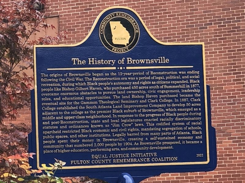
1. The History of Brownsville side of marker
Inscription.
The History of Brownsville
The origins of Brownsville began as the 12-year period of Reconstruction was ending following the Civil War. The Reconstruction era was a period of legal, political, and social recreation, during which Black people's autonomy and rights as citizens expanded. Black people like Bishop Gilbert Haven, who purchased 450 acres south of Summerhill in 1877, overcame enormous obstacles to pursue land ownership, civic engagement, leadership roles, and educational opportunities. The land Bishop Haven purchased became the eventual site for the Gammon Theological Seminary and Clark College. In 1887, Clark College established the South Atlanta Land Improvement Company to develop 50 acres adjacent to the college as the premier Black suburb of Brownsville, which emerged as a middle and upper-class neighborhood. In response to the progress of Black people during and post-Reconstruction, state and local legislatures enacted racially discriminatory statutes and ordinances known as “Jim Crow” laws. This codified system of racial apartheid restricted Black economic and civil rights, mandating segregation of schools,
Click or scan to see this page online
public spaces, and other institutions. Legally barred from many parts of Atlanta, Black people spent their money in Brownsville, creating a self-sustained economy and community that numbered 2,000 people by 1904. As Brownsville prospered, it became a place of higher education, performing arts, and community development.
Brownsville and the 1906 Atlanta Race Massacre
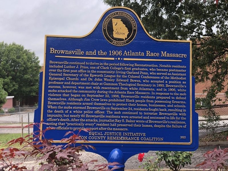
Brownsville continued to thrive in the period following Reconstruction. Notable residents included Luther J. Price, one of Clark College's first graduates, who became postmaster over the first post office in the community; Irving Garland Penn, who served as Assistant General Secretary of the Epworth League for the Colored Conferences of the Methodist Episcopal Church; and Dr. John Wesley Edward Bowen, who accepted a position as professor and department chair at Gammon Theological Seminary in 1893. Brownsville's success, however, was met with resentment from white Atlantans, and in 1906, white mobs attacked the community during the Atlanta Race Massacre. In response to the mob violence that began on September 22, 1906, Brownsville residents prepared to defend themselves.
Photographed by Duane and Tracy Marsteller, June 11, 2023
2. Brownsville and the 1906 Atlanta Race Massacre side of marker
Although Jim Crow laws prohibited Black people from possessing firearms, Brownville residents armed themselves to protect their homes, businesses, and schools. When the mobs stormed Brownsville on September 24, residents fought back, resulting in the death of a white police officer. The mob continued to terrorize Brownsville with impunity, but nearly 60 Brownsville residents were arrested and sentenced to life for the officer's death. After the attacks, journalist Ray S. Baker wrote of Brownsville's resilience, noting that “practically every” resident had preserved their homes, despite the failure of white officials to provide support after the massacre.
Erected 2022 by Equal Justice Initiative and Fulton County Remembrance Coalition.
Location. 33° 43.053′ N, 84° 23.359′ W. Marker is in Atlanta, Georgia, in Fulton County. It is in South Atlanta. It can be reached
Photographed by Duane and Tracy Marsteller, June 11, 2023
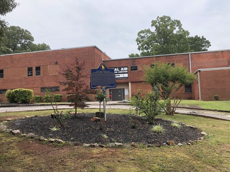
3. The History of Brownsville / Brownsville and the 1906 Atlanta Race Massacre Marker
from Gammon Street Southeast 0.2 miles west of Lansing Street Southeast, on the left when traveling west. Touch for map. Marker is at or near this postal address: 9 Gammon St SE, Atlanta GA 30315, United States of America. Touch for directions.
Regionally, this marker is in Georgia’s Piedmont. It is also in the American South and specifically in the Deep South. Globally, it is in North America, the Western Hemisphere, the Western World, and the Anglosphere. Historically, it finds itself in what was once the territory of the Mississippian Culture, one of the original Thirteen Colonies, one of the Confederate States of America, and the Antebellum South.
Also see . . . South Atlanta. Wikipedia entry on the community within Atlanta that was previously known as Brownsville. (Submitted on July 3, 2023, by Duane and Tracy Marsteller of Murfreesboro, Tennessee.)
Credits. This page was last revised on October 1, 2023. It was originally submitted on July 3, 2023, by Duane and Tracy Marsteller of Murfreesboro, Tennessee. This page has been viewed 4,089 times since then and 370 times this year. Photos:1, 2, 3. submitted on July 3, 2023, by Duane and Tracy Marsteller of Murfreesboro, Tennessee.