
Fort Snelling in Hennepin County, Minnesota — The American Midwest (Upper Plains)
Wokiksuye K'a Woyuonihan
Remembering and Honoring
Photographed by K. Linzmeier, June 11, 2011
1. Wokiksuye K'a Woyuonihan Marker
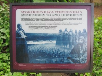
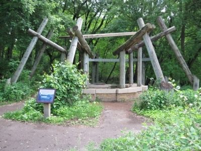
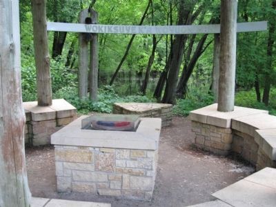
This memorial honors the sixteen hundred Dakota people, many of them women and children, who were imprisoned here at Fort Snelling in the aftermath of the 1862 U.S.-Dakota Conflict. Frightened, uprooted, and uncertain of the fate of their missing relatives, the interned Dakota suffered severe hardship. At least 130 died during the cold winter months of captivity.
In May, 1863, the survivors from the camp were crowded aboard steamboats and taken to Crow Creek in southeastern South Dakota. Those who survived Crow Creek were moved again three years later to the Santee Reservation in Nebraska.
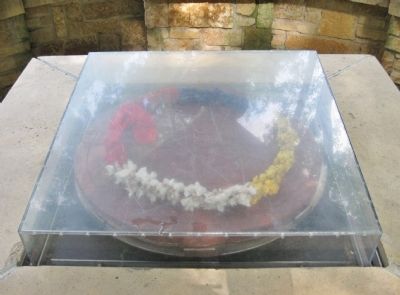
The pipestone in the center of the memorial was placed here by Amos Owen of the Prairie Island Indian Community during a ceremony in 1987. Please be respectful of this sacred place.
Topics and series. This historical marker is listed in these topic lists: Forts and Castles • Indigenous Peoples and Communities • Wars, US Indian. In addition, it is included in the Minnesota Historical Society series list. A significant historical month for this entry is May 1863.
Location. 44° 53.443′ N, 93° 10.91′ W. Marker is in Fort Snelling,
this page online

Regionally, this marker is in the Twin Cities Metropolitan Area. It is also in the American Midwest, in the Corn Belt, and in the Great River Road Region. Globally, it is in North America, the Western Hemisphere, the Western World, and the Anglosphere. Historically, it finds itself in what was once Rupert’s Land, the territory of the Mississippian Culture, and the Louisiana Purchase.
Other nearby markers. At least 8 other markers are within walking distance of this marker: Welcome to Fort Snelling State Park / A Moving Obstacle (within shouting distance of this marker); Three Sisters Garden (about 600 feet away, measured in a direct line); St. Peters Agency (about 700 feet away); Gatehouse and Guardhouse (about 700 feet away); The Hospital (about 700 feet away); The Schoolhouse (about 700 feet away); Executions at Fort Snelling
Photographed by K. Linzmeier, June 11, 2011
2. Wokiksuye K'a Woyuonihan Marker
Also see . . . 2012: How should Minnesota remember the U.S.-Dakota War of 1862?. (Submitted on December 21, 2011.)
Photographed by K. Linzmeier, June 11, 2011
3. Dakota Memorial
Photographed by K. Linzmeier, June 11, 2011
4. Pipestone
Credits. This page was last revised on February 13, 2026. It was originally submitted on December 21, 2011, by Keith L of Wisconsin Rapids, Wisconsin. This page has been viewed 5,539 times since then and 399 times this year. Last updated on July 8, 2023, by McGhiever of Minneapolis, Minnesota. Photos: 1, 2, 3, 4. submitted on December 21, 2011, by Keith L of Wisconsin Rapids, Wisconsin. • J. Makali Bruton was the editor who published this page.
