Manning in Clarendon County, South Carolina — The American South (South Atlantic)
Murray's Ferry - Santee River
Photographed by C Summers, circa September 2008
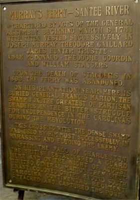
1. Murray's Ferry - Santee River Marker
Chartered by acts of the General Assembly beginning March 8, 1741 with title vested successively in Joseph Murray • Theodore Gaillard • James Hunter, Trustee • Adam McDonald • Theodore Gourdin and William Staggers.
Upon the death of Staggers in 1863, the ferry was abandoned.
On his plantation near here is buried General Francis Marion, the Swamp Fox, the greatest of partisan leaders in the bitter struggle for independence in the Carolinas during the Revolution.
This crossing with the dense swamp was used by him most successfully in harassing and eluding the enemy.
After the fall of Charleston, the British established a guard here and on the night of August 23, 1780, General Marion, then Lieutenant Colonel of the Second South Carolina Continental Regiment, attacked and captured the post.
Topics. This historical marker is listed in these topic lists: Colonial Era • Patriots & Patriotism • War, US Revolutionary • Waterways & Vessels. A significant historical date for this entry is August 23, 1780.
Location. 33° 41.75′ N, 80° 12.65′ W. Marker is in Manning, South Carolina, in Clarendon County. It is on North
this page online

Regionally, this marker is in the Pee Dee and in Santee Cooper Country. It is also in the American South and specifically in the Deep South. Globally, it is in North America, the Western Hemisphere, the Western World, and the Anglosphere. Historically, it finds itself in what was once the territory of the Mississippian Culture, one of the original Thirteen Colonies, one of the Confederate States of America, and the Antebellum South.
Other nearby markers. At least 8 other markers are within walking distance of this marker: The Swamp Fox (within shouting distance of this marker); Fuel 24 (about 300 feet away, measured in a direct line); Francis Marion Reflections (about 300 feet away); Clarendon County Veterans Memorial (about 300 feet away); Clarendon County Confederate Monument (about 400 feet away); Clarendon County / Manning (about 400 feet away); Ambush at Half-Way Swamp
Photographed by C Summers, January 21, 2015
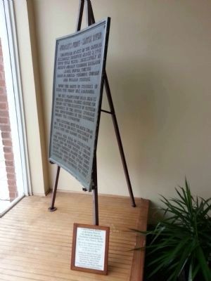
2. Murray's Ferry - Santee River Marker
More about this marker. Marker is in the window of the Clarendon County Chamber of Commerce office.
Credits. This page was last revised on May 25, 2026. It was originally submitted on January 19, 2015, by C Summers of Manning, South Carolina. This page has been viewed 3,565 times since then and 143 times this year. Last updated on July 9, 2023, by C Summers of Manning, South Carolina. Photos: 1. submitted on January 19, 2015, by C Summers of Manning, South Carolina. 2. submitted on January 22, 2015, by C Summers of Manning, South Carolina. • Bernard Fisher was the editor who published this page.
