Lilydale in Dakota County, Minnesota — The American Midwest (Upper Plains)
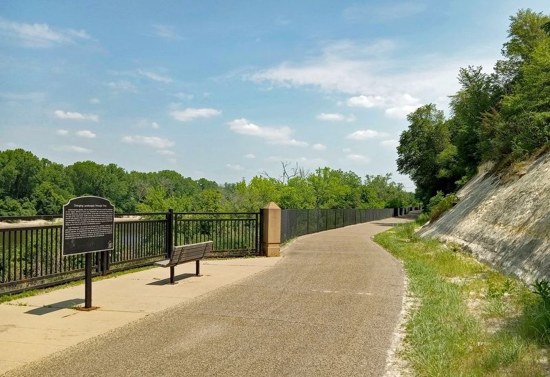
Changing Landscapes Through Time

Photographed by McGhiever, June 9, 2023
1. Changing Landscapes Through Time Marker
Ancient oceans, glaciers, and the powerful action of rivers carved the landscape of this region. Millions of years ago, Minnesota was covered by a shallow sea teeming with corals, sponges and shellfish. At the close of the Pleistocene, a time of Ice Ages which ended about 13,000 years ago, the glaciers receded, leaving behind Glacial Lake Agassiz, which covered much of Canada and the northern United States. For thousands of years, the mighty River Warren was the only outlet of Glacial Lake Agassiz. The river cut a powerful course through Minnesota, forming the Mississippi Valley, and the Falls at St. Anthony and Minnehaha upstream.
Large Pleistocene - era animals such as giant bison, mastodon, mammoth, and giant beavers the size of bears still roamed the spruce forests of Minnesota after the glaciers receded. As temperatures rose, spruce forests were replaced by elm and oak, and later by prairie. Populations of bison, elk and deer emerged with the gradual disappearance of the Pleistocene creatures. By 5000 years ago, the deciduous forests and prairie openings that we see today were well established.
Erected by Dakota
this page online
Topics. This historical marker is listed in these topic lists: Environment • Paleontology • Waterways & Vessels.
Location. 44° 54.008′ N, 93° 8.598′ W. Marker is in Lilydale, Minnesota, in Dakota County. It can be reached from Sibley Memorial Highway. The marker is on the Big Rivers Regional Trail, southwest of the Lilydale Trailhead (1292 Lilydale Road). Touch for map. Marker is in this post office area: Saint Paul MN 55118, United States of America. Touch for directions.

Regionally, this marker is in the Twin Cities Metropolitan Area. It is also in the American Midwest, in the Corn Belt, and in the Great River Road Region. Globally, it is in North America, the Western Hemisphere, the Western World, and the Anglosphere. Historically, it finds itself in what was once Rupert’s Land, the territory of the Mississippian Culture, and the Louisiana Purchase.
Other nearby markers. At least 8 other markers are within walking distance of this marker: The Railroad and Mendota (approx. ¼ mile away); Confluence of the Rivers (approx. ¼ mile away); The West End Landscape / The Changing West End Landscape
Photographed by McGhiever, June 9, 2023
2. Changing Landscapes Through Time Marker on the Big Rivers Regional Trail
Credits. This page was last revised on July 21, 2023. It was originally submitted on July 17, 2023, by McGhiever of Minneapolis, Minnesota. This page has been viewed 238 times since then and 28 times this year. Photos: 1, 2. submitted on July 17, 2023, by McGhiever of Minneapolis, Minnesota. • J. Makali Bruton was the editor who published this page.
