Clinton Township in Wauseon in Fulton County, Ohio — The American Midwest (Great Lakes)
Ohio Buckeye
Aesculus glabra
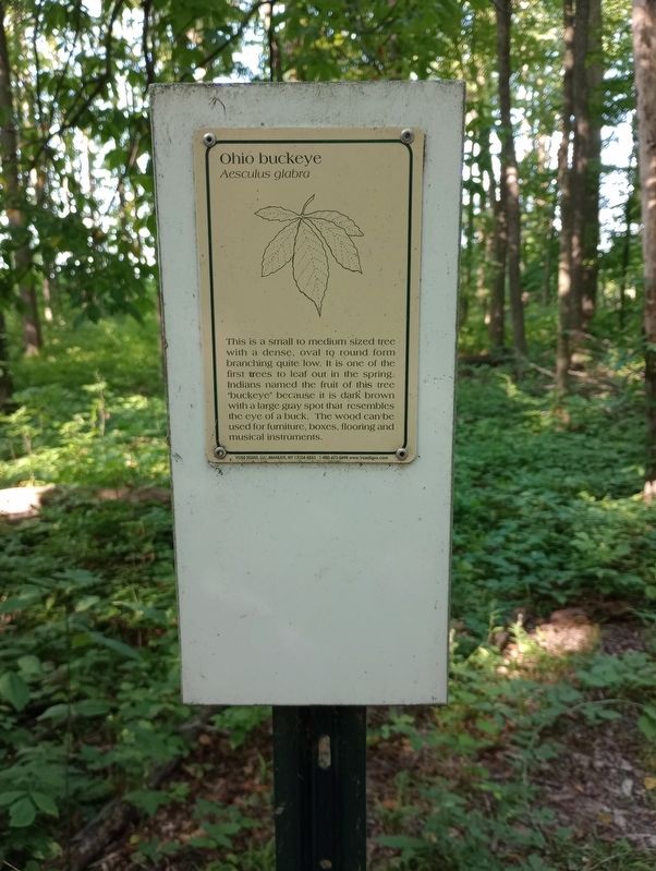
Photographed by Craig Doda, July 19, 2023
1. Ohio Buckeye Marker
Topics. This historical marker is listed in these topic lists: Anthropology & Archaeology • Horticulture & Forestry • Indigenous Peoples and Communities.
Location. 41° 32.124′ N, 84° 8.799′ W. Marker is in Wauseon, Ohio, in Fulton County. It is in Clinton Township. It can be reached from County Road 15 south of Fairway Lane, on the right when traveling north. Touch for map. Marker is at or near this postal address: 570 Woodside Dr, Wauseon OH 43567, United States of America. Touch for directions.

Regionally, this marker is in the Black Swamp and in the Till Plains. It is also in the American Midwest and in the Corn Belt. Globally, it is in North America, the Western Hemisphere, the Western World, and the
this page online
Other nearby markers. At least 8 other markers are within walking distance of this marker: American Elm (about 500 feet away, measured in a direct line); Restoring The American Chestnut Tree (about 600 feet away); Eastern White Pine (approx. ¼ mile away); Gregory B. Wertz (approx. 0.3 miles away); Jones-Read-Touvelle House (approx. 0.7 miles away); Sky Pilot (approx. ¾ mile away); Fulton County War Memorial (approx. ¾ mile away); a different marker also named Fulton County War Memorial (approx. 0.8 miles away). Touch for a list and map of all markers in Wauseon.

Photographed by Craig Doda, July 19, 2023
2. Ohio Buckeye Marker
Credits. This page was last revised on August 1, 2023. It was originally submitted on July 21, 2023, by Craig Doda of Napoleon, Ohio. This page has been viewed 159 times since then and 22 times this year. Photos: 1, 2. submitted on July 21, 2023, by Craig Doda of Napoleon, Ohio. • Devry Becker Jones was the editor who published this page.
