
Sister Bay in Door County, Wisconsin — The American Midwest (Great Lakes)
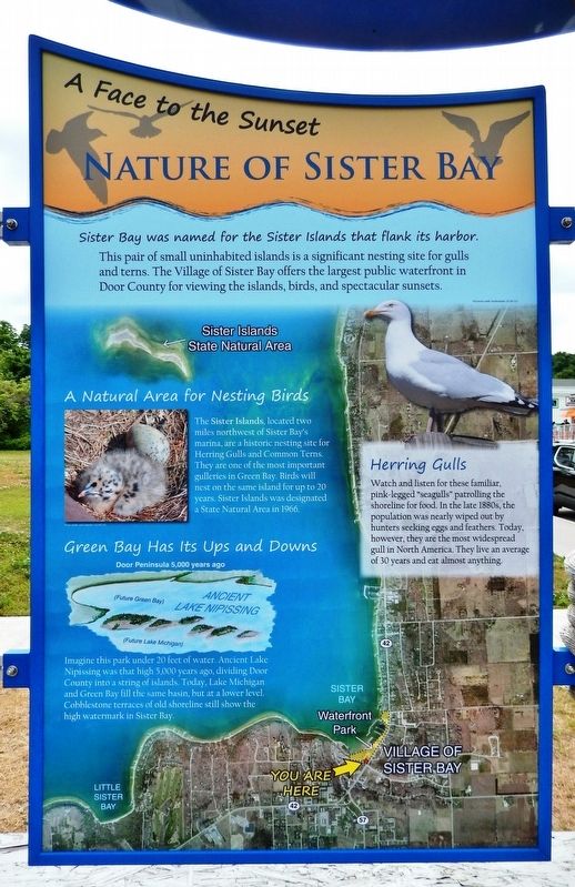
Nature of Sister Bay
A Face to the Sunset
Photographed by Cosmos Mariner, July 20, 2018
1. Nature of Sister Bay Marker
Sister Bay was named For the Sister Islands that Flank its harbor.
This pair of small uninhabited islands is a significant nesting site for gulls and terns. The Village of Sister Bay offers the largest public waterfront in Door County for viewing the islands, birds, and spectacular sunsets.
A Natural Area for Nesting Birds
The Sister Islands, located two miles northwest of Sister Bay's marina, are a historic nesting site for Herring Gulls and Common Terns. They are one of the most important gulleries in Green Bay. Birds will nest on the same island for up to 20 years. Sister Islands was designated a State Natural Area in 1966.
Herring Gulls
Watch and listen for these familiar, pink-legged "seagulls" patrolling the shoreline for food. In the late 1880s, the population was nearly wiped out by hunters seeking eggs and feathers. Today, however, they are the most widespread gull in North America. They live an average of 30 years and eat almost anything.
Green Bay Has Its Ups and Downs
Imagine this park under 20 feet of water. Ancient Lake Nipissing was that high 5,000 years ago, dividing Door County into a string of islands. Today, Lake Michigan and Green Bay fill the same basin, but at a lower level. Cobblestone terraces of old shoreline still show the high watermark in Sister Bay.
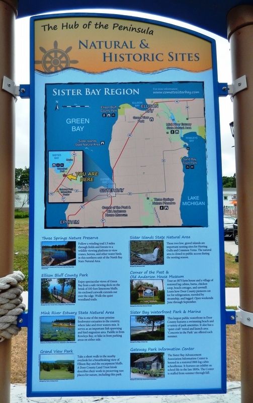
Natural & Historic Sites
• Ellison Bluff County Park - Enjoy spectacular views of Green Bay from a safe viewing deck on the brink of 100-foot limestone bluffs. An enclosed catwalk extends out over the edge. Walk the quiet woodland trails.
• Mink River Estuary State Natural Area
this page online
• Grand View Park - Take a short walk to the nearby overlook for a breathtaking view of Ellison Bay and the escarpment bluffs. A Door County Land Trust kiosk describes their work in preserving rare places for nature, including this park.
• Sister Islands State Natural Area - These two low, gravel islands are important nesting sites for Herring Gulls and Common Terns. The natural area is closed to public access during the nesting season.
• Corner of the Past & Old Anderson House Museum - Tour an 1875 farm house and a village of restored log cabins, barns, chicken coop, beach cottages, and sawmill. Learn how Door County pioneers cut ice for refrigeration, traveled by steamship, and logged. Open weekends June through September.
• Sister Bay Waterfront Park & Marina - This largest public waterfront in Door County features a swimming beach and a variety of park amenities. It also has a “quiet
Photographed by Cosmos Mariner, July 20, 2018
2. Natural & Historical Sites Panel (mounted adjacent to marker on right side of kiosk)
• Gateway Park Information Center - The Sister Bay Advancement Association Information Center is housed in a restored 1866 log cabin schoolhouse. It features an exhibit on school life in the late 1800s. The Center is staffed from summer through fall.
Erected by Door County Coastal Byway, Federal Highway Administration, and Wisconsin Department of Transportation.
Topics and series. This historical marker is listed in these topic lists: Animals • Parks & Recreational Areas • Waterways & Vessels. In addition, it is included in the Door County Coastal Byway (Wisconsin) series list.
Location. 45° 11.338′ N, 87° 7.301′ W. Marker is in Sister Bay, Wisconsin, in Door County. It is at the intersection of Mill Road (State Highway 42) and Bay Shore Drive, on the right when traveling west on Mill Road. Marker is located near the sidewalk, in front of the public restroom at Mill Road and Bay Shore Drive, near Sister Bay Beach and the bandshell. It was previously located nearby in the field across the
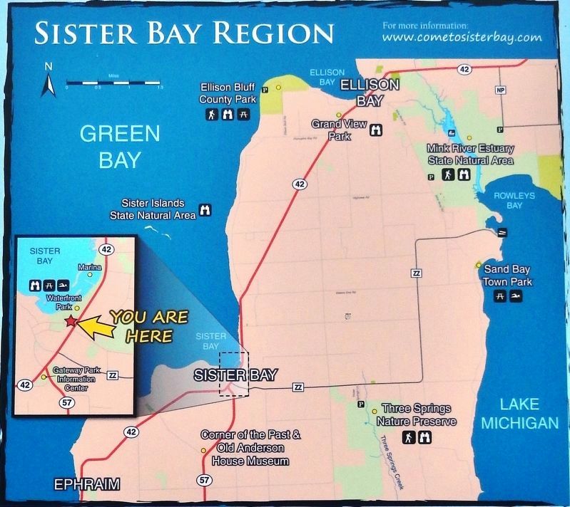
3. Marker detail: Sister Bay Region Natural & Historic Site Map

Regionally, this marker is on Wisconsin’s Door Peninsula. It is also in the American Midwest and in the Corn Belt. Globally, it is in North America, on the Great Lakes, in the Western Hemisphere, in the Western World, and in the Anglosphere. Historically, it finds itself in what was once the territory of the Mississippian Culture and also the Northwest Territory.
Other nearby markers. At least 8 other markers are within walking distance of this marker: Village of Sister Bay (here, next to this marker); Veterans Memorial (here, next to this marker); a different marker also named Village of Sister Bay (about 300 feet away, measured in a direct line); Old Schoolhouse No. 2 (approx. ¼ mile away); Atlantic Coast Buccaneers (approx. 0.6 miles away); Jean Lafitte and Andrew Jackson (approx. 0.6 miles away); Blackbeard's Beard (approx. 0.6 miles away); Pirate Flags (approx. 0.6 miles away). Touch for a list and map of all markers in Sister Bay.
More about this marker.
Photographed by Cosmos Mariner, July 20, 2018
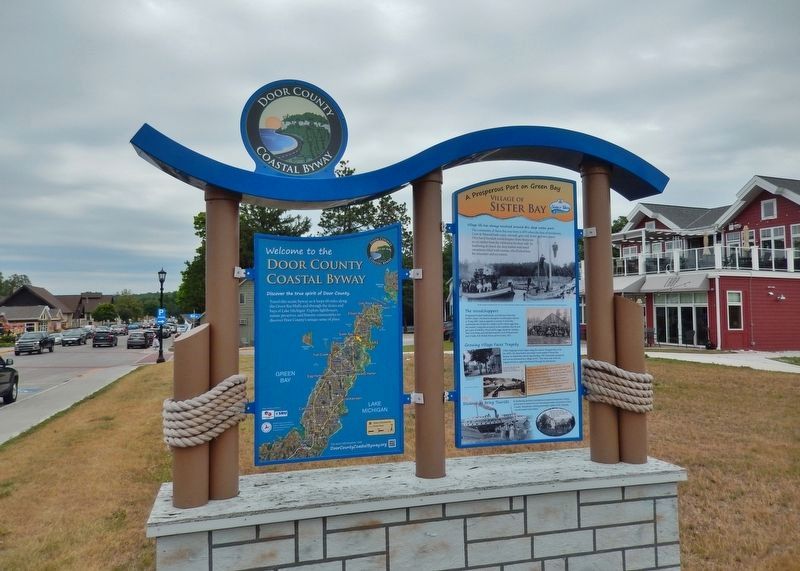
4. Sister Bay Marker Kiosk (wide view; marker is on reverse side of this kiosk)
Related markers. Click here for a list of markers that are related to this marker. Door County Coastal Byway
Photographed by Sean Flynn, July 28, 2023
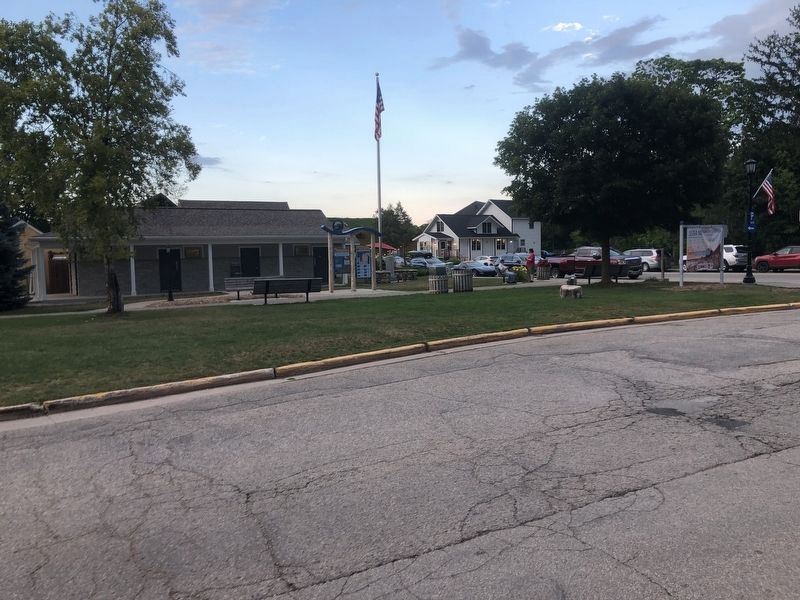
5. Nature of Sister Bay Marker, new location (2023)
Credits. This page was last revised on August 24, 2023. It was originally submitted on March 1, 2019, by Cosmos Mariner of Cape Canaveral, Florida. This page has been viewed 405 times since then and 30 times this year. Last updated on July 28, 2023, by Sean P. Flynn of Oak Park, Illinois. Photos: 1, 2, 3, 4. submitted on March 1, 2019, by Cosmos Mariner of Cape Canaveral, Florida. 5. submitted on July 28, 2023, by Sean P. Flynn of Oak Park, Illinois. • J. Makali Bruton was the editor who published this page.
