Montara State Beach in San Mateo County, California — The American West (Pacific Coastal)
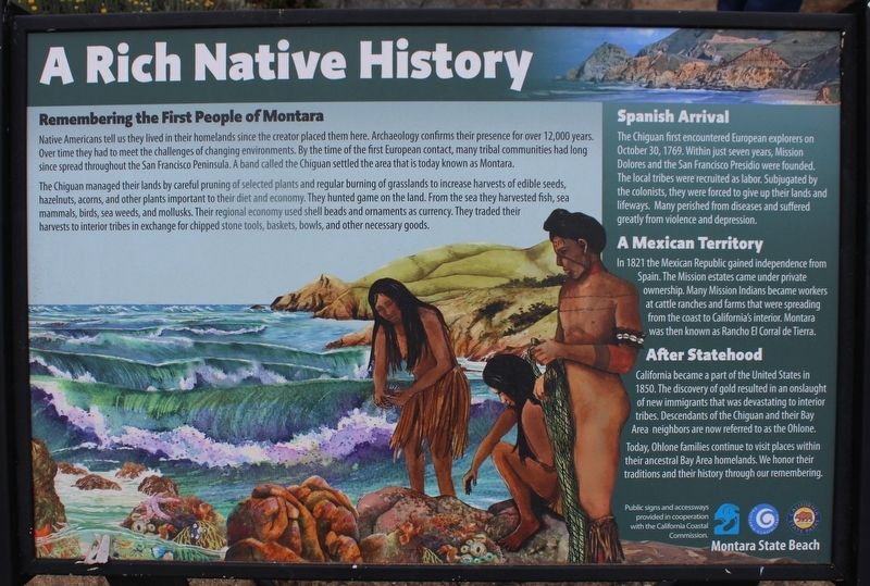
A Rich Native History
Montara State Beach
Native Americans tell us they lived in their homelands since the creator placed them here. Archaeology confirms their presence for over 12,000 years. Over time they had to meet the challenges of changing environments. By the time of the first European contact, many tribal communities had long since spread throughout the San Francisco Peninsula. A band called the Chiguan settled that area that is today known as Montara.
The Chiguan managed their lands by careful pruning of selected plants and regular burning of grasslands to increase harvests of edible seeds, hazelnuts, acorns, and other plants important to their diet and economy. They hunted game on the land. From the sea they harvested fish, sea mammals, birds, sea weeds, and mollusks. Their regional economy used shell beads and ornaments as currency. They traded their harvests to interior tribes in exchange for chipped stone tools, baskets, bowls, and other necessary goods.
Spanish Arrival
The Chiguan first encountered European explorers on October 30, 1769. Within just seven years, Mission Dolores and the San Francisco Presidio were founded. The local tribes were recruited as labor. Subjugated by the colonists, they were forced to give up their lands and lifeways. Many perished from diseases and suffered greatly from violence and depression.
A Mexican Territory
In 1821, the Mexican Republic gained independence from Spain. The Mission estates came under private ownership. Many Mission Indians became workers at cattle ranches and farms that were spreading from the coast to California’s interior. Montara was then known as Rancho El Corral de Tierra.
After Statehood
California became a part of the United States in 1850. The discovery of gold resulted in an onslaught of new immigrants that was devastating to interior tribes. Descendants of the Chiguan and their Bay Area neighbors are now referred to as the Ohlone.
Today, Ohlone families continue to visit places within their ancestral Bay Area homelands. We honor their traditions and their history through our remembering.
Topics. This historical marker is listed in these topic lists: Exploration • Immigration • Native Americans • Parks & Recreational Areas. A significant historical date for this entry is October 30, 1769.
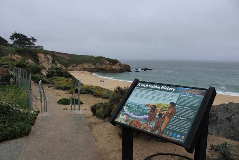
Location. 37° 32.783′ N, 122° 30.85′ W. Marker is in Montara, California, in San Mateo County. It is in Montara State Beach. Marker is at the intersection of Cabrillo Highway (State Highway 1) and 1st Street, on the right when traveling south on Cabrillo Highway. The resin marker is next to the beach access trail. Touch for map. Marker is at or near this postal address: 8150 Cabrillo Highway, Montara CA 94037, United States of America. Touch for directions.
Other nearby markers. At least 8 other markers are within 4 miles of this marker, measured as the crow flies. Bob Breen: Fitzgerald Marine Reserve's First Park Ranger (approx. 1.6 miles away); The Moss Beach Distillery (approx. 2 miles away); Cut Off! (approx. 2.7 miles away); Open Spaces and Wild Places (approx. 2.7 miles away); Sanchez Adobe (approx. 3.1 miles away); In Memorial to the Commercial Fisherman Lost at Sea (approx. 3½ miles away); Captain Don Gaspar de Portolà (approx. 3.7 miles away); Discovery of San Francisco Bay (approx. 3.7 miles away).
Also see . . . Encounters with the Portolá Expedition. National Park Service
"A passage from the 1774 Rivera y Moncada Expedition describes a friendly encounter between the natives and the explorers in more detail. The Chiguan brought “large baskets of thick atole and some large tamales made of their black seeds,” which the soldiers found flavorful."(Submitted on July 31, 2023, by Joseph Alvarado of Livermore, California.)
Credits. This page was last revised on July 31, 2023. It was originally submitted on July 31, 2023, by Joseph Alvarado of Livermore, California. This page has been viewed 115 times since then and 63 times this year. Photos: 1, 2. submitted on July 31, 2023, by Joseph Alvarado of Livermore, California.

