Fort Snelling in Hennepin County, Minnesota — The American Midwest (Upper Plains)
The Prairie
Photographed by Keith L, October 16, 2008
1. The Prairie Marker
(photo caption)
The Prairie · Back of Fort Snelling, Seth Eastman, 1840s
The Prairie · Back of Fort Snelling, Seth Eastman, 1840s
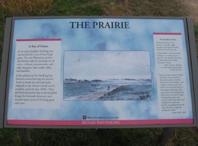
In its early days Fort Snelling was surrounded by a sea of head-high grass. The vast Minnesota prairie was broken only by small groves of trees—willows, cottonwoods, and oaks that grew near creeks, lakes, and marshes.
Early soldiers at Fort Snelling had limited success farming the prairie. Tools to break the soil and seeds adapted to the climate would not be available until the late 1840's. They did find the prairie hay to be excellent forage for livestock, however, and mowed many acres of the long grass each year.
Tremendous Fires
"Tremendous fires on the Prairies—last night—light enough to pick up the Smallest Substance from the ground.
"Public Wood—20 Cords which had been cut, Corded up and paid for—was entirely consumed by the fireing of the Prairies yesterday evening."
Major Lawrence Taliaferro,
St. Peters Indian Agency Journal
October 24, 1827
"There are many modes by which the fire is communicated to them [the prairies], both by white men and by Indians—par accident; and yet many more where it is voluntarily done for the purpose of getting a fresh crop of grass, for the grazing of their
this page online
George Catlin, 1830
Minnesota Historical Society
Historic Fort Snelling
Erected by Minnesota Historical Society.
Topics and series. This historical marker is listed in these topic lists: Agriculture • Forts and Castles • Natural Features. In addition, it is included in the Minnesota Historical Society series list. A significant historical month for this entry is October 1860.
Location. Marker has been reported permanently removed. It was located near 44° 53.572′ N, 93° 10.979′ W. Marker was in Fort Snelling, Minnesota, in Hennepin County. It could be reached from State Highway 55 north of State Highway 5, on the right when traveling north. The marker is at Historic Fort Snelling. Touch for map. Marker was in this post office area: Saint Paul MN 55111, United States of America.
We have been informed that this marker is no longer there and will not be replaced. This page is an archival view of what was.
Regionally, this marker was in the Twin Cities
Photographed by Keith L, July 23, 2009
2. The Prairie Marker and Fort Snelling
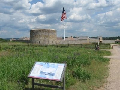
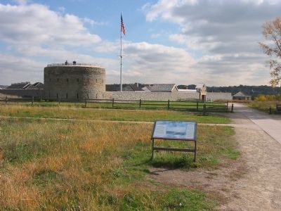
The Round Tower is the oldest standing structure in Minnesota, having been built around 1820. It is believed that the tower may have been designed as a last-ditch defensive position since its musket loopholes face both inside and outside the fort's walls.

Other nearby markers. At least 8 other markers are within walking distance of this location: Perseverance (here, next to this marker); Sacrifice (a few steps from this marker); Pride (a few steps from this marker); US–Dakota War of 1862 (within shouting distance of this marker); Imprisonment of Dakota Families (within shouting distance of this marker); Executions at Fort Snelling (within shouting distance of this marker); DAR Commemorative Plaques (within shouting distance of this marker); The Round Tower (within shouting distance of this marker). Touch for a list and map of all markers in Fort Snelling.
Another marker is no longer nearby. U.S. Army, Buildings 17 and 18 (was within shouting distance of this marker but has been permanently removed).
Also see . . . Historic Fort Snelling.
Photographed by Keith L, October 16, 2008
3. The Prairie Marker and Fort Snelling
"The story of Fort Snelling is the story of the development of the U.S. Northwest. While surrounded today by freeways and a large urban population, Fort Snelling was once a lonely symbol of American ambition in the wilderness." (Submitted on March 22, 2009.)
Photographed by Keith L, October 16, 2008
4. Below the Marker
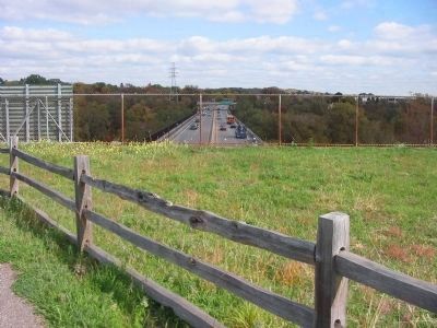
Photographed by Keith L, October 16, 2008
5. View from the Bridge
Credits. This page was last revised on January 16, 2026. It was originally submitted on March 22, 2009, by Keith L of Wisconsin Rapids, Wisconsin. This page has been viewed 1,731 times since then and 24 times this year. Last updated on August 4, 2023, by McGhiever of Minneapolis, Minnesota. Photos: 1. submitted on March 22, 2009, by Keith L of Wisconsin Rapids, Wisconsin. 2. submitted on August 26, 2009, by Keith L of Wisconsin Rapids, Wisconsin. 3, 4, 5. submitted on March 22, 2009, by Keith L of Wisconsin Rapids, Wisconsin. • Bill Pfingsten was the editor who published this page.
