Chattahoochee in Gadsden County, Florida — The American South (South Atlantic)
Ellicott's Camp and Observatory
George Washington's Commissioner of Limits
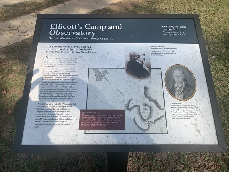
No one who signed the treaty had ever seen it, but the point of land formed by the confluence of the Chattahoochee and Flint Rivers (today's Lake Seminole) marked the western end of the East Florida border.
To survey and mark the new border, the United States and Spain appointed two commissioners. Col. Andrew Ellicott, a friend of George Washington and the surveyor who marked the lines of the District of Columbia, was the U.S. commissioner. Estevan Minor represented Spain.
The two men arrived here aboard two schooners on August 23, 1799, and set up an observatory on the heights that overlook River Landing Park. They started taking readings of the stars and sun two days later, using these to show the latitude and longitude of the confluence. The work went well, but the United States and Spain did not include the Creek Nation in their discussions, and many Native Americans were not happy about it.
A message arrived on September 17 from a man that Ellicott called "Indian Will" - probably William Perryman - warning that a party of Tallassee warriors planned to attack the surveyors. Col. Benjamin Hawkins, the U.S. Agent for Indian Affairs, was present and called the military escort to arms. No battle took place, but Ellicott and Minor thought it "best to retreat." Boarding their schooners, they sailed away down the Apalachicola River.
Ellicott's Observatory
The temporary astronomical observatory used here in August-September 1799 was the second such facility in Florida history. The tools used by the surveyors were primitive by modern standards, and their estimates of latitude and longitude were slightly off.
Col. Benjamin Hawkins
Col. Hawkins, the U.S. Agent for Indian Affairs, joined the survey party here in September 1799. Like Endicott, he was a veteran of the American Revolution appointed to office by President Washington.
Andrew Ellicott
An officer of the American Revolution, Andrew Ellicott was a noted surveyor and engineer. He surveyed the western border of Pennsylvania, and George Washington appointed him to mark the limits of the new nation's capital, Washington, D.C.
Erected by Chattahoochee River Landing Park - An Apalachicola River Heritage Destination.
Topics. This historical marker is listed in these topic lists: Colonial Era • Native Americans • Waterways & Vessels. A significant historical date for this entry is August 23, 1799.
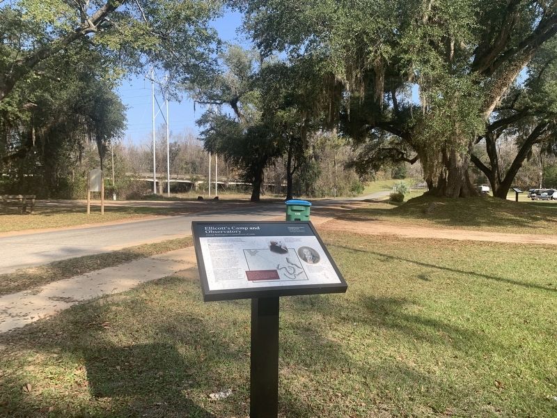
Location. 30° 42.059′ N, 84° 51.358′ W. Marker is in Chattahoochee, Florida, in Gadsden County. Marker is on River Landing Road, 0.3 miles south of U.S. 90, on the left when traveling west. Located near the end of River Landing Road in the Chattahoochee River Landing Park. Touch for map. Marker is in this post office area: Chattahoochee FL 32324, United States of America. Touch for directions.
Other nearby markers. At least 8 other markers are within walking distance of this marker. Old Spanish Trail (within shouting distance of this marker); Victory Bridge (within shouting distance of this marker); The Scott Massacre (within shouting distance of this marker); The Chattahoochee Landing Mound Group (within shouting distance of this marker); Nicoll's Outpost (within shouting distance of this marker); The Scott Battle of 1817 (within shouting distance of this marker); a different marker also named Nicolls' Outpost (within shouting distance of this marker); a different marker also named Chattahoochee Landing Mound Group (within shouting distance of this marker). Touch for a list and map of all markers in Chattahoochee.
Also see . . . Andrew Ellicott. (Submitted on August 14, 2023, by Tim Fillmon of Webster, Florida.)
Credits. This page was last revised on August 14, 2023. It was originally submitted on August 14, 2023, by Tim Fillmon of Webster, Florida. This page has been viewed 66 times since then and 17 times this year. Photos: 1, 2. submitted on August 14, 2023, by Tim Fillmon of Webster, Florida.

