Sonoma State Historic Park in Sonoma County, California — The American West (Pacific Coastal)
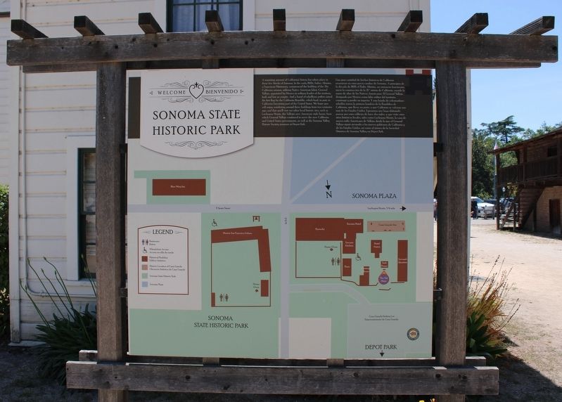
Sonoma State Historic Park
Welcome ♥ Bienvenido
Photographed by Joseph Alvarado, June 17, 2023
1. Sonoma State Historic Park Marker
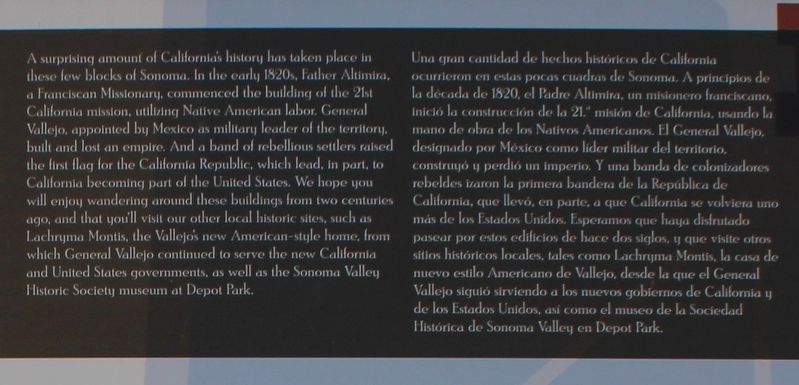
Una gran cantidad de hechos históricos de California ocurrieron en estas pocas cuadras de Sonoma. A principios de la década de 1820, el Padre Altimira, un misionero franciscano, inició la construcción de la 21st misión de California, usando la mano de obra de los Nativos Americanos.
this page online
Erected by California Department of Parks & Recreation.
Topics. This historical marker is listed in these topic lists: Indigenous Peoples and Communities • Parks & Recreational Areas • Religion & Religious Structures • Settlements & Settlers.
Location. 38° 17.646′ N, 122° 27.43′ W. Marker is in Sonoma, California, in Sonoma County. It is in Sonoma State Historic Park. It can be reached from East Spain Street
Photographed by Joseph Alvarado, June 17, 2023
2. Sonoma State Historic Park Marker

Regionally, this marker is in Wine Country, in the San Francisco Bay Area, in the North Coast, and specifically on the Coast Ranges. It is also on the American Pacific Coast. Globally, it is in North America, on the Ring of Fire, on the Pacific Rim, in the Western Hemisphere, in the Western World, and in the Anglosphere. Historically, it finds itself in what was once New Spain and also Mexico’s Alta California.
Other nearby markers. At least 8 other markers are within walking distance of this marker: Servants' Quarters (here, next to this marker); a different marker also named Servants Quarters (a few steps from this marker); Toscano Hotel (a few steps from this marker); Welcome to Sonoma State Historic Park (within shouting distance of this marker); a different marker also named Toscano Hotel (within shouting distance of this marker); Sonoma Barracks
Photographed by Joseph Alvarado, June 17, 2023
3. Sonoma State Historic Park Marker
Also see . . . Sonoma State Historic Park. California Department of Parks & Recreation
"Unlike most parks with a single plot of land and a continuous boundary, Sonoma State Historic Park is a scattering of historical sites consisting of six midtown locations near Sonoma's Plaza."(Submitted on August 17, 2023, by Joseph Alvarado of Livermore, California.)
Credits. This page was last revised on August 17, 2023. It was originally submitted on August 17, 2023, by Joseph Alvarado of Livermore, California. This page has been viewed 247 times since then and 21 times this year. Photos: 1, 2, 3. submitted on August 17, 2023, by Joseph Alvarado of Livermore, California.
