Lemmon in Perkins County, South Dakota — The American Midwest (Upper Plains)
Ole Quammen
Photographed by Connor Olson, August 19, 2023
1. Ole Quammen Marker
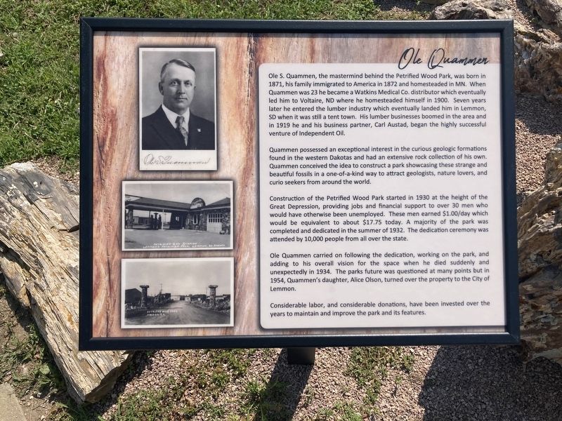
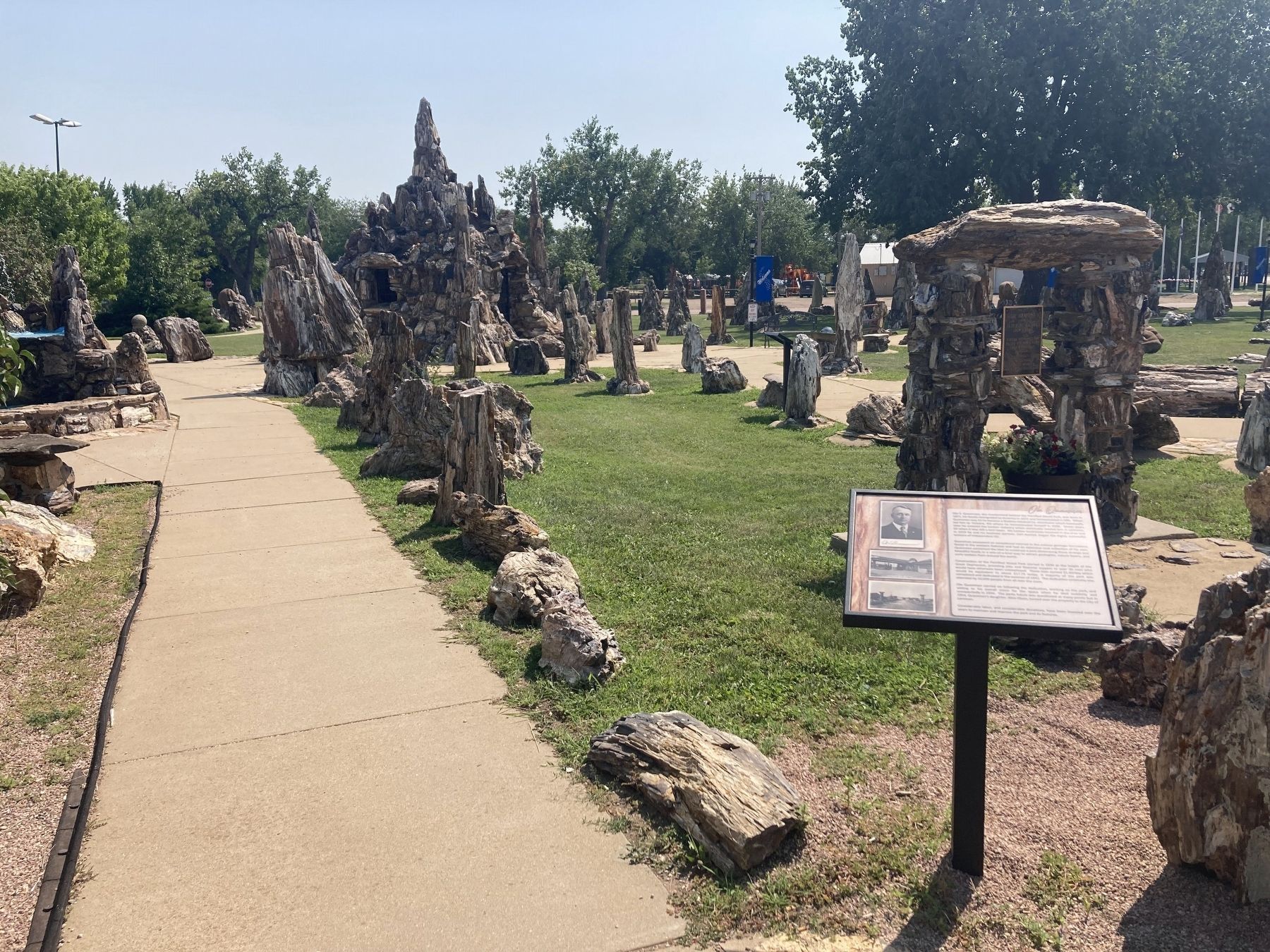
Quammen possessed an exceptional interest in the curious geologic formations found in the western Dakotas and had an extensive rock collection of his own. Quammen conceived the idea to construct a park showcasing these strange and beautiful fossils in a one-of-a-kind way to attract geologists, nature lovers, and curio seekers from around the world.
Construction of the Petrified Wood Park started in 1930 at the height of the Great Depression, providing jobs and financial support to over 30 men who would have otherwise been unemployed. These men earned $1.00/day which
this page online
Ole Quammen carried on following the dedication, working on the park, and adding to his overall vision for the space when he died suddenly and unexpectedly in 1934. The parks future was questioned at many points but in 1954, Quammen's daughter, Alice Olson, turned over the property to the City of Lemmon.
Considerable labor, and considerable donations, have been invested over the years to maintain and improve the park and its features.
Erected 2023 by City of Lemmon.
Topics. This historical marker is listed in these topic lists: Immigration • Industry & Commerce • Parks & Recreational Areas. A significant historical year for this entry is 1871.
Location. 45° 56.372′ N, 102° 9.538′ W. Marker is in Lemmon, South Dakota, in Perkins County. It is on Main Avenue north of Sixth Street East, on the right when traveling north. Touch for map. Marker is at or near this postal address: 500 Main Avenue, Lemmon SD 57638, United States
Photographed by Connor Olson, August 19, 2023
2. Ole Quammen Marker

Regionally, this marker is in South Dakota’s Standing Rock Sioux Tribe, on the Cheyenne River Reservation, and in West River. It is also in the American Lewis & Clark Corridor, on the prairies, and on the Northern Plains. Globally, it is in North America, the Western Hemisphere, the Western World, and the Anglosphere. Historically, it finds itself in what was once Rupert’s Land and also the Louisiana Purchase.
Other nearby markers. At least 8 other markers are within 13 miles of this marker, measured as the crow flies: Interesting Structures (a few steps from this marker); Petrified Wood (a few steps from this marker); The Museum/The Restoration (a few steps from this marker); Ole S. Quammen (within shouting distance of this marker); Quartzite Border Markers / Yellowstone Trail (within shouting distance of this marker); Shadehill Dam & Reservoir (approx. 13.1 miles away); a different marker also named Hugh Glass (approx. 13.1 miles away); Seim, South Dakota (approx. 13.1 miles away). Touch for a list and map of all markers in Lemmon.
Another marker is no longer nearby. Hugh Glass (was approx. 13.1 miles away but has been replaced with another marker now near it).
Credits. This page was last revised on December 27, 2024. It was originally submitted on August 19, 2023, by Connor Olson of Menomonee Falls, Wisconsin. This page has been viewed 655 times since then and 109 times this year. Photos: 1. submitted on August 19, 2023, by Connor Olson of Menomonee Falls, Wisconsin. 2. submitted on August 20, 2023, by Connor Olson of Menomonee Falls, Wisconsin. • Andrew Ruppenstein was the editor who published this page.
